Exploring the Waiorongomai Valley
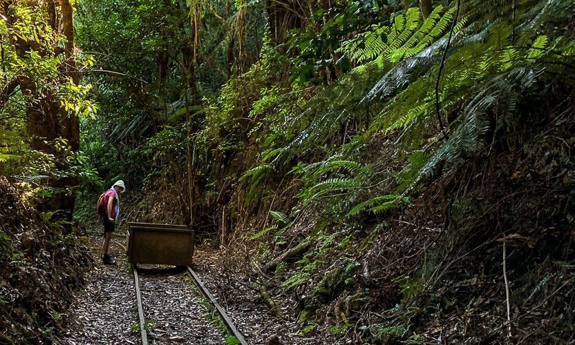
Nestled on the southwestern slopes of Mount Te Aroha, on the eastern side of the Kaimai Range, the Waiorongomai Valley offers a series of interesting, even captivating walks. These tracks were originally carved out during several attempts to mine gold commercially, which largely ended in failure. The trails include old tramways and steep inclines designed for gravity-driven trams. For those eager for a challenge, the well-maintained Butlers Incline is a rewarding hike.
History, Nature, and Meaning
Waiorongomai can be translated as “waters of longing” or “stream of desire,” reflecting the valley's connection to Māori history and tradition. The area was historically traversed and occupied by iwi such as Ngāti Hinerangi and Ngāti Tumutumu, with the valley’s waterways and forested trails forming part of traditional travel routes and resource gathering areas.
The Impact of Gold Discovery
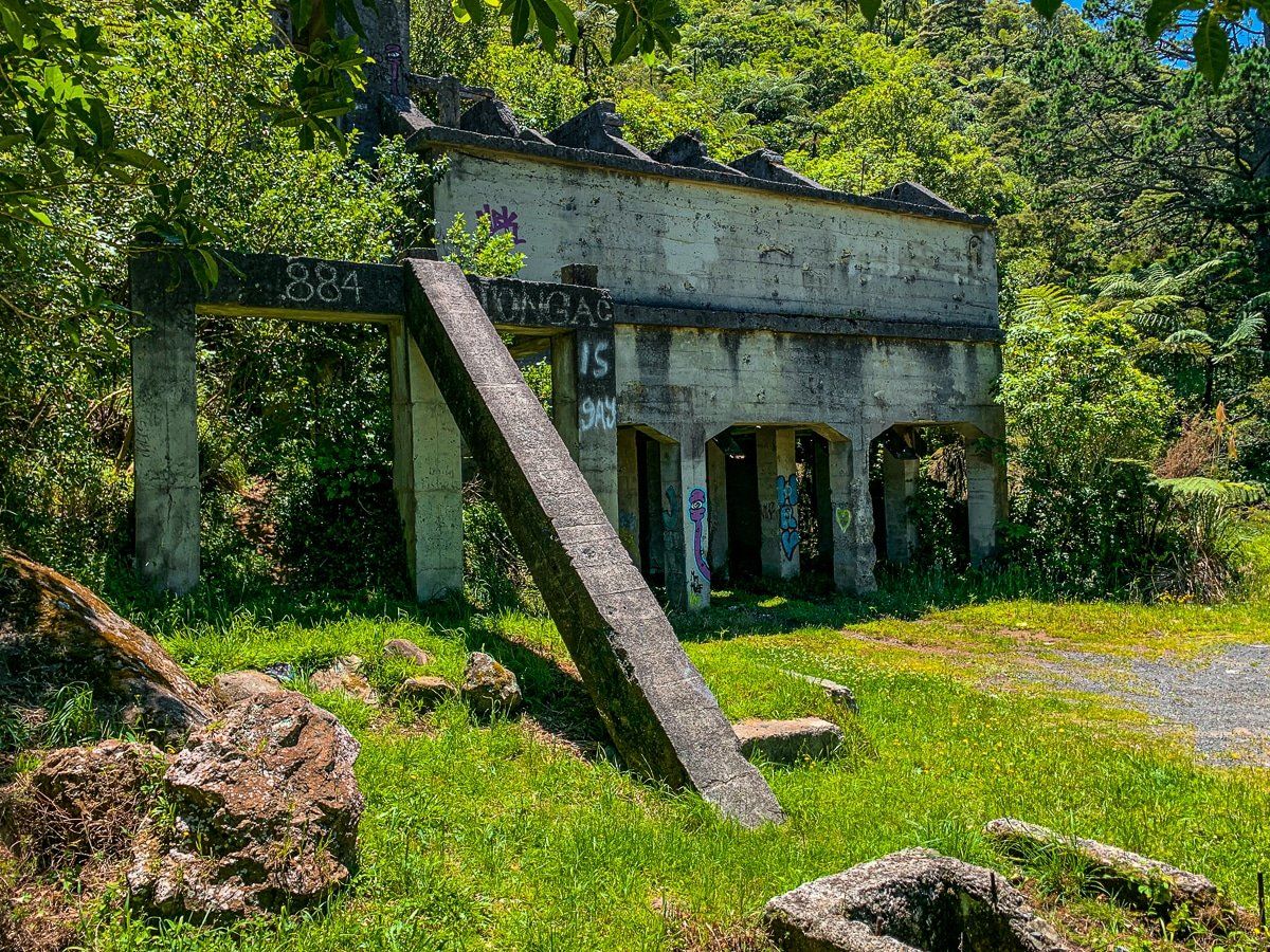
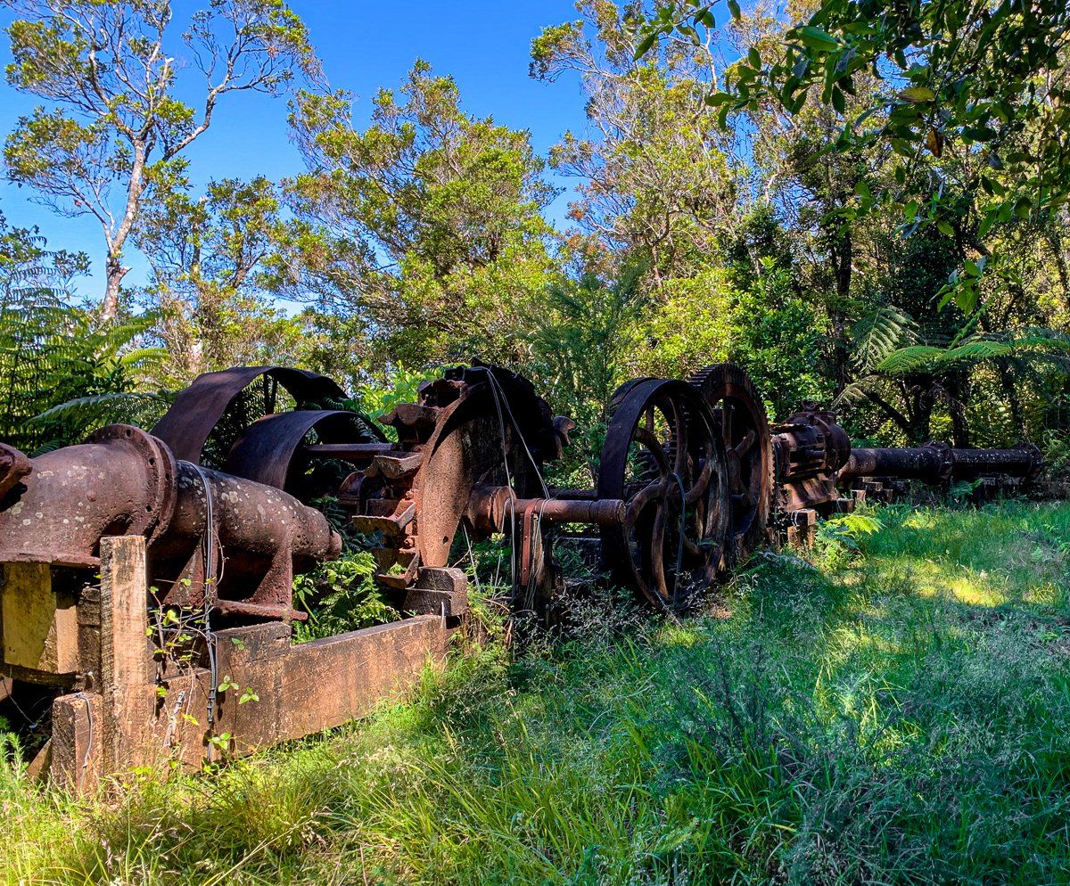
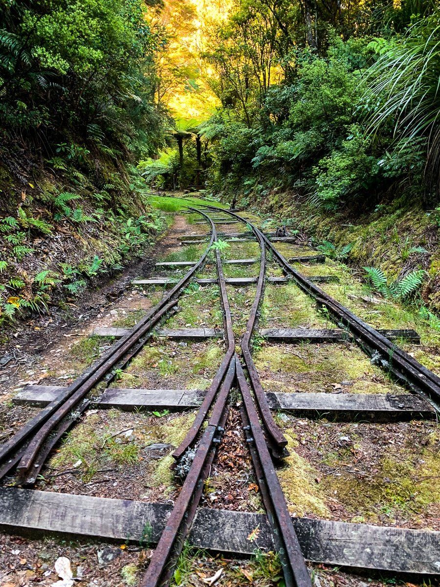
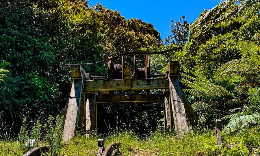
The valley became a hub of gold mining activity in the 1880s, during the Coromandel gold rush. It was home to New Zealand’s first successful large-scale mining tramway, the Piako County Tramway, which was built to haul ore from the steep hillsides down to the battery below.
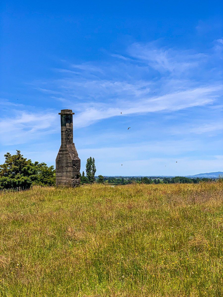
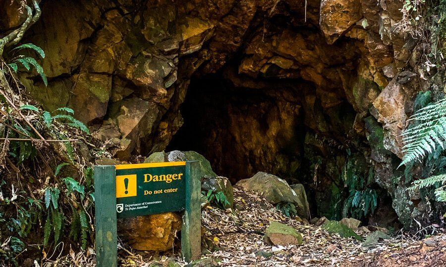
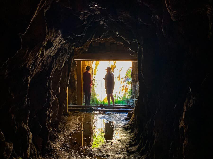
Today, walkers can follow these historical routes, including steep incline planes, tram tracks, ore wagons, and tunnels carved into the hillside. Relics such as rusting winches, old stamper batteries, and disused shafts are scattered throughout the landscape, making it one of the most accessible and intact examples of a 19th-century gold mining operation in the country. Interpretive panels along the track help bring this industrial history to life.
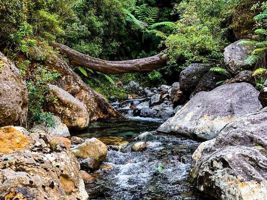
Natural Features
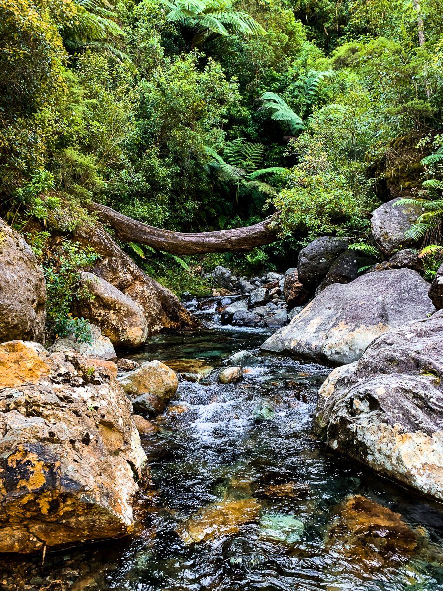
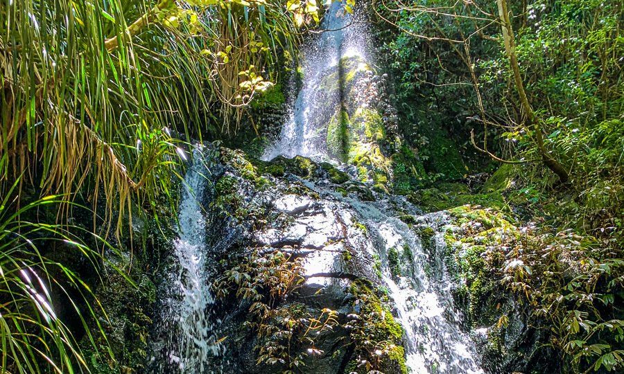
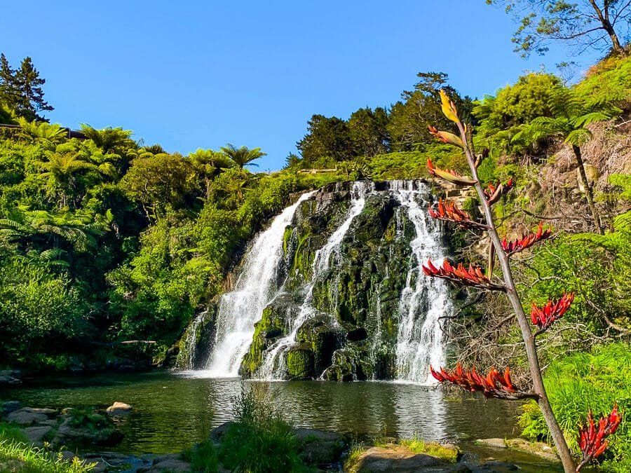
The valley is rich in biodiversity and natural features. Native forest is slowly reclaiming the once-bare hillsides, with regenerating rimu, tawa, and kāmahi creating green canopies over the old tracks. Birdsong from tūī, kererū, and pīwakawaka has returned, and the area’s numerous waterfalls, including Butlers Incline Falls and Waterfall Creek, are scenic rest points. Ferns and mosses thrive in the moist microclimate, softening the edges of industrial ruins and adding to the valley’s sense of quiet reclamation.
For the Adventurous
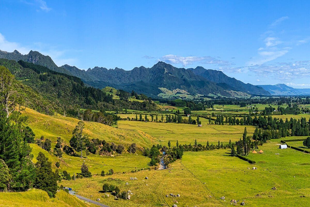
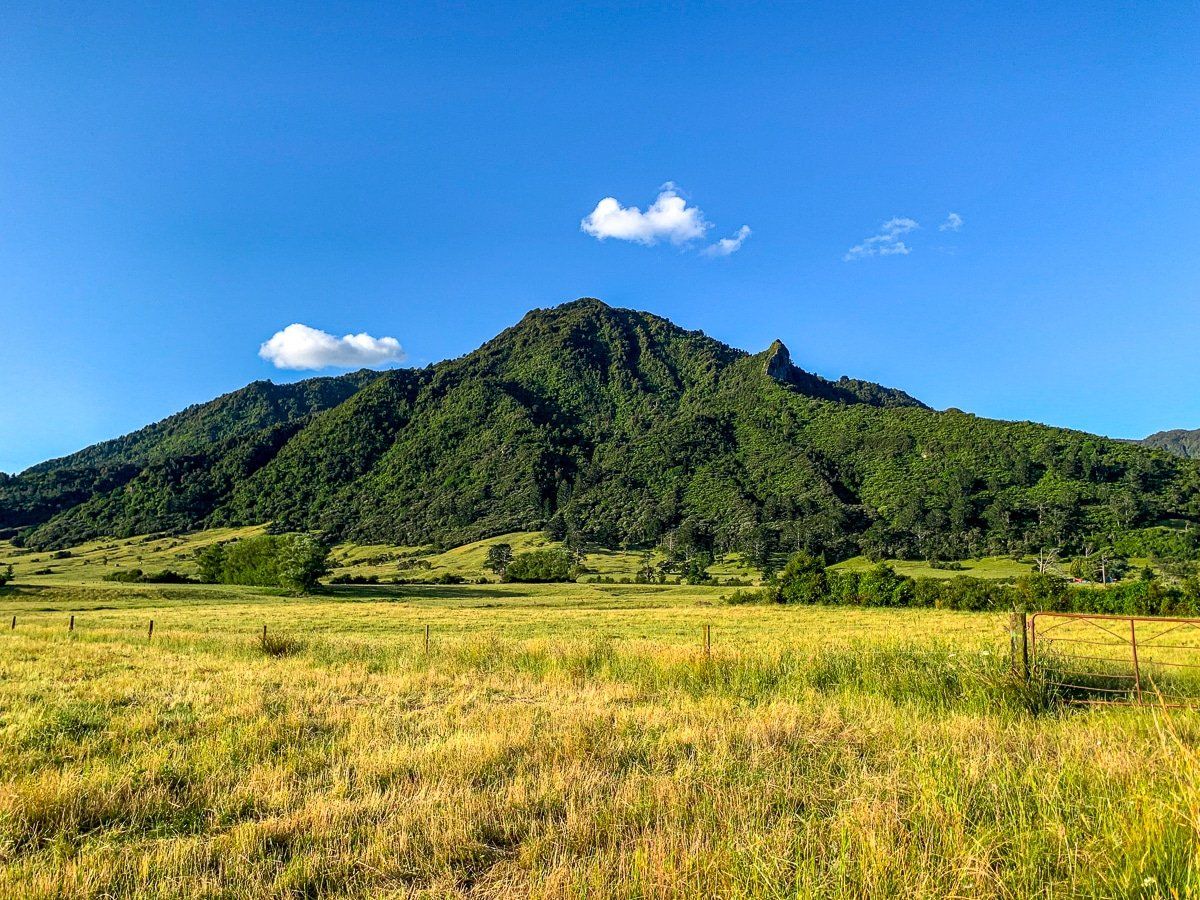
For those seeking a challenge, the trail system extends to the summit of Mount Te Aroha (952 m), the highest point in the Kaimai Range. The climb is steep but rewarding, with panoramic views over the Hauraki Plains and beyond to the Bay of Plenty. The summit also holds cultural significance, with Te Aroha meaning “the love,” a name linked to Māori stories of devotion and loss.
Choosing Your Route
When planning your visit, carefully check a map as there are multiple looped routes above and within the valley. Select a route that suits your time and ability. Some tracks are steep and involve stream crossings, while others are mostly flat and straightforward.
Getting to the Waiorongomai Valley
To reach the start of the tracks, take Waiorongomai Road off Te Aroha Gordon Road, located southwest of Te Aroha. From Te Araoha, it is a 6-minute 5.4 km drive. From Auckland, the drive is 110 minutes and 147km, and from Hamilton, it is 55 minutes and 64 km.
Nearby places to visit include Wairere Falls, and various options in the Karangahake Gorge, including the Karangahake Loop, Windows Walk, Victoria Battery and Waikino.