Walking the Spine of an Ancient Volcano
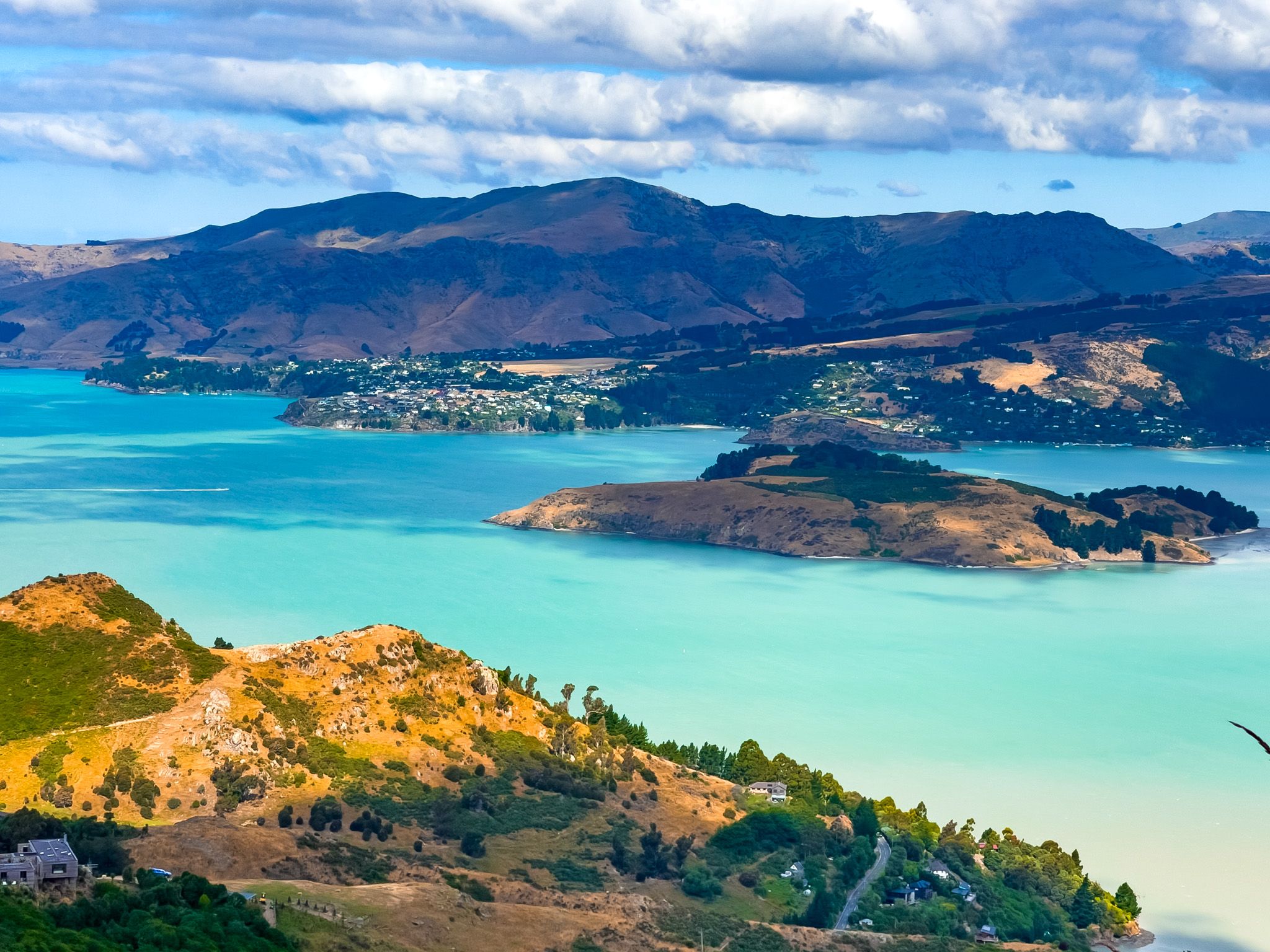
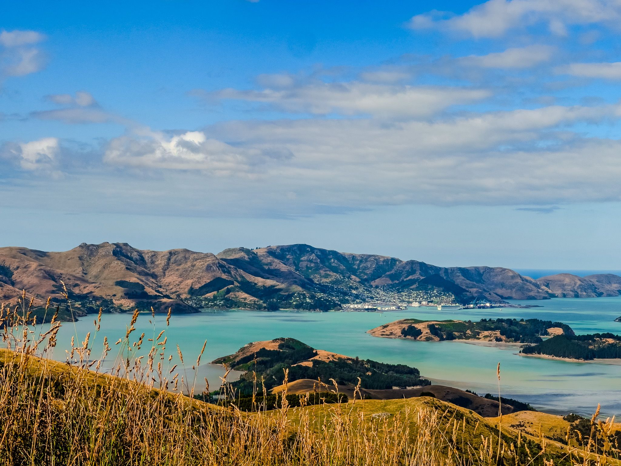
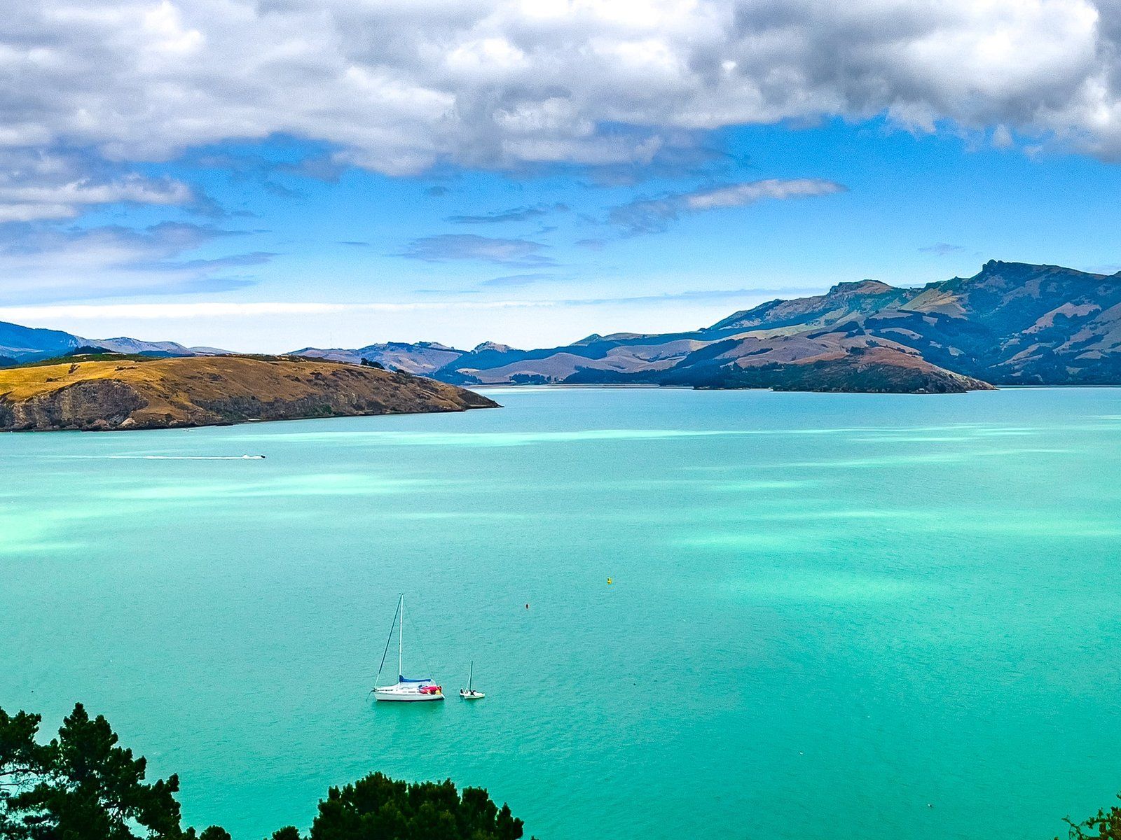
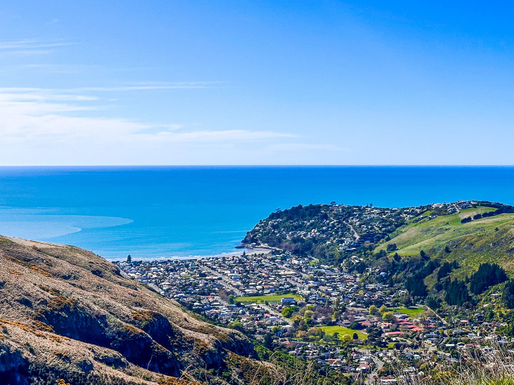
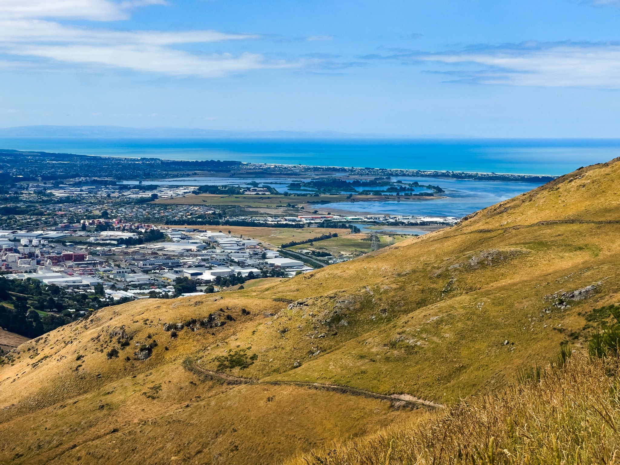
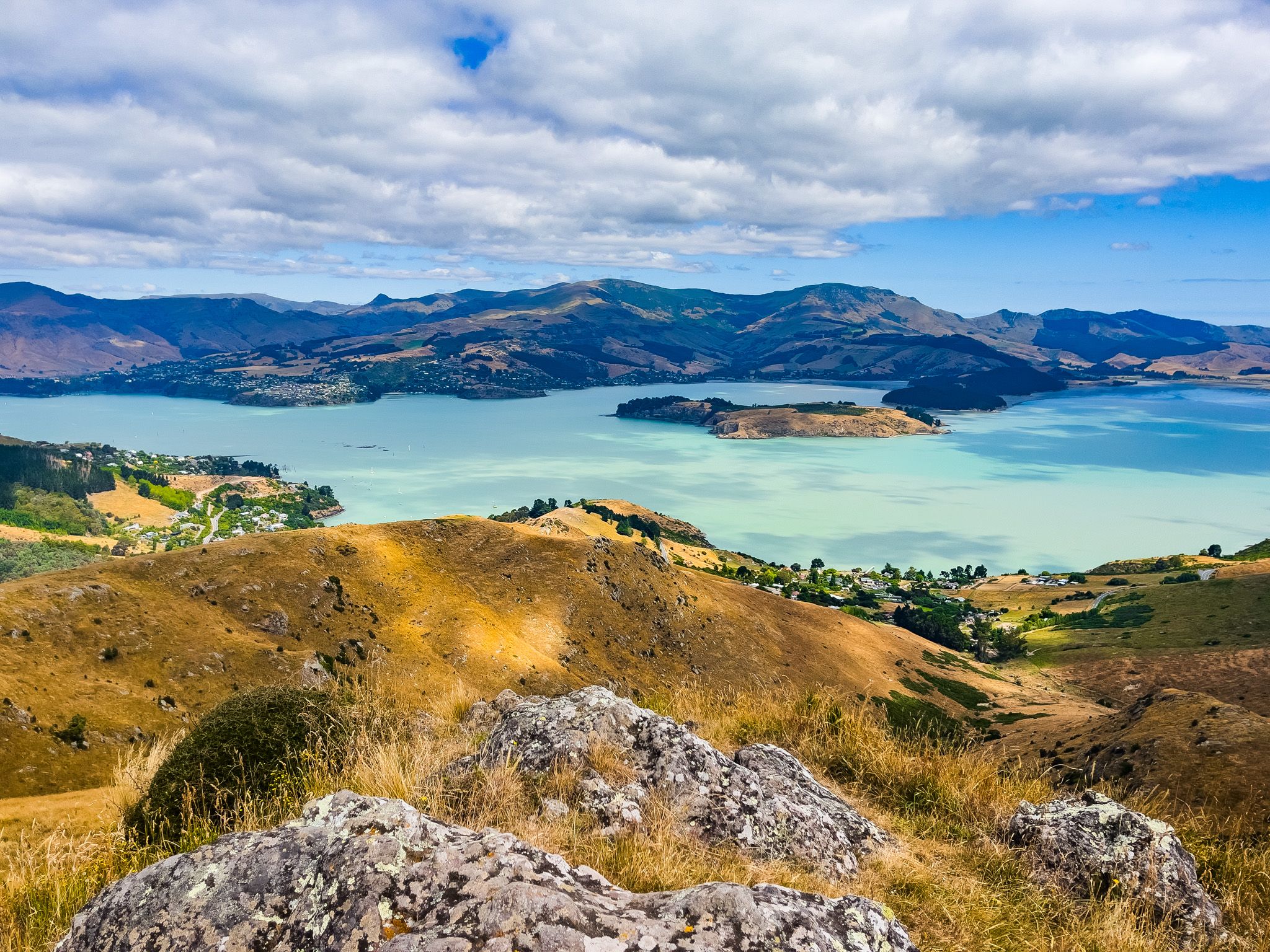
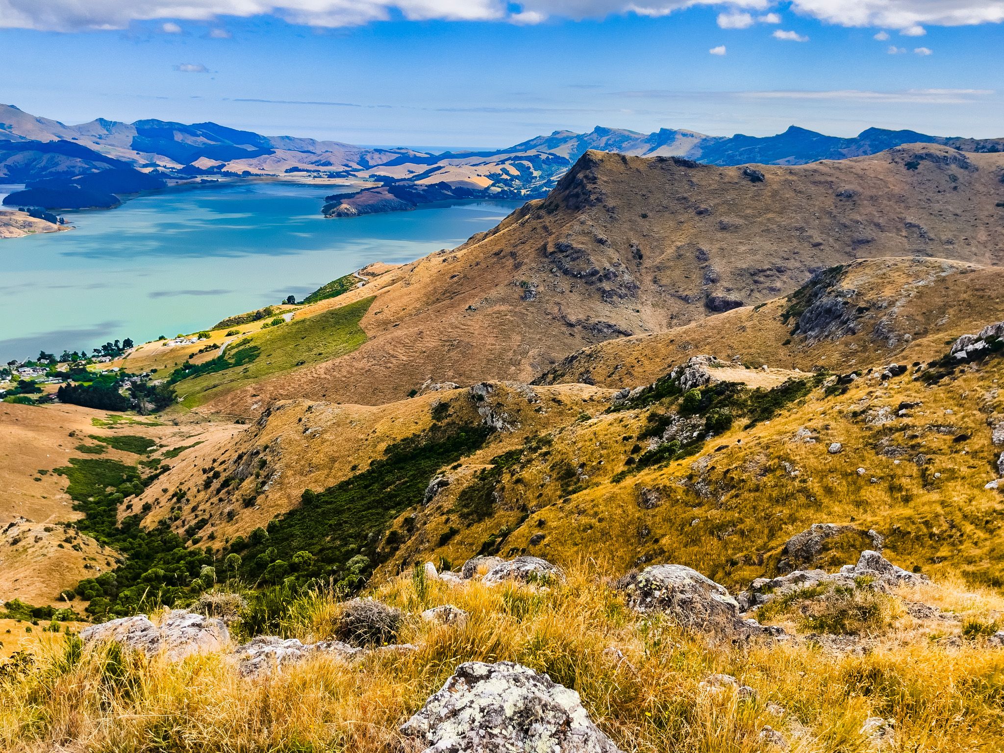
The Crater Rim Walkway follows the full arc of the Port Hills from Awaroa / Godley Head in the northeast to Ahuriri Reserve near Gebbies Pass in the southwest, 27 km along the eroded rim of the ancient Lyttelton Volcano, with Whakaraupō / Lyttelton Harbour on one side and Christchurch, the Canterbury Plains, and the Southern Alps on the other. It is one of the great urban fringe walks in New Zealand: close to a major city, yet on a ridge that feels genuinely wild, with views that stop you in your tracks every few hundred metres.
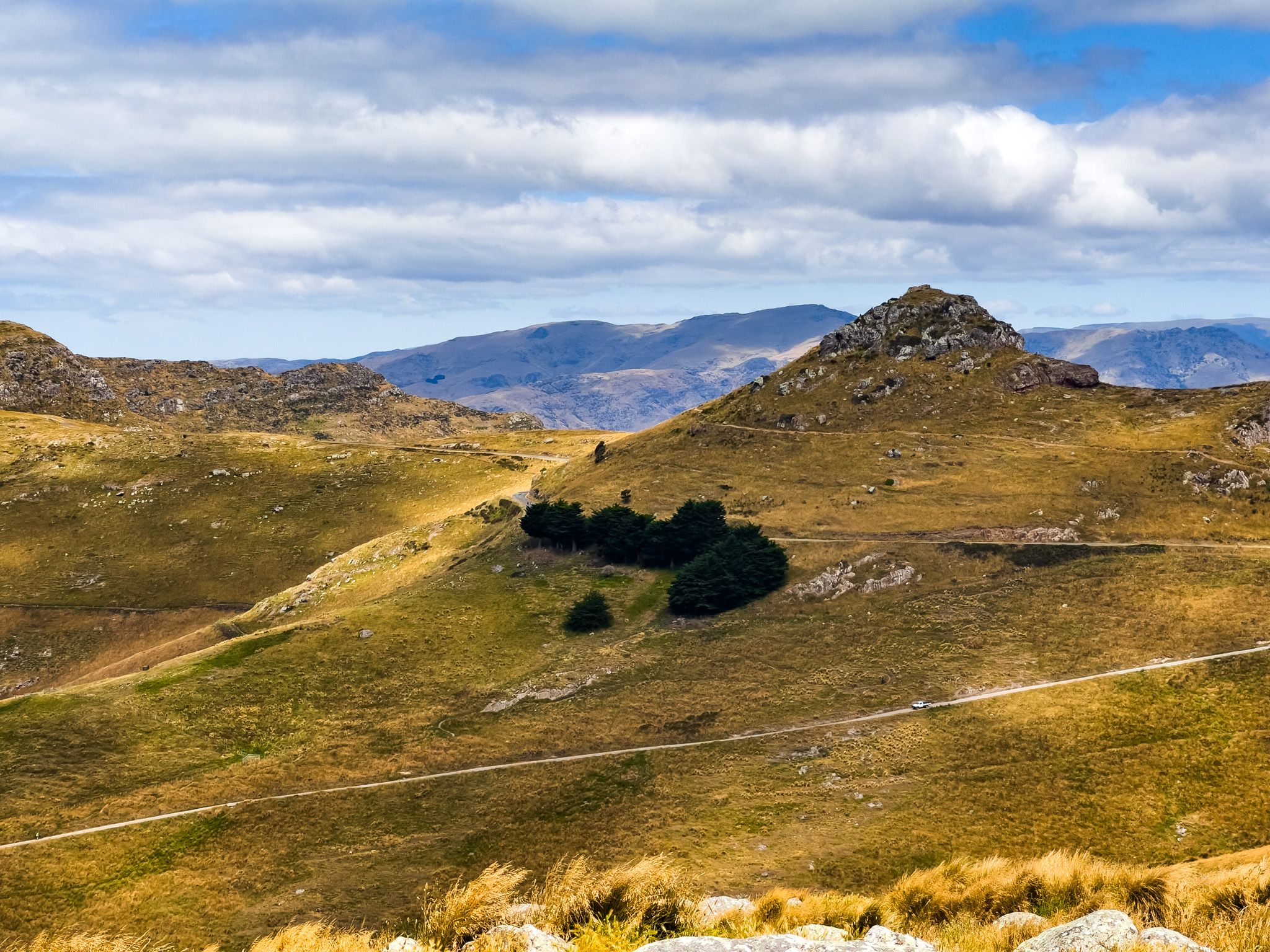
Most people walk sections rather than the full length, and the Summit Road, which runs parallel for much of the route, makes it easy to join the walkway at several points. But the walkway rewards time. Every turn along the rim brings a new angle on the harbour, a new volcanic outcrop, a different light on the plains. The peaks, side tracks, reserves, and geological features along the way are numerous enough that a single day could absorb weeks of return visits.
The Southern Section
Ahuriri Bush Scenic Reserve to Sign of the Kiwi
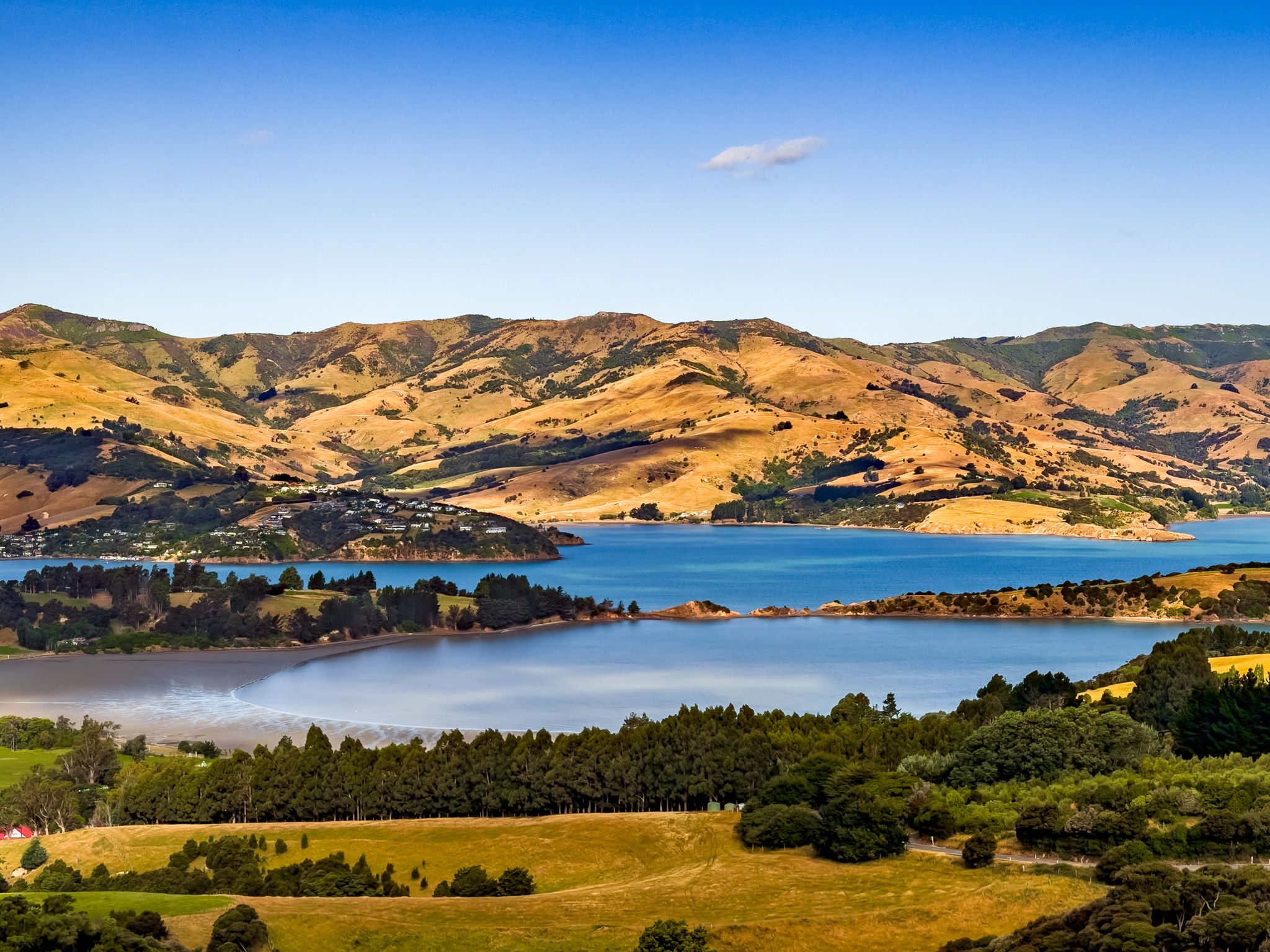
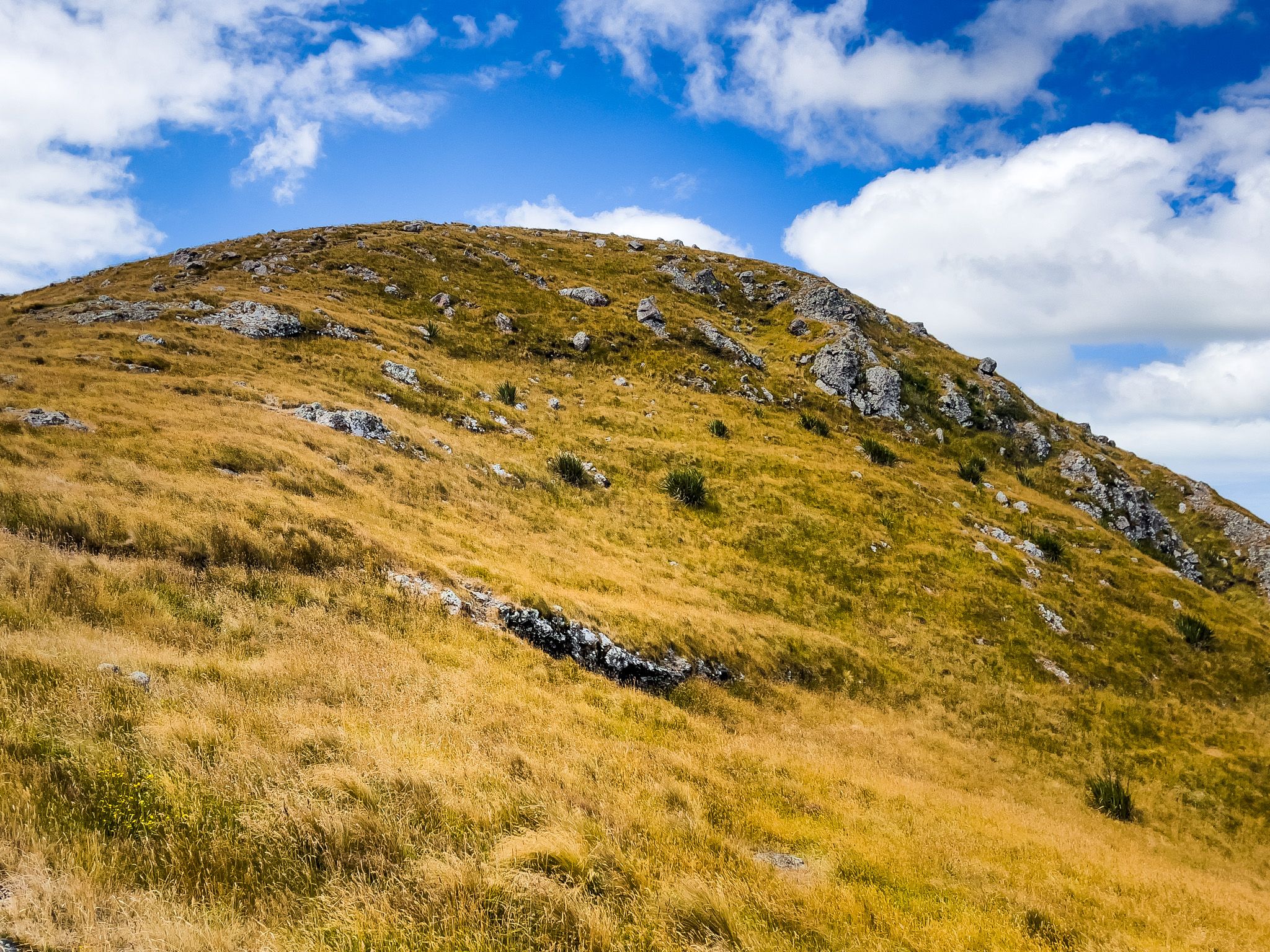
The Southern end of the walkway begins at Ahuriri Bush Scenic Reserve, where the track starts in a pocket of native bush, tree fuchsia and horopito, then crosses Summit Road and emerges onto the open grassy ridge. The next major landmark is Coopers Knob / Ōmawete at 573 m, the highest point on the Port Hills. The outcrops here are near-vertical on the harbour side and gently sloping toward the west, a pattern repeated along the entire rim. Gibraltar Rock is another striking nearby feature.
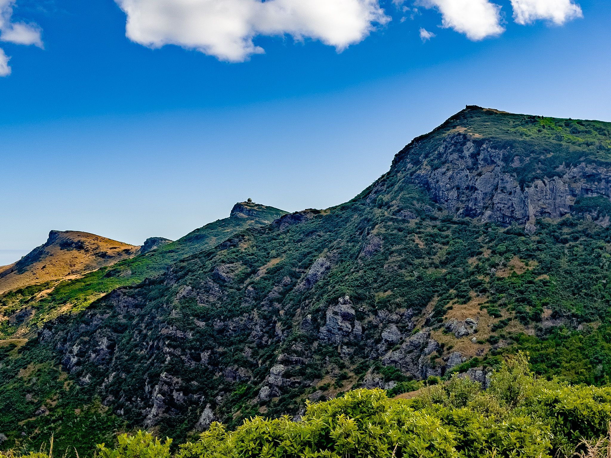
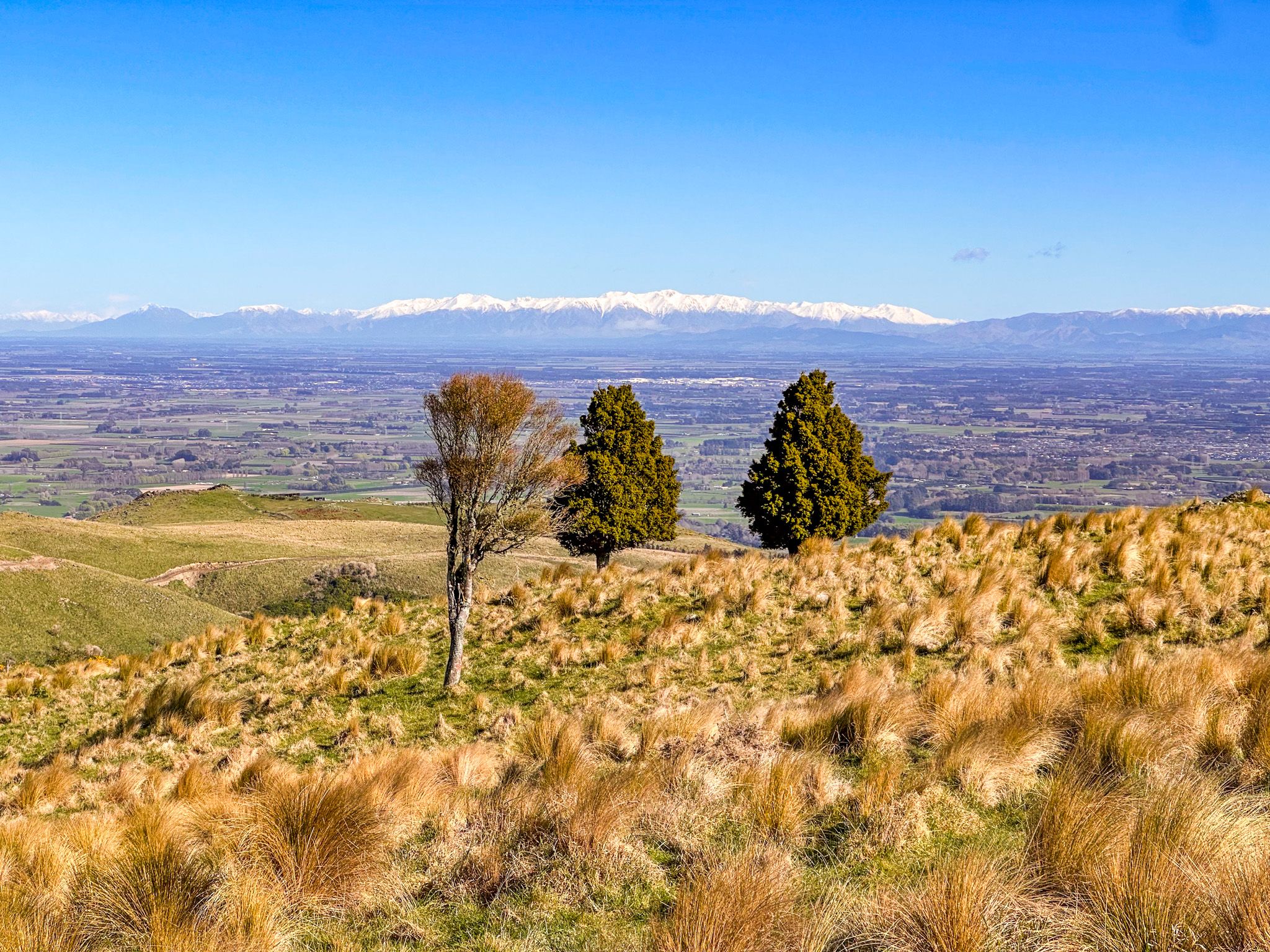
From Coopers Knob, the track continues northeast past Cass Peak / Ō-Rongo-Mai (545 m), recognisable by its large air traffic control radar dome, then descends through recovering scrub to the Sign of the Bellbird shelter and Kennedy's Bush. The John Jameson Lookout is on the opposite side of Summit Road here, with some of the finest harbour views on the entire walkway. From there, the track continues to Hoon Hay Scenic Reserve, with side trips to the crater rim, then to the Sign of the Kiwi café at Pukeatua / Dyers Pass. This cafe marks roughly the midpoint of the walkway.
The Central Section
Sign of the Kiwi to the Bridle Path
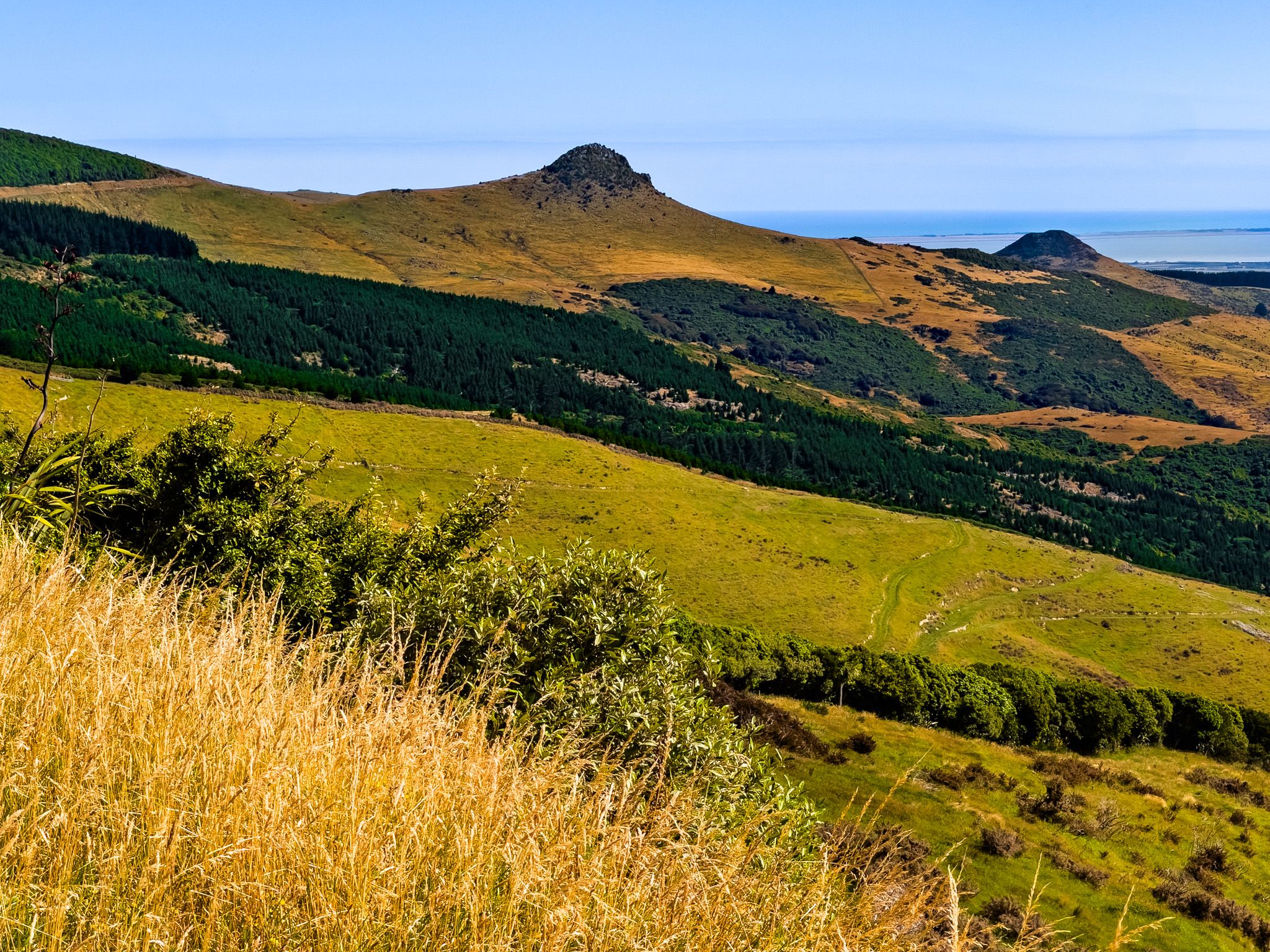
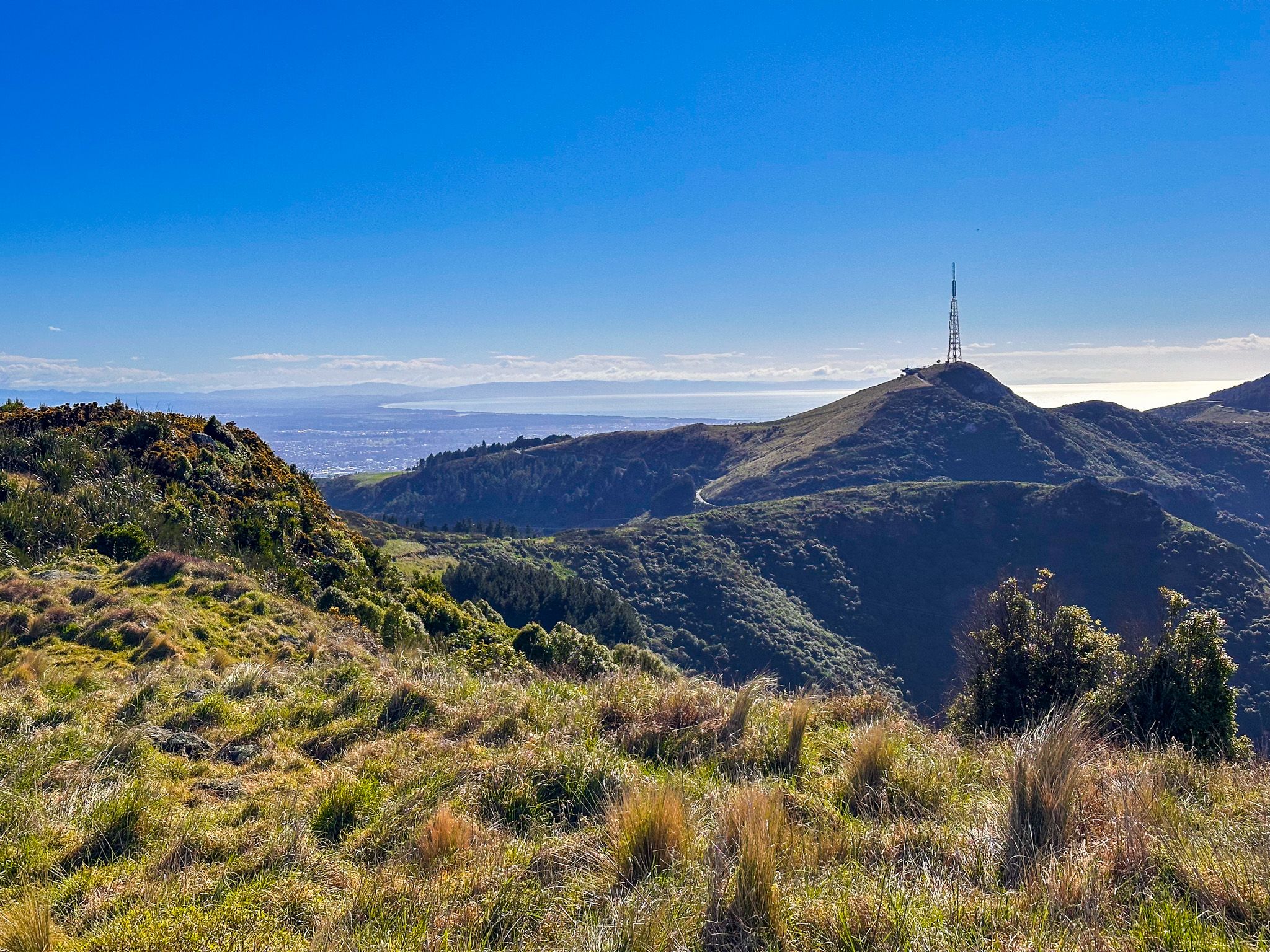
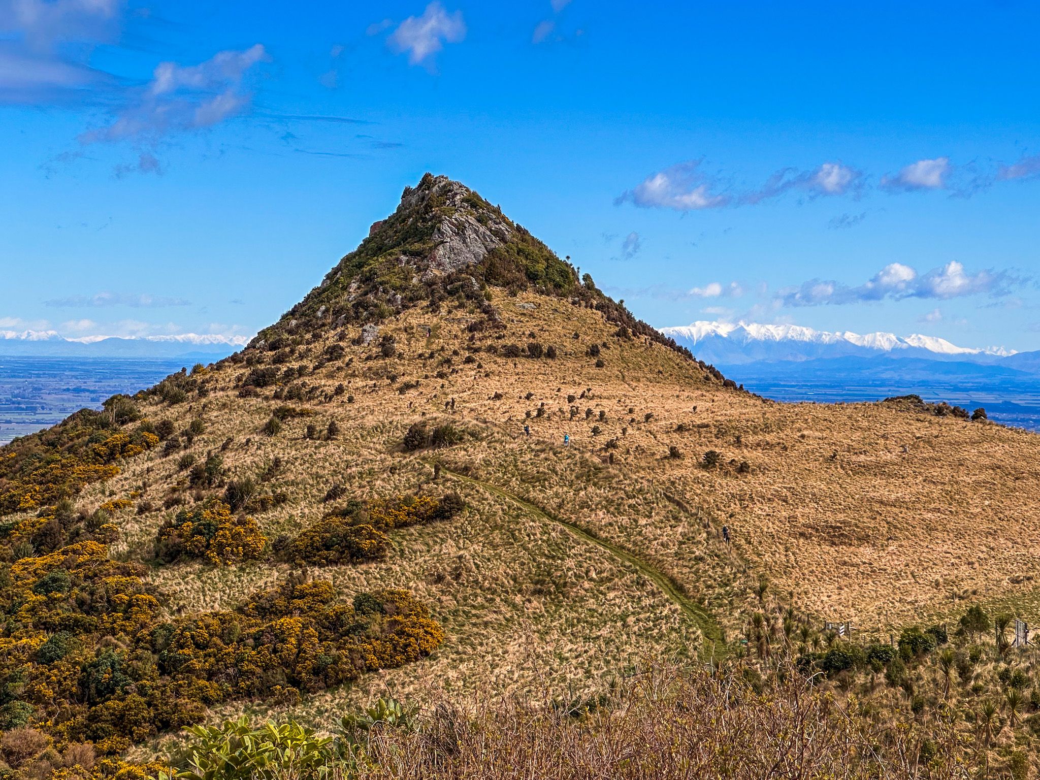
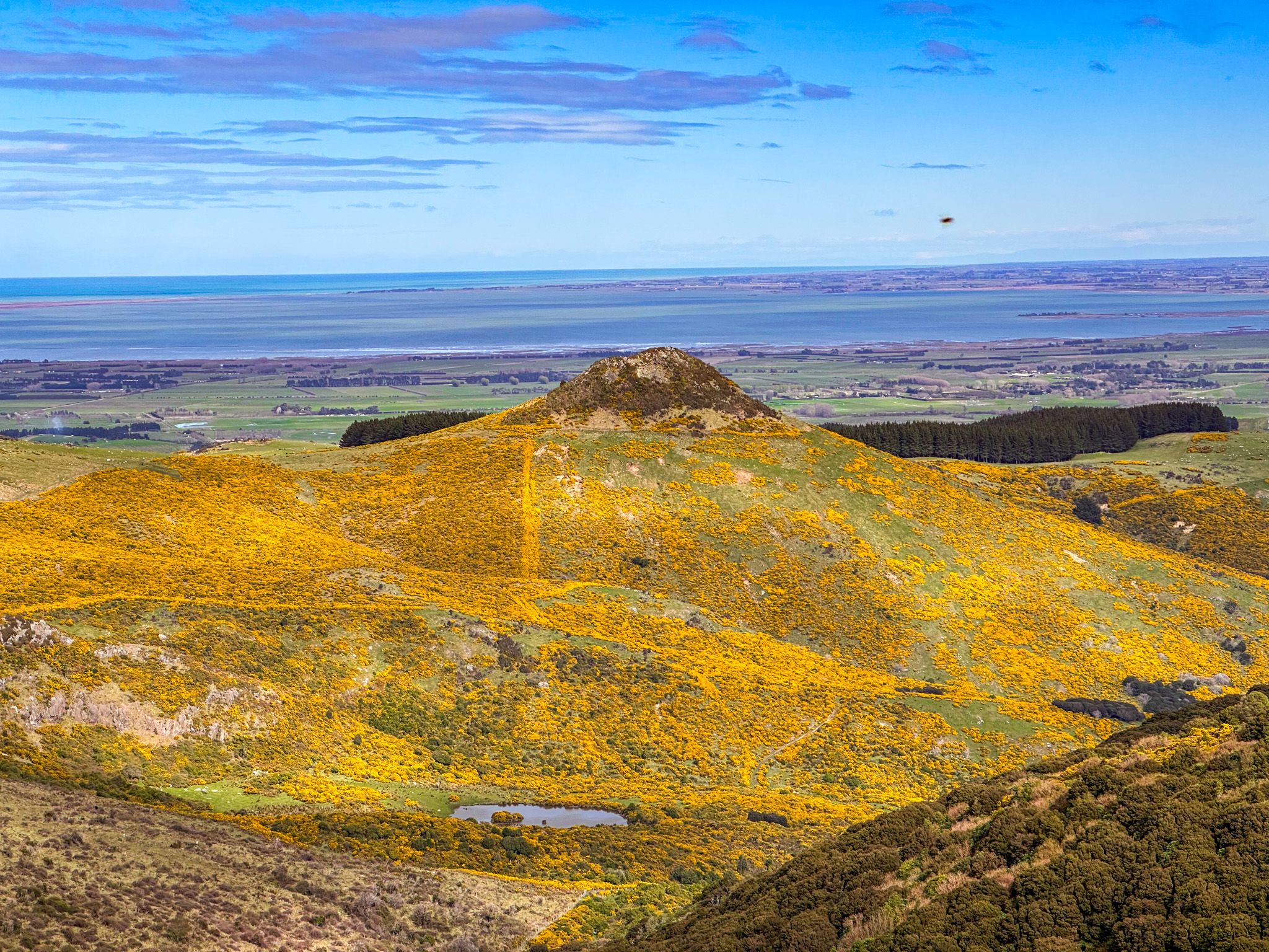
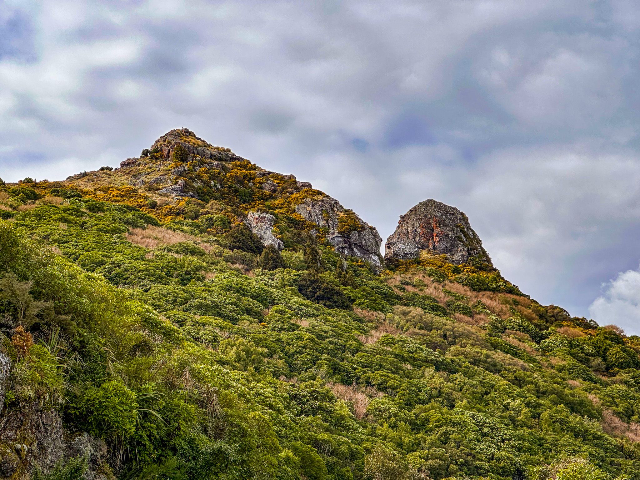
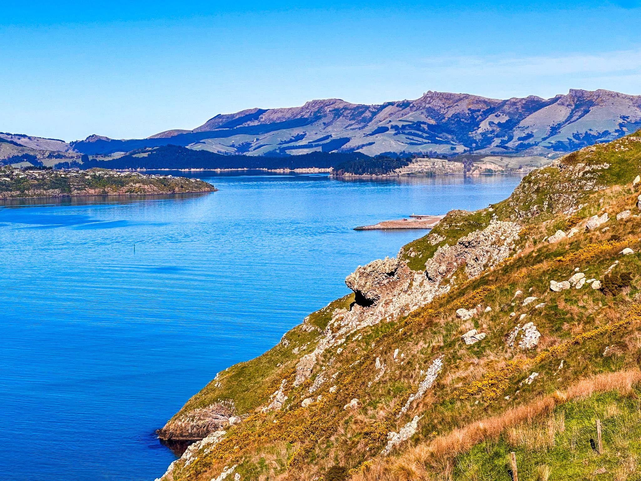
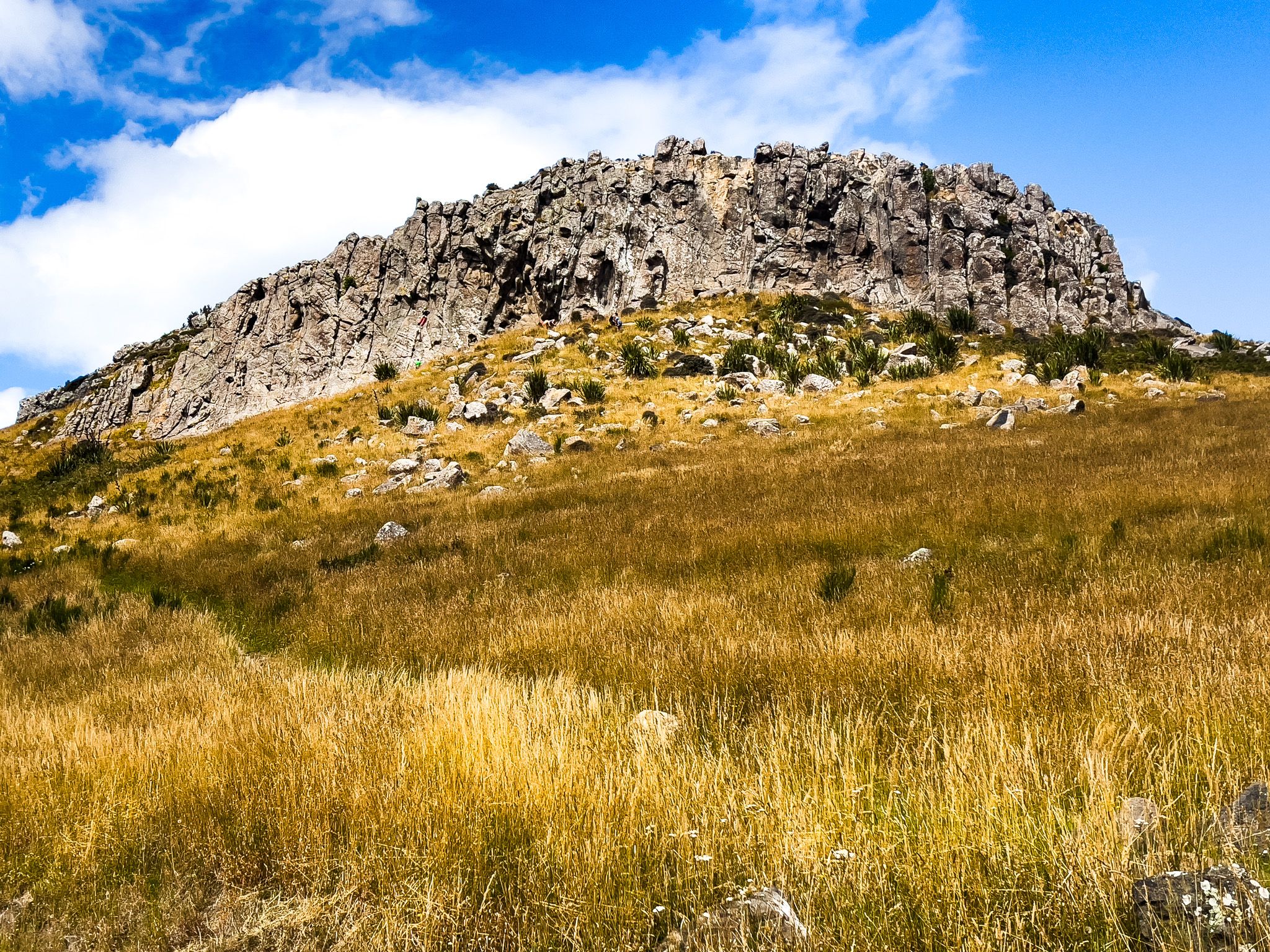
From the Sign of the Kiwi, the track veers northeast, following the steep slopes of Te Heru o Kahukura / Sugarloaf (494 m), whose television transmission tower is a fixed point on the Christchurch skyline. It then undulates along the crater rim to Mt Vernon, then heads east to Te Ahi-a-Tamatea / Rāpaki Rock and Witch Hill / Te Upoko-o-Kurī. The former is a volcanic dyke named for the ancient fire sent by Tamatea. Te Moenga-o-Wheke / The Tors, and Te Tihi-o-Kahukura / Castle Rock, then add their own distinctive silhouette to the ridge.
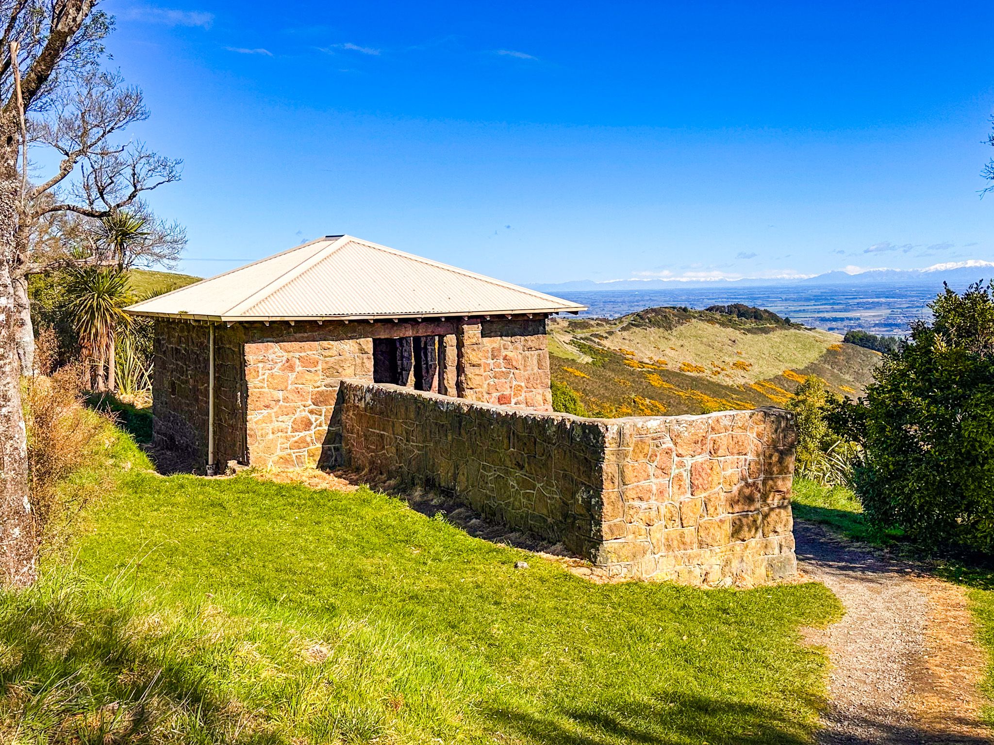
The track descends to the Bridle Path saddle, where a small stone shelter marks the Pioneer Women's Memorial and the crossing point used by Canterbury's first European settlers on their climb from Lyttelton to the plains.
The Eastern Section
Bridle Path to Godley Head
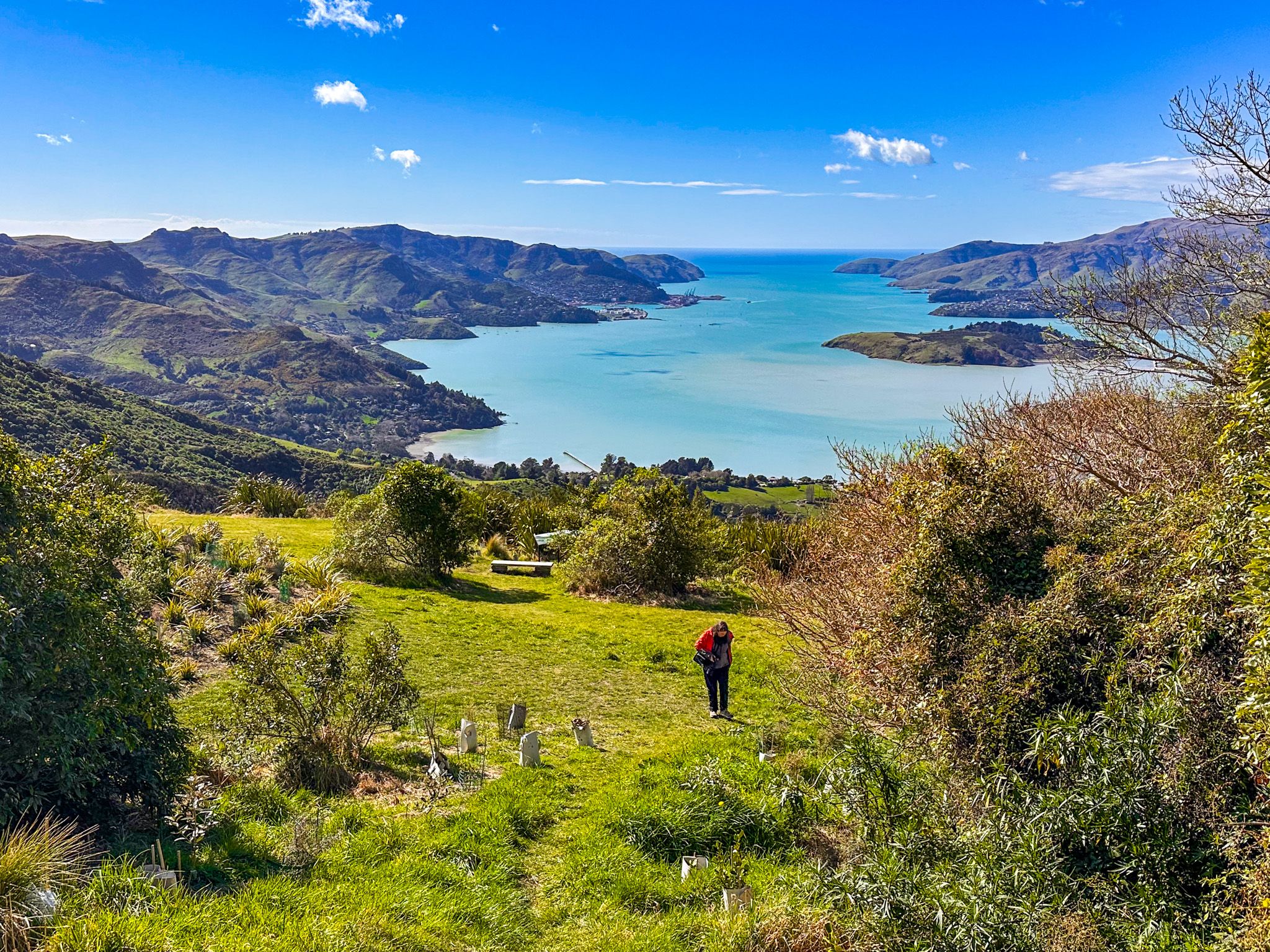
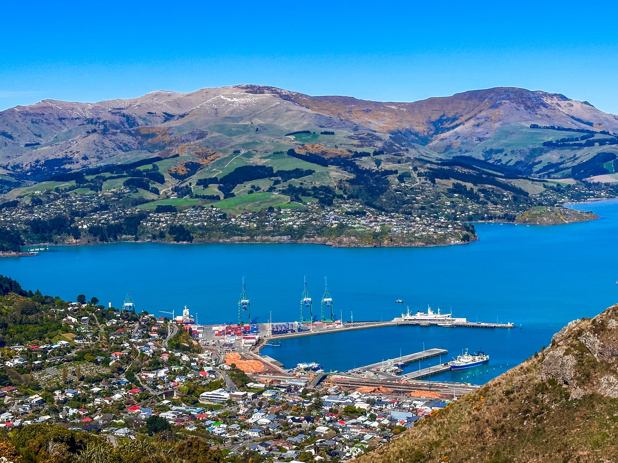
From the Bridle Path saddle, the walkway climbs past the top station of the Christchurch Gondola on Mt Cavendish (448 m), which provides a welcome stop for refreshments and a viewing platform above the harbour.
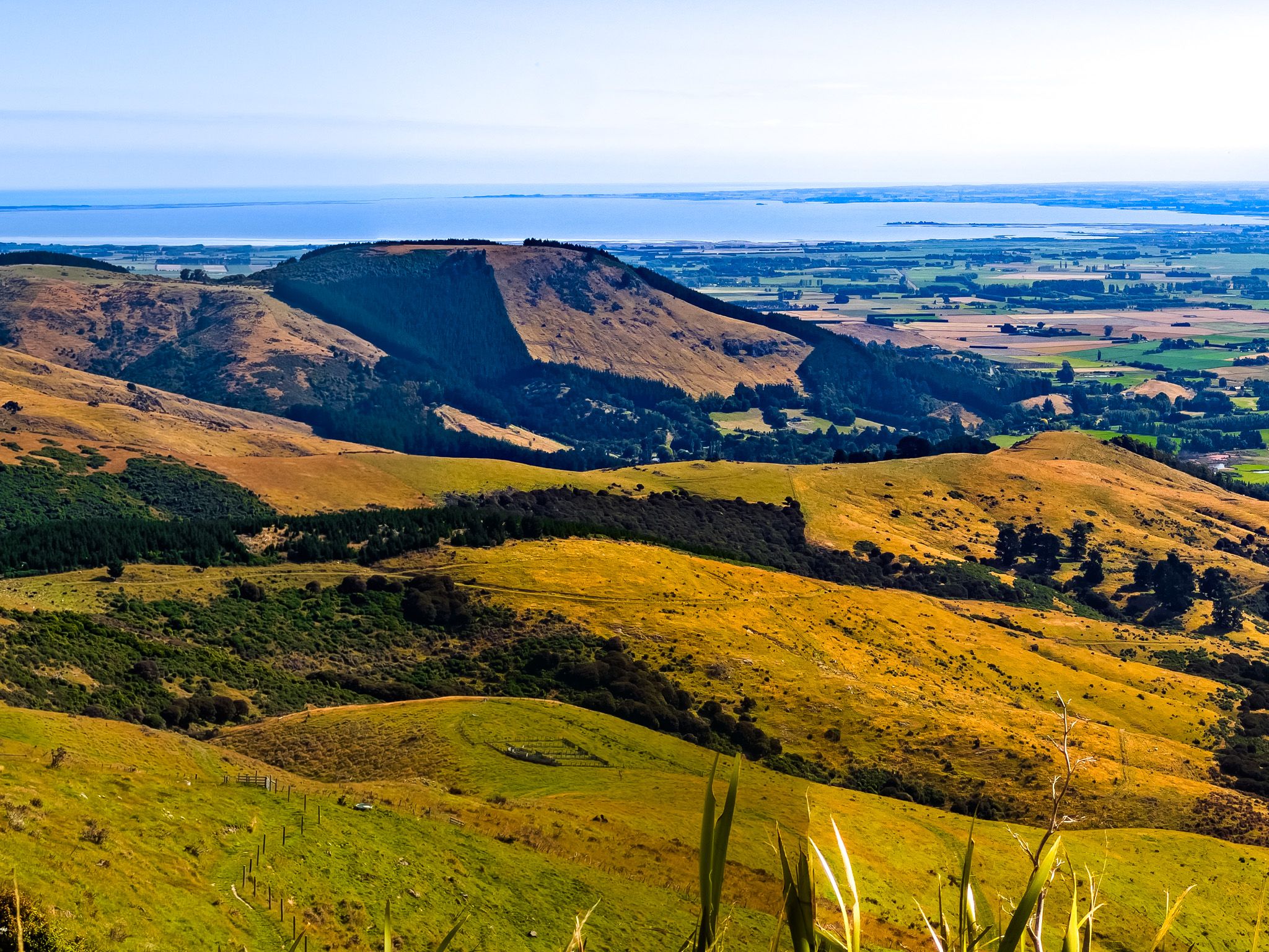
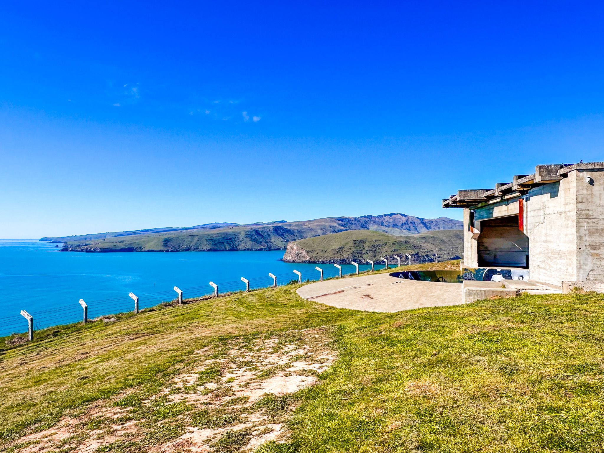
The track then drops to the saddle between Mt Cavendish and Tauhinukorokio / Mt Pleasant (499 m), the highest summit in the northern arc of the Port Hills, before descending gradually to Evans Pass. The final section traverses several significant hill tops on the way out to Awaroa / Godley Head, where the track ends above the old WWII gun emplacements overlooking the harbour entrance. The eastern end feels more remote and exposed, with big coastal views opening out over Pegasus Bay and New Brighton to the north.
Walking in Sections
The easiest approach for most visitors is to pick a section and walk it from a Summit Road car park, returning the same way or catching a lift. Popular shorter walks include the section between the Sign of the Kiwi and the Sign of the Bellbird (roughly 4 km, mostly open ridge); the stretch from Witch Hill to the Bridle Path saddle; and the eastern section from Evans Pass to Godley Head.
Multiple tracks climb from the city to the rim, including the Harry Ell Walkway from Victoria Park, the Rapaki Track from Rapaki Road, the Bridle Path from Heathcote Valley, and the Major Hornbrook Track to Mt Cavendish, making one-way walks with a drop-off straightforward to arrange. The Gondola also provides access to the track via Mt Cavendish.
The track is well marked with waratahs and signposts at all key junctions. The surface varies from a formed gravel path to open tussock and rocky scramble on the more exposed peaks. Wind can be fierce on the open sections, and the ridge offers little shade. Choose the conditions and be prepared for a change if you're out for a longer walk.
How to Get There
The most convenient starting point for the central section is the Sign of the Kiwi at Pukeatua / Dyers Pass, reached via Dyers Pass Road from Cashmere. The drive is 9.7 km and takes 17 minutes from central Christchurch.
For the southern end, turn off State Highway 75 at Gebbies Pass Road, then take Summit Road to Ahuriri Bush Scenic Reserve. For the eastern end, Godley Head is reached via Evans Pass Road from Sumner, then Summit Road heading east from the pass.
Summit Road car parks at Hoon Hay Reserve, John Jameson Lookout / Sign of the Bellbird, and Rāpaki / Witch Hill are other options for joining the walkway.