A Beach that Earns its Drama
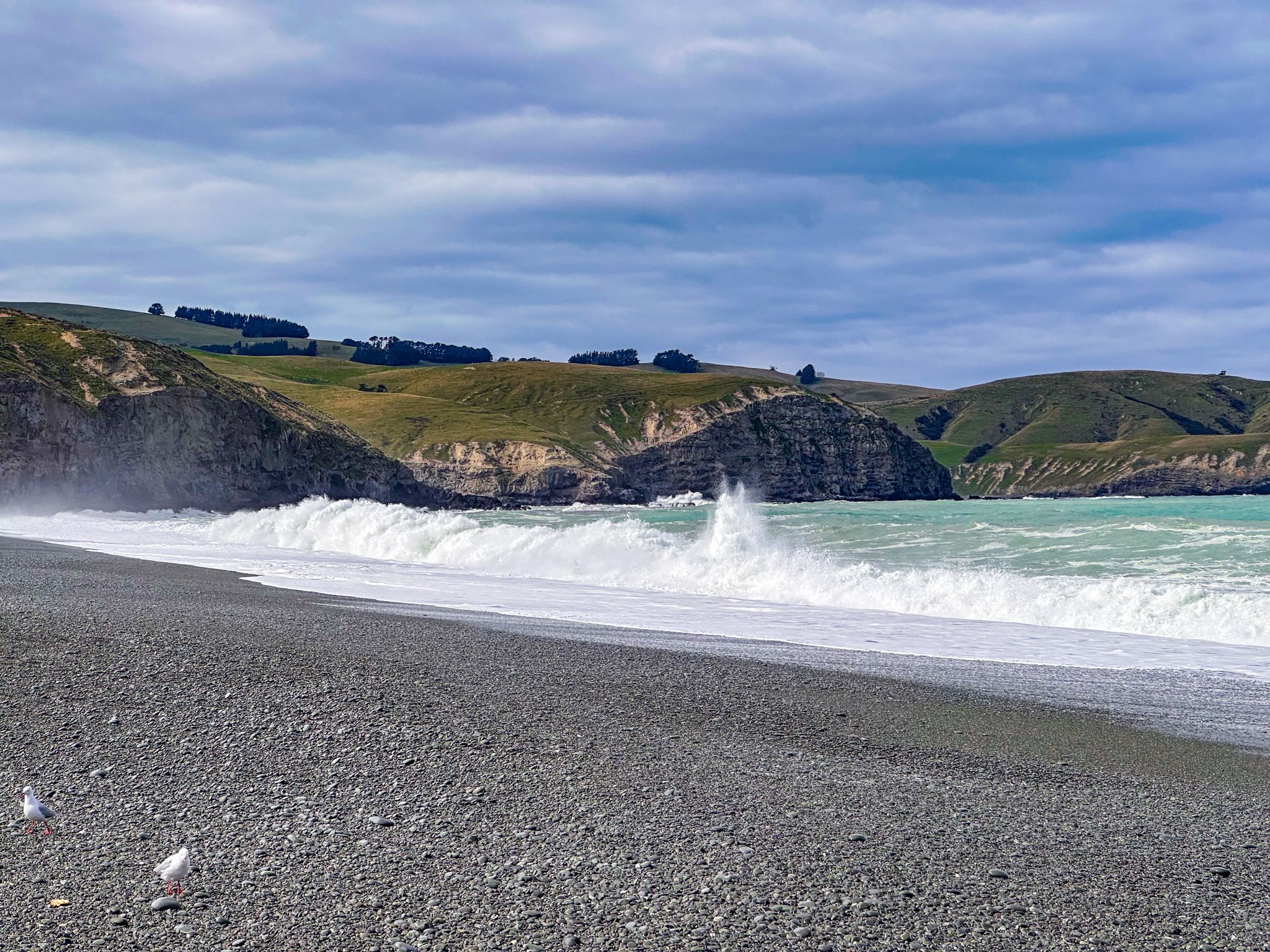
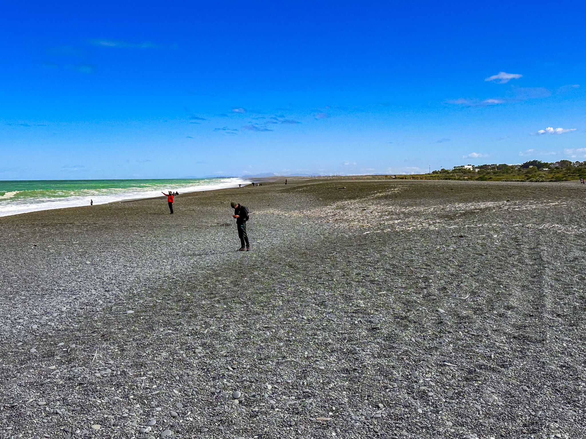
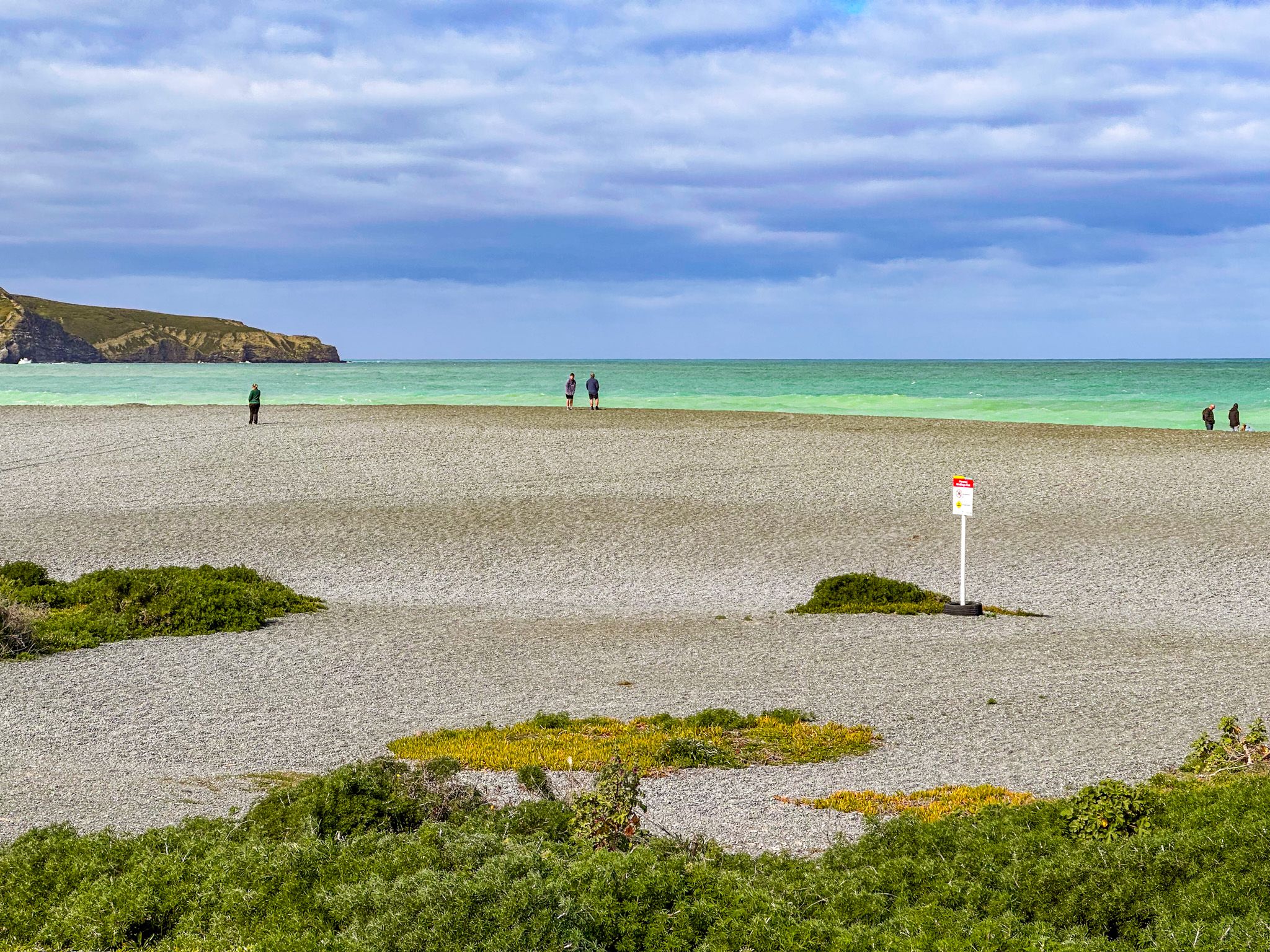
Birdlings Flat Beach sits at the eastern end of Kaitorete Spit on the Canterbury Pacific coast, where the Canterbury Bight meets Banks Peninsula, about 45 minutes south of Christchurch. The beach is one of the most unusual in New Zealand. There is no sand. Instead, the shore is a massive expanse of rounded stones, and the Pacific Ocean beyond it is not for swimming. What draws people here is something different: raw coastal force, the thrill of geological treasure-hunting, and wildlife that surprises most first-time visitors.
How this Beach Came to Be
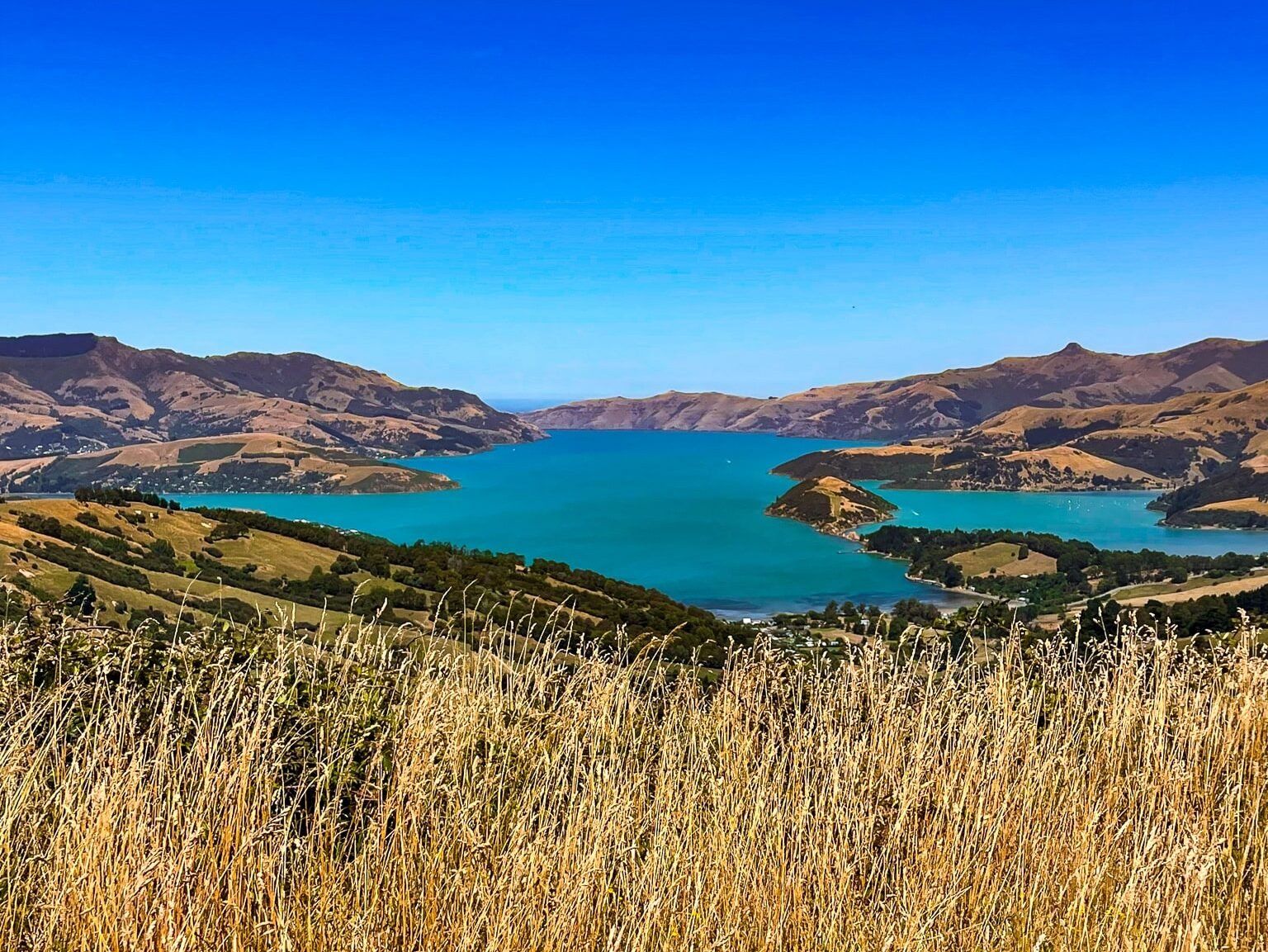
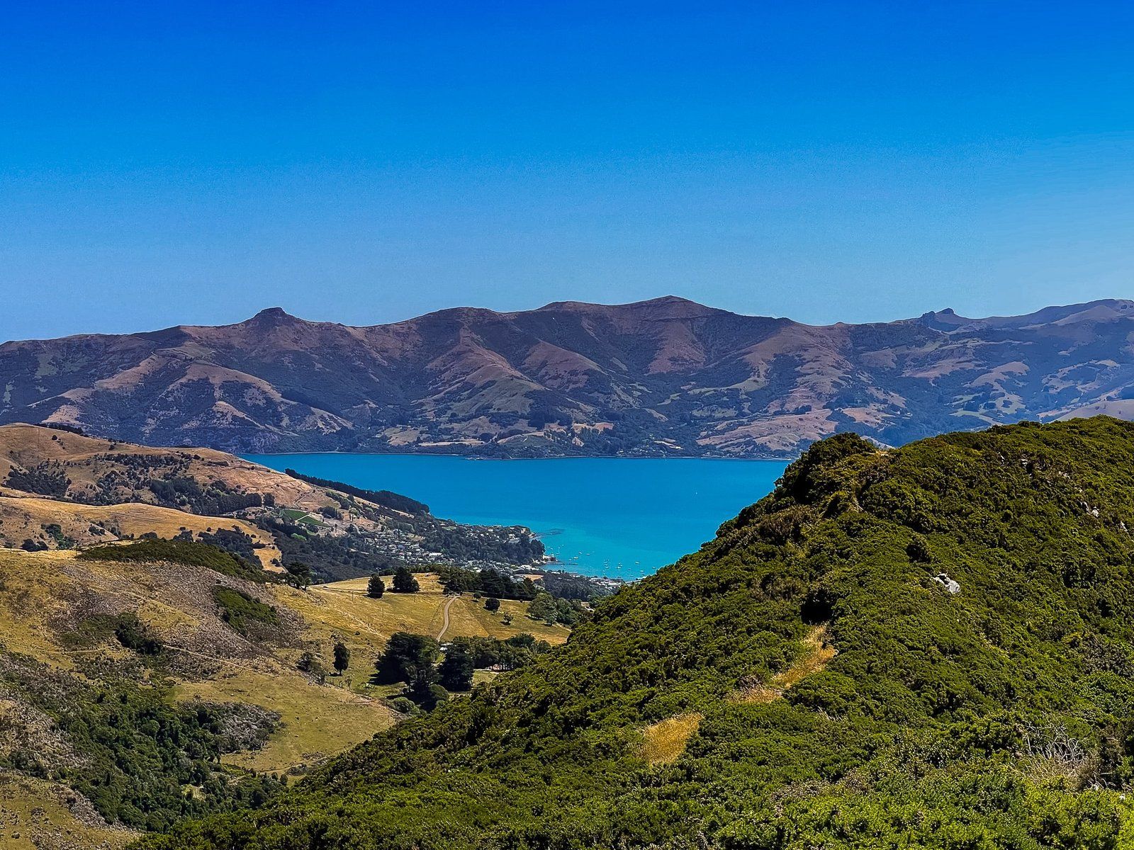
The story of Birdlings Flat beach starts in the Southern Alps. The braided rivers of Canterbury, such as the Rakaia and Rangitata, have been bringing stones from the mountains for millions of years and delivering them to the sea. Ocean currents then carry the by now rounded river stones northward along the Canterbury Bight. The volcanic mass of Banks Peninsula acts as a barrier, and material accumulates where the spit and peninsula meet. Over the past 10,000 years, this process built Kaitorete Spit: a 25 km barrier of gravel and stone separating Lake Ellesmere / Te Waihora from the Pacific Ocean.
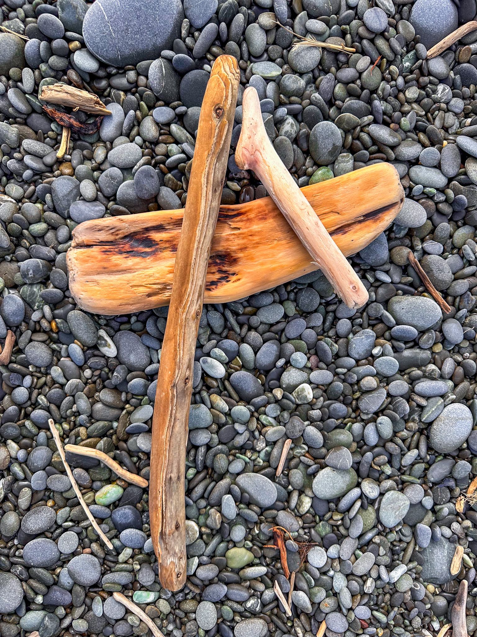
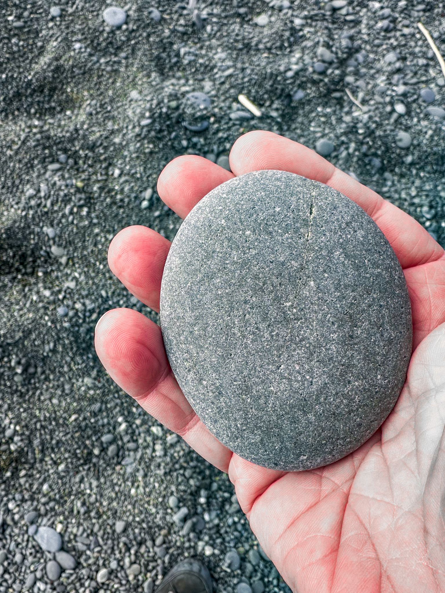
The result is a beach stocked with stones from across the South Island. Among the ordinary grey sandstone and chert of the Torlesse basement rock, you can fossick for agates, jasper, chalcedony, carnelian, sardonyx, quartzite, rhodonite, and petrified wood. The best time to search is immediately after a storm, when the sea churns the surface and exposes fresh material underneath. The beach was gazetted as a reserve in 1965.
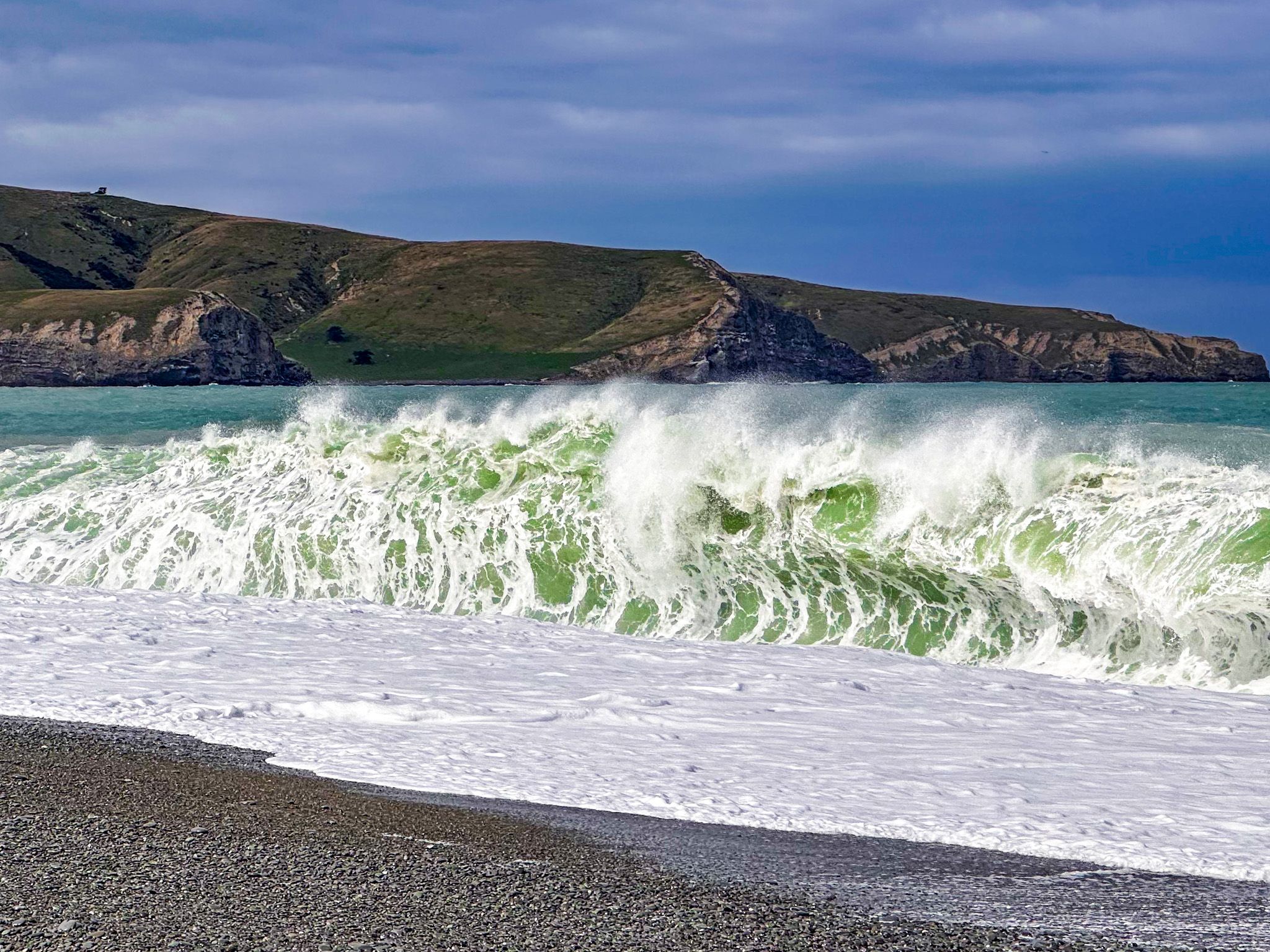
Waves that Detonate
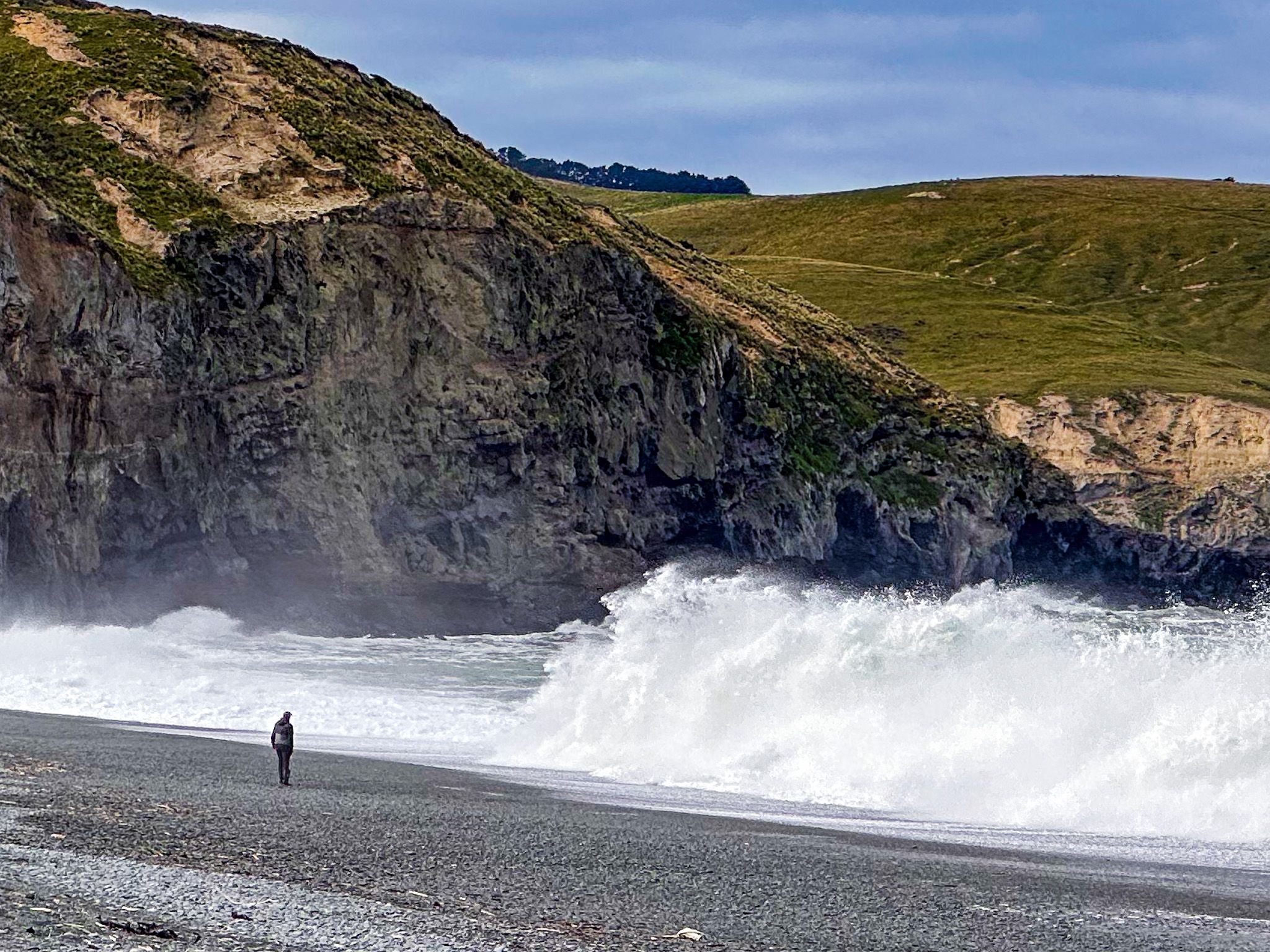
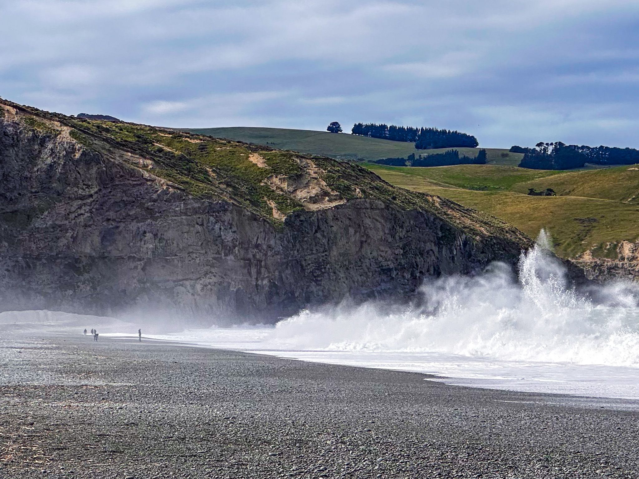
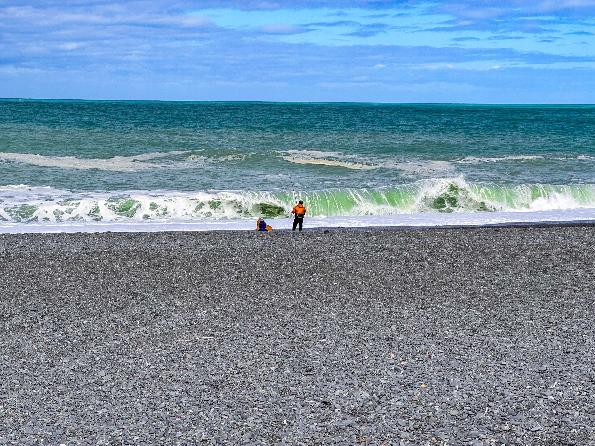
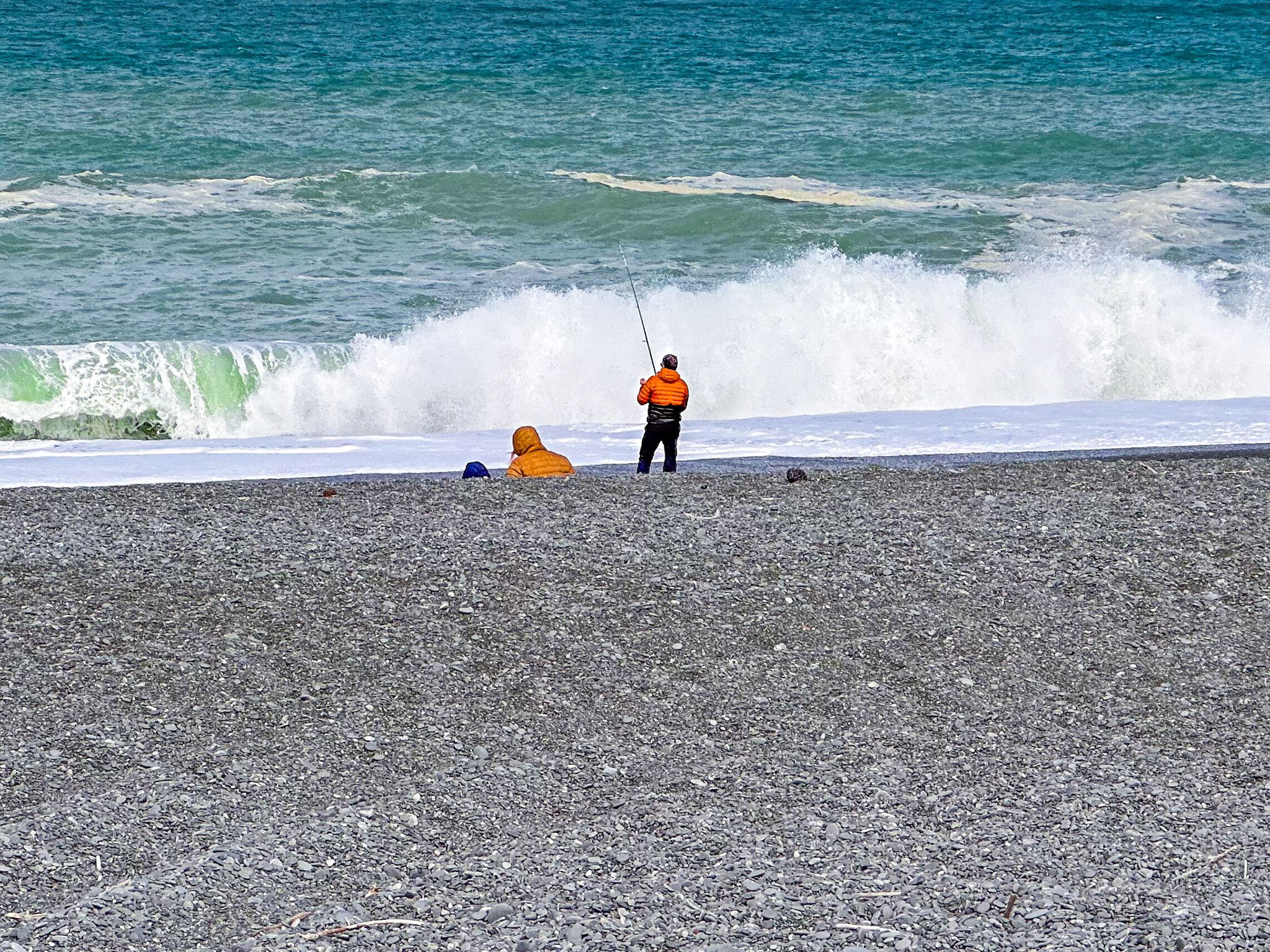
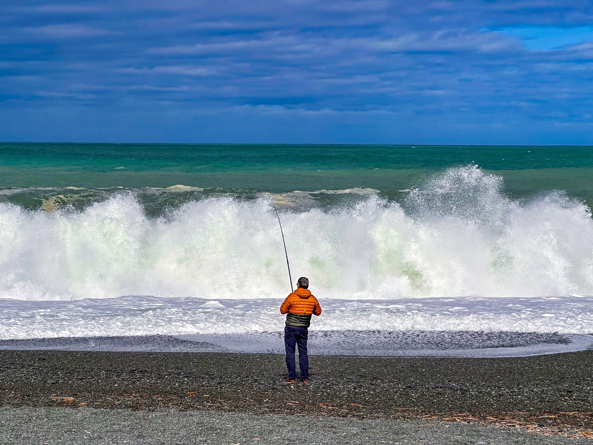
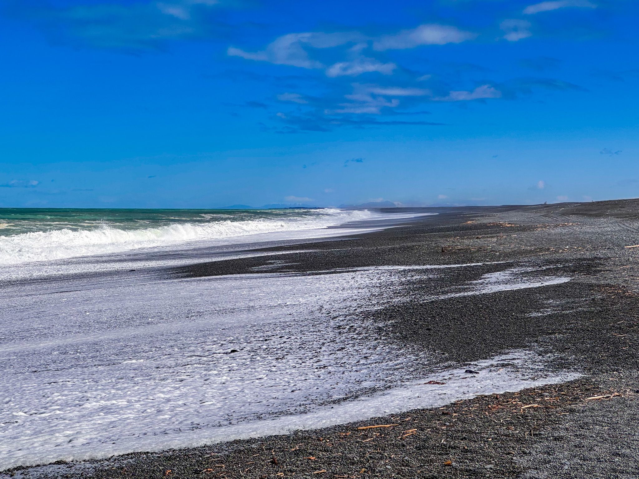
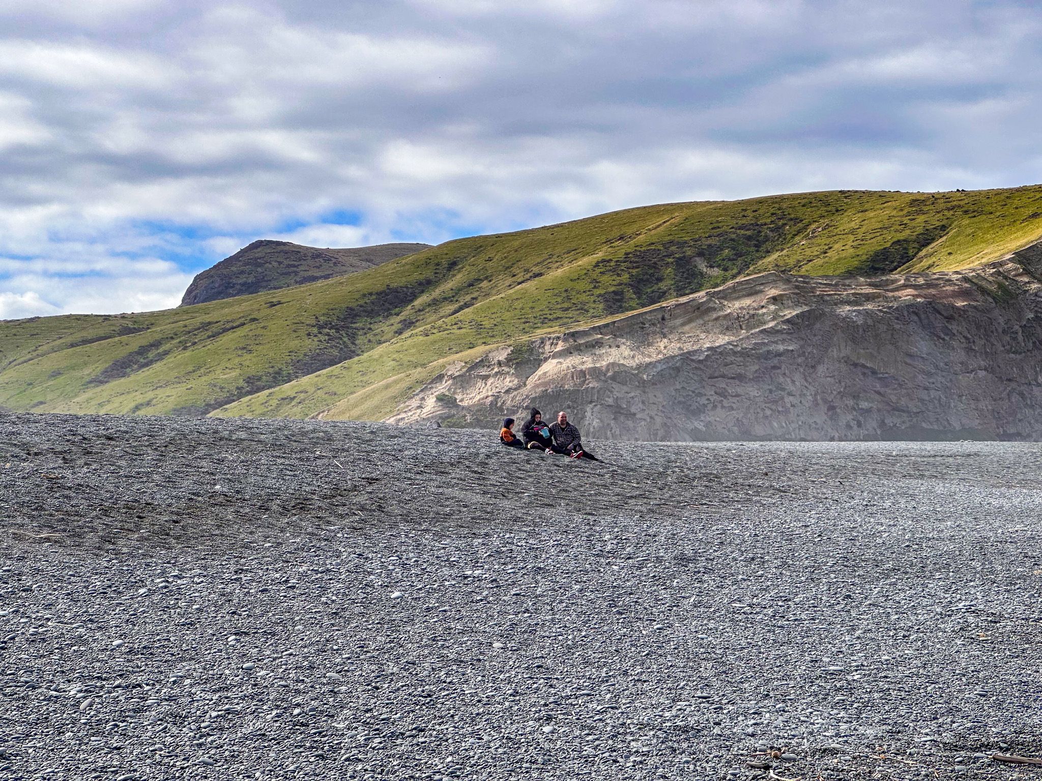
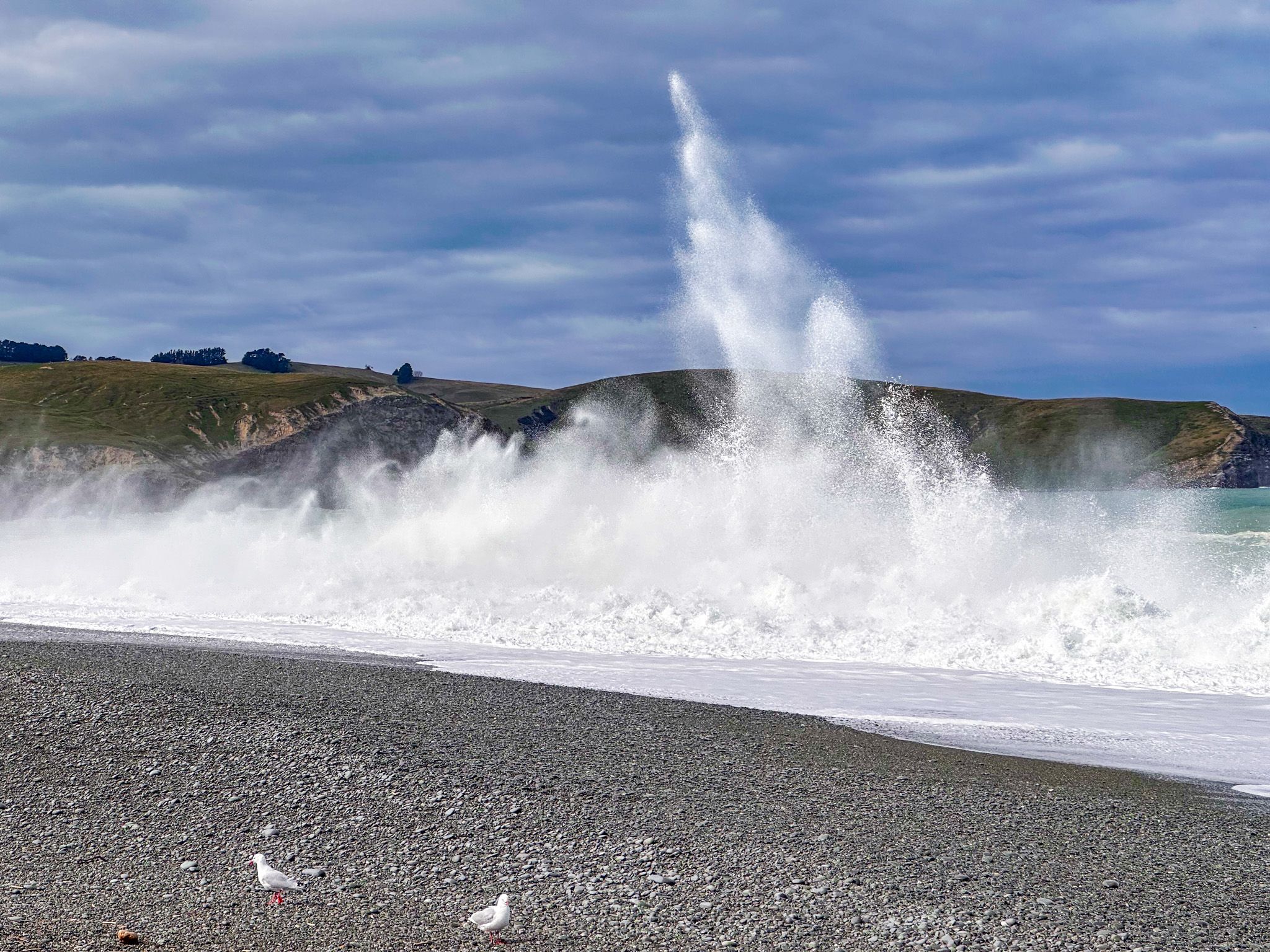
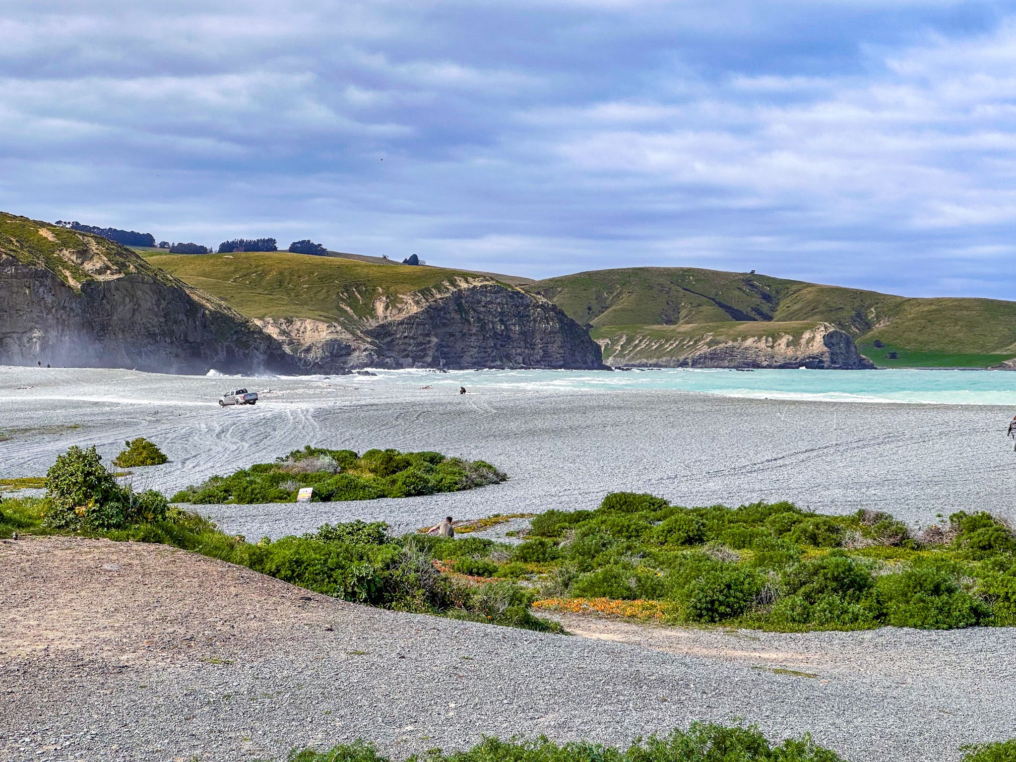
From the car park, the surf line is 200 metres away across the stones, which shift and slip underfoot with every step. This is not a gentle approach. The beach is steeply shelved, and the waves here do not roll - they detonate. A southerly swell arriving across the open Southern Ocean meets the shingle at full force, compresses, and explodes upward in towers of spray that can reach several storeys high, with little energy left to wash up the shore. Because the tide line is so steep, you can get surprisingly close to this spectacle. However, swimming and surfing are not possible here as the undertow is severe and the waves can strike without warning.
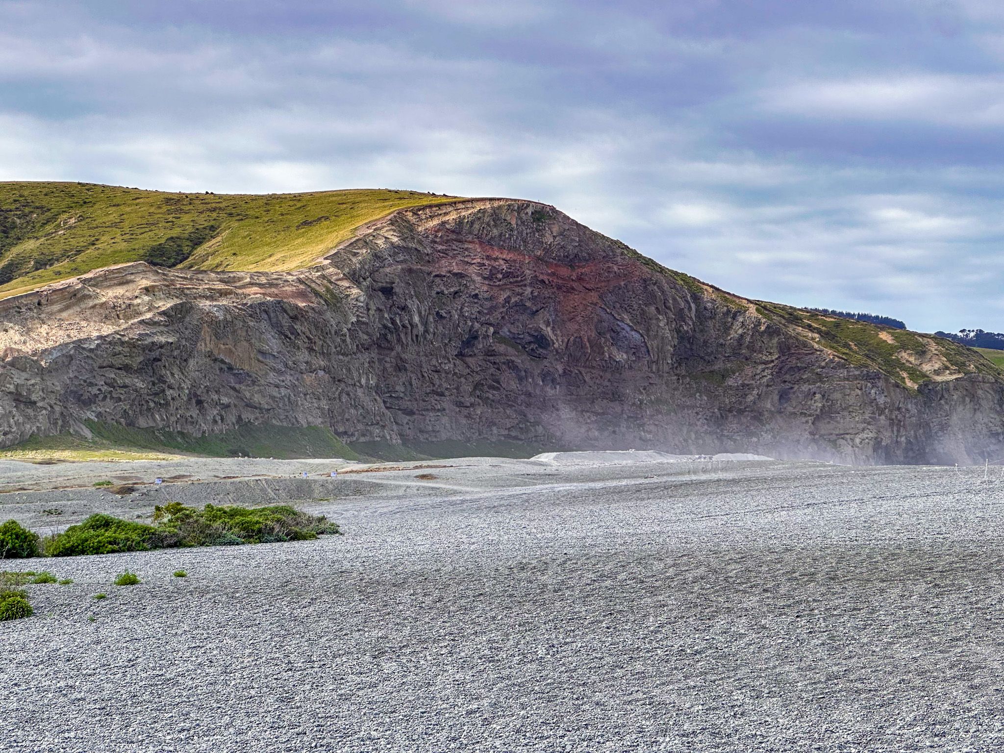
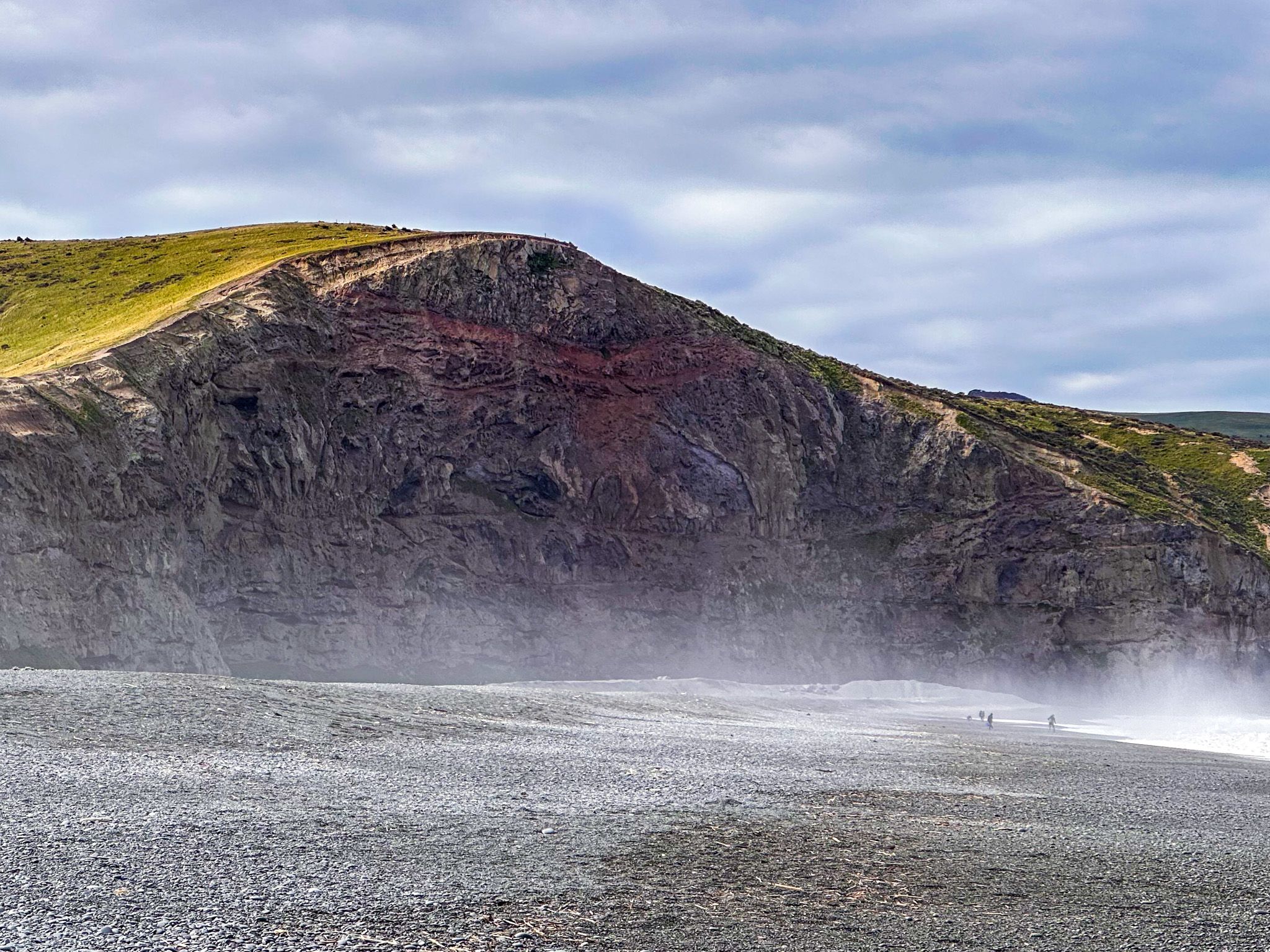
A one-km walk eastward along the stones leads to the base of the coloured cliffs that mark the start of Banks Peninsula. These volcanic faces rise to heights of up to 100 metres and mark the geological boundary between the flat shingle world of Kaitorete Spit and the ancient lava country of the peninsula. The waves are most dramatic here, where the water is funnelled by the cliff base.
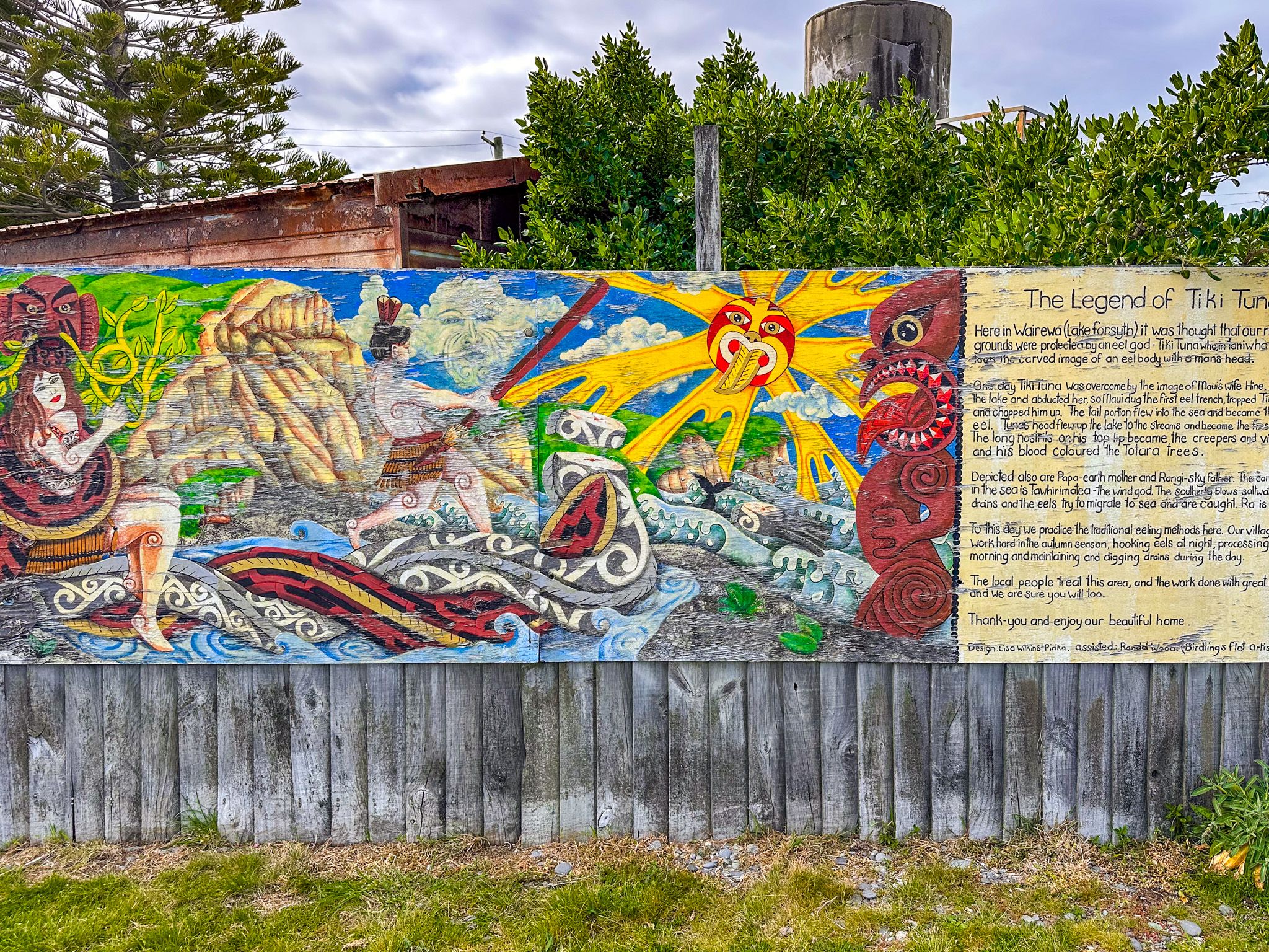
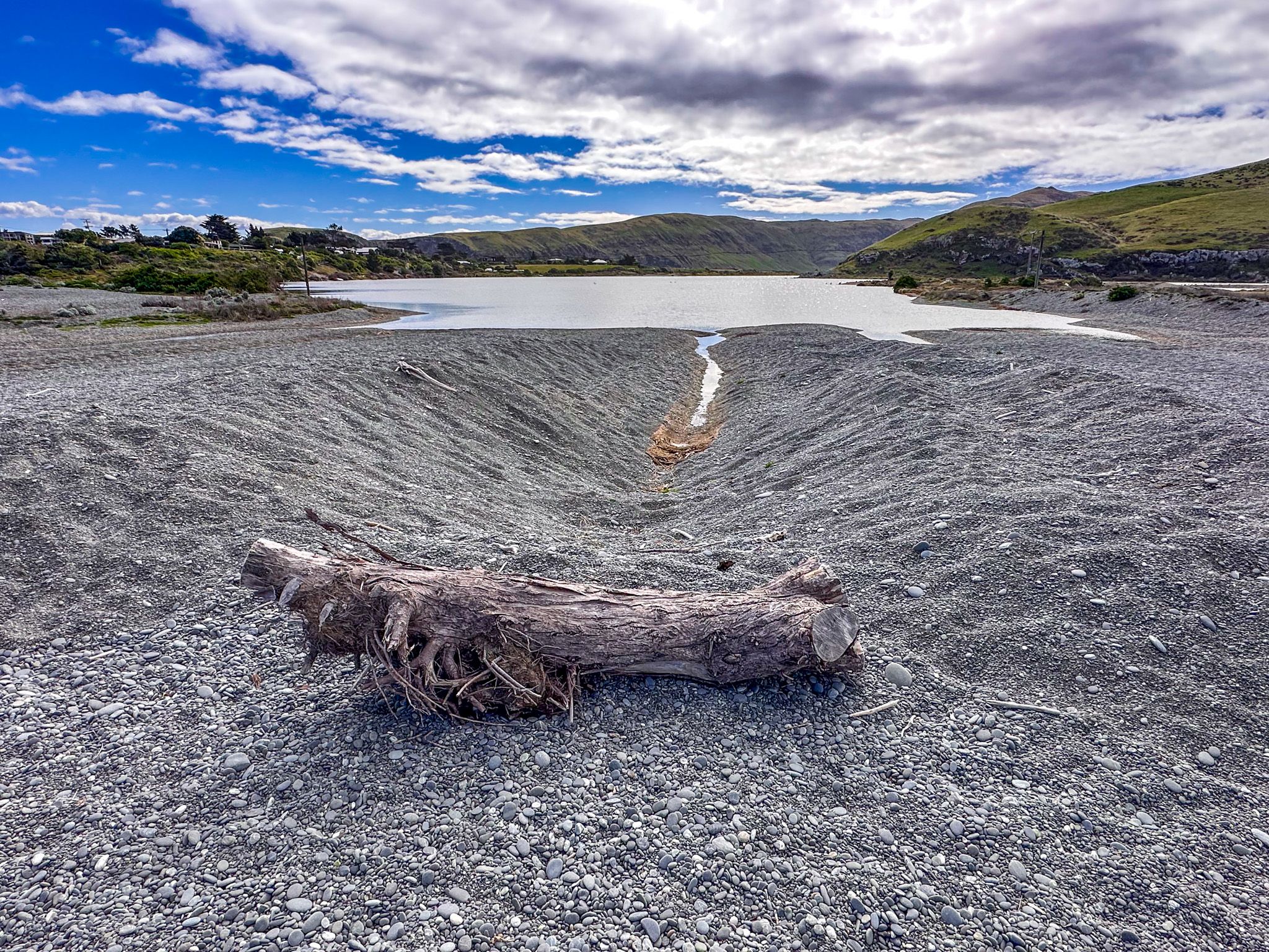
The outlet of Lake Forsyth / Te Roto o Wairewa also meets the beach at this eastern end. Lake Forsyth is a much smaller lake than Lake Ellesmere / Te Waihora to the west, filling the valley back toward Little River. It is shallower and more enclosed, and at this point its waters drain across the shingle to the sea, a crossing point of considerable cultural significance, as described below.
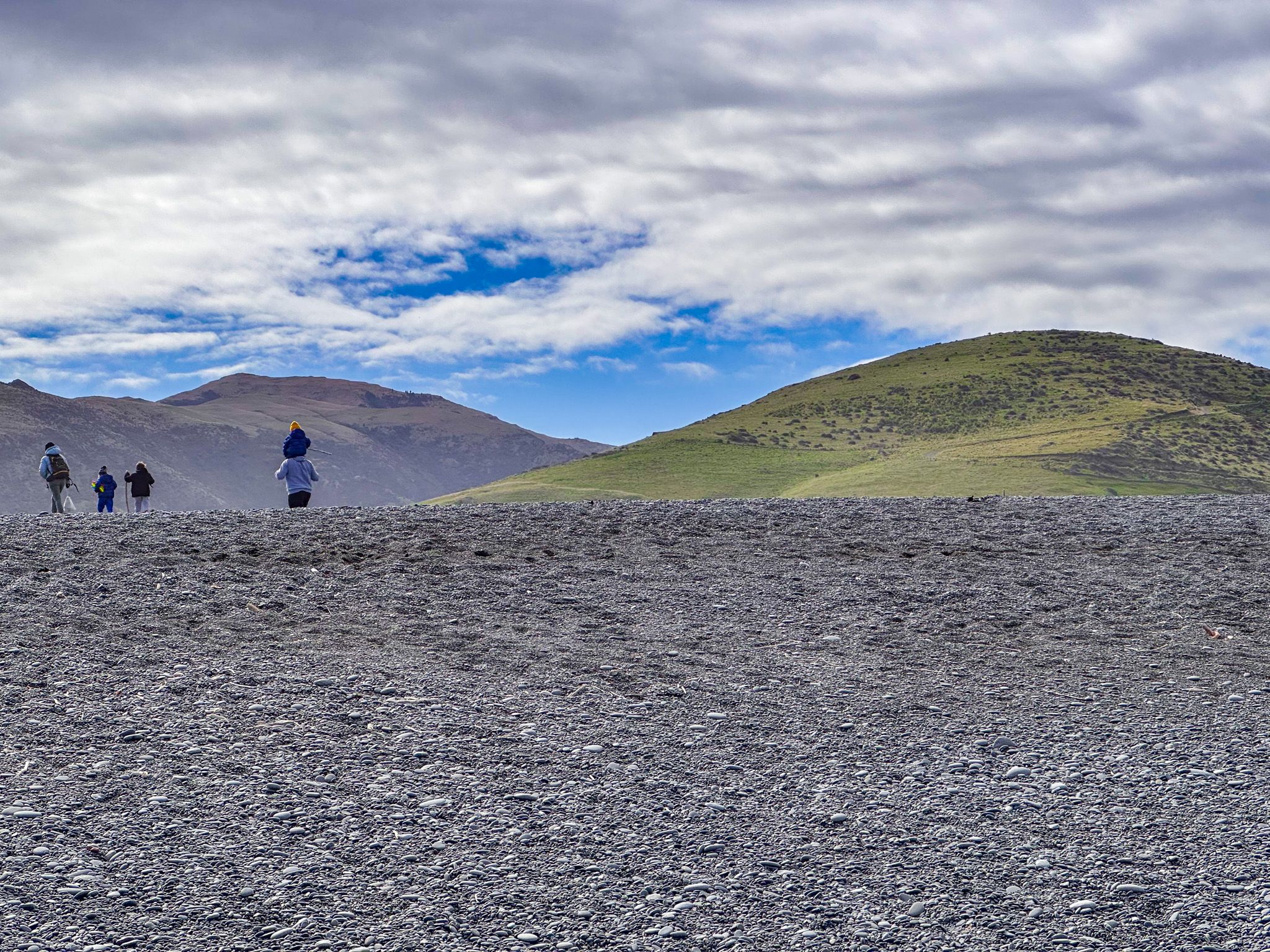
Driving onto the gravel expanse is possible, but requires wide, soft tyres to avoid sinking into the stones. Surf casting is popular along the beach. For those who come simply to watch, the waves near the eastern cliffs are a spectacle unlike anywhere else on the Canterbury coast.
Hector's Dolphins and Coastal Wildlife
The coastal waters off Birdlings Flat are a reliable habitat for Hector's dolphins, New Zealand's rarest marine dolphin, which frequent the waters around Banks Peninsula in notable numbers. Southern right whales pass along the beach, kokeno (fur seals) rest on the stones with some regularity, and ihupuku (elephant seals) can be seen occasionally. Tern colonies nest on the gravel between the beach and Lake Forsyth, and the lake itself supports large populations of wading birds and waterfowl.
The Kaitorete Scenic Reserve
At the southern end of the township, the Kaitorete Scenic Reserve occupies the low barrier stretching westward. Its Māori name, Kā Poupou a Te Rakihouia, describes the spit's function as analogous to an eel weir, channelling migrating tuna toward Taumutu at the western end, where they could be harvested. For Ngāi Tahu, the spit was a major travel route, a fishing ground, and a source of plant materials for weaving and other purposes.
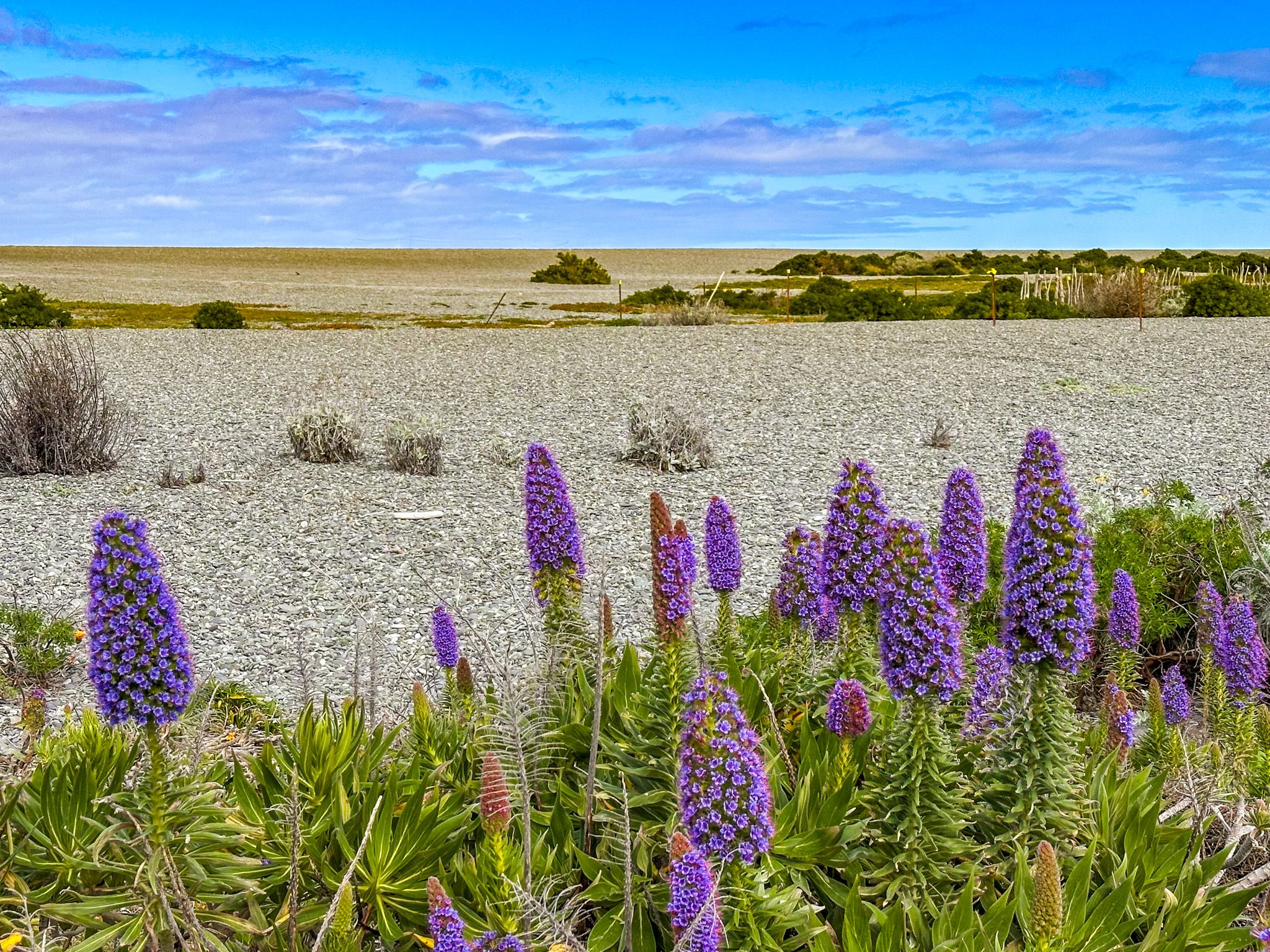
To Pākehā eyes, the reserve can appear barren. The vegetation is low, wind-stripped, and sparse, adapted to an environment of low rainfall, high summer heat, persistent salt spray, and almost no shelter. But the ecological significance is considerable. The reserve holds the largest surviving population of pīngao, the native orange sand-binder prized by Māori for weaving. Several moth species are endemic to Kaitorete Spit, including a naturally flightless one. Four of the five lizard species known from Banks Peninsula are found here. Threatened plants and invertebrates occur here that exist nowhere else.
The spit's archaeological record is also significant. In 2004, fragments of a korowai were uncovered, dating to around 1500 AD, and the oldest Māori textile ever found in New Zealand.
A Living Tradition
Each autumn, the eel harvest at the Lake Forsyth outlet remains a living tradition. Kāti Irakehu and Kāti Mako hapū members gather at Wairewa to harvest tuna as they migrate across the shingle bar on their seaward journey. Drains dug into the gravel draw the eels, which smell the salt water and follow. This is one of the most enduring seasonal food practices in Canterbury. The take is limited, and the hapū also work to aid the eels in crossing the bar to the ocean, allowing them to swim to Tonga or New Caledonia, where they breed. Follow the link to discover more about tuna in Aotearoa.
How to Get There
From Christchurch, take State Highway 75 south toward Akaroa. Before reaching Little River, turn right onto Poranui Beach Road and follow it to the end. The drive takes around 45 minutes. Parking is available at the road end above the beach. There are public toilets at the car park. Poranui Road can also be accessed from the Little River Rail Trail.
Nearby places to visit include Summit Road, via Gebbies Pass Road, Governors Bay, Lyttelton and Diamond Harbour.
For a similar fossicking experience, you can also visit Gemstone Beach in Te Waewae Bay in Southland.