Where the Mataura Meets the Sea
Fortrose sits at the mouth of the Mataura River on Toetoes Bay, at the western end of the Catlins in Southland. It is southeast of Invercargill along the Southern Scenic Route, and serves as the southern gateway to the Catlins coastal route. The settlement is small and unhurried, with an open estuary and a nearby raw, driftwood-strewn Pacific Ocean surf beach on the other. A history of whaling, port trade, and gradual decline is still readable in the landscape, and the cliffs just south of town are among the more dramatic coastal viewpoints in Southland.
Toetoes Harbour
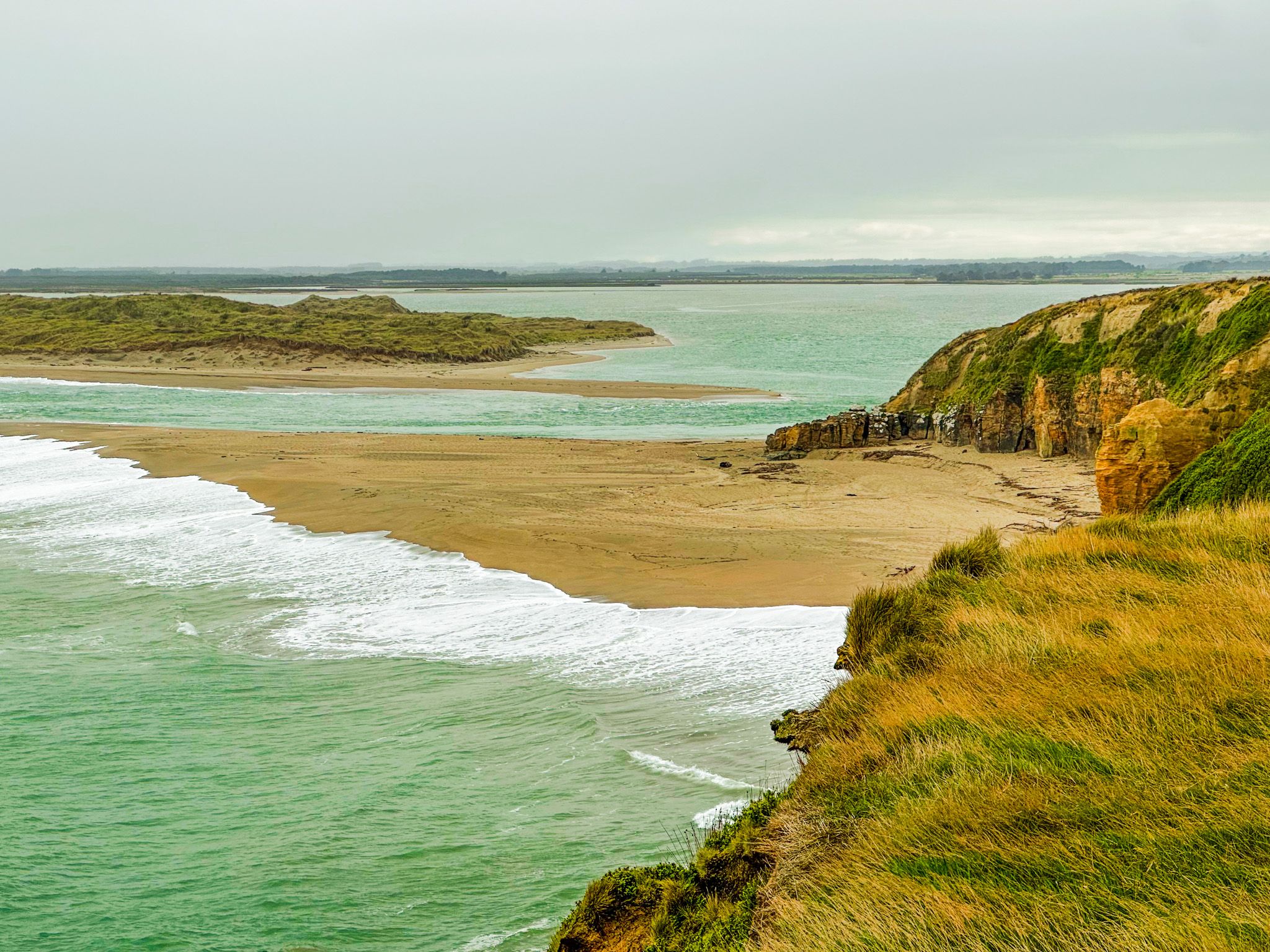
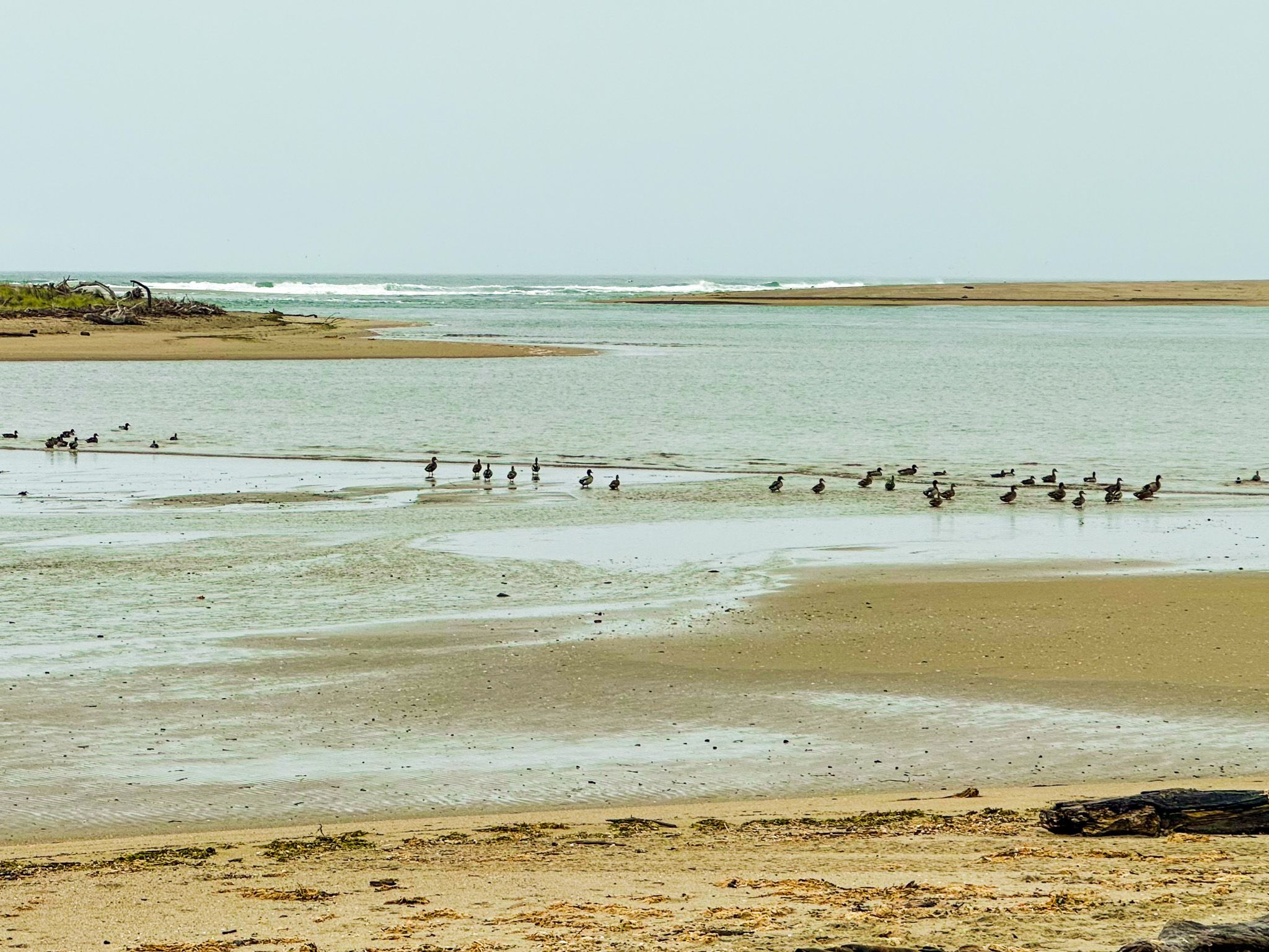
The 500-hectare Toetoes Harbour estuary is next to the township and directly behind a long sandspit and dune system that runs west of the estuary mouth. The Mataura River, 240 km long and draining much of Southland, enters the harbour at the west end. At low tide, the mudflats extend across much of the estuary, drawing in a consistent variety of wading birds. Pied oystercatchers and Kōtuku ngutupapa (royal spoonbills) are regulars, and black swans are common. During Spring and Summer, the estuary receives migratory waders from the northern hemisphere. Alongside Awarua Bay and Waituna Lagoon, the harbour is one of the most significant bird habitats in Southland, with over 80 species recorded.
Moray Terrace, then Boat Harbour Road, follow the edge of the harbour south from the highway and cafe, with a boat ramp and freedom camping.
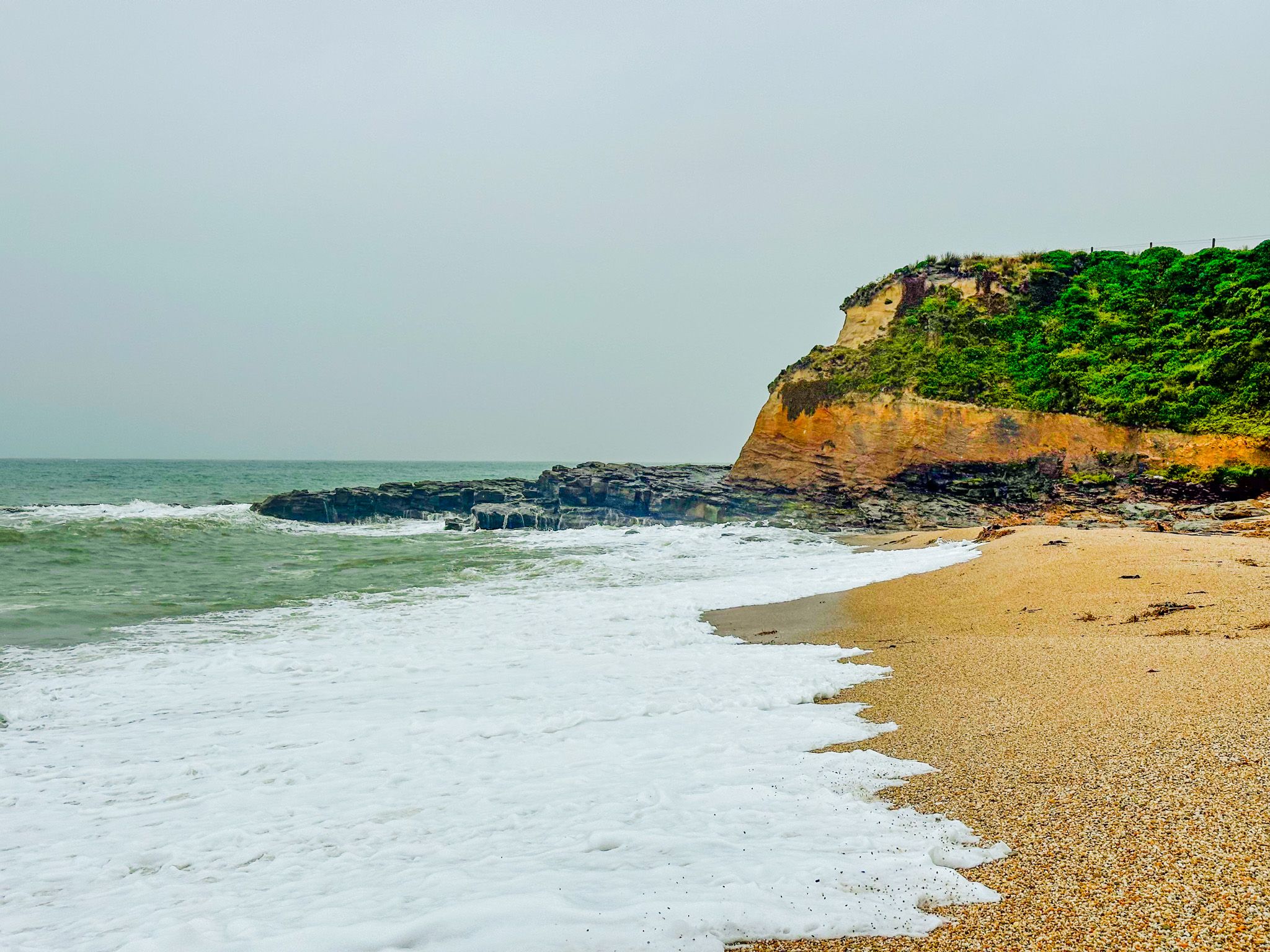
The Beach and the Cliffs
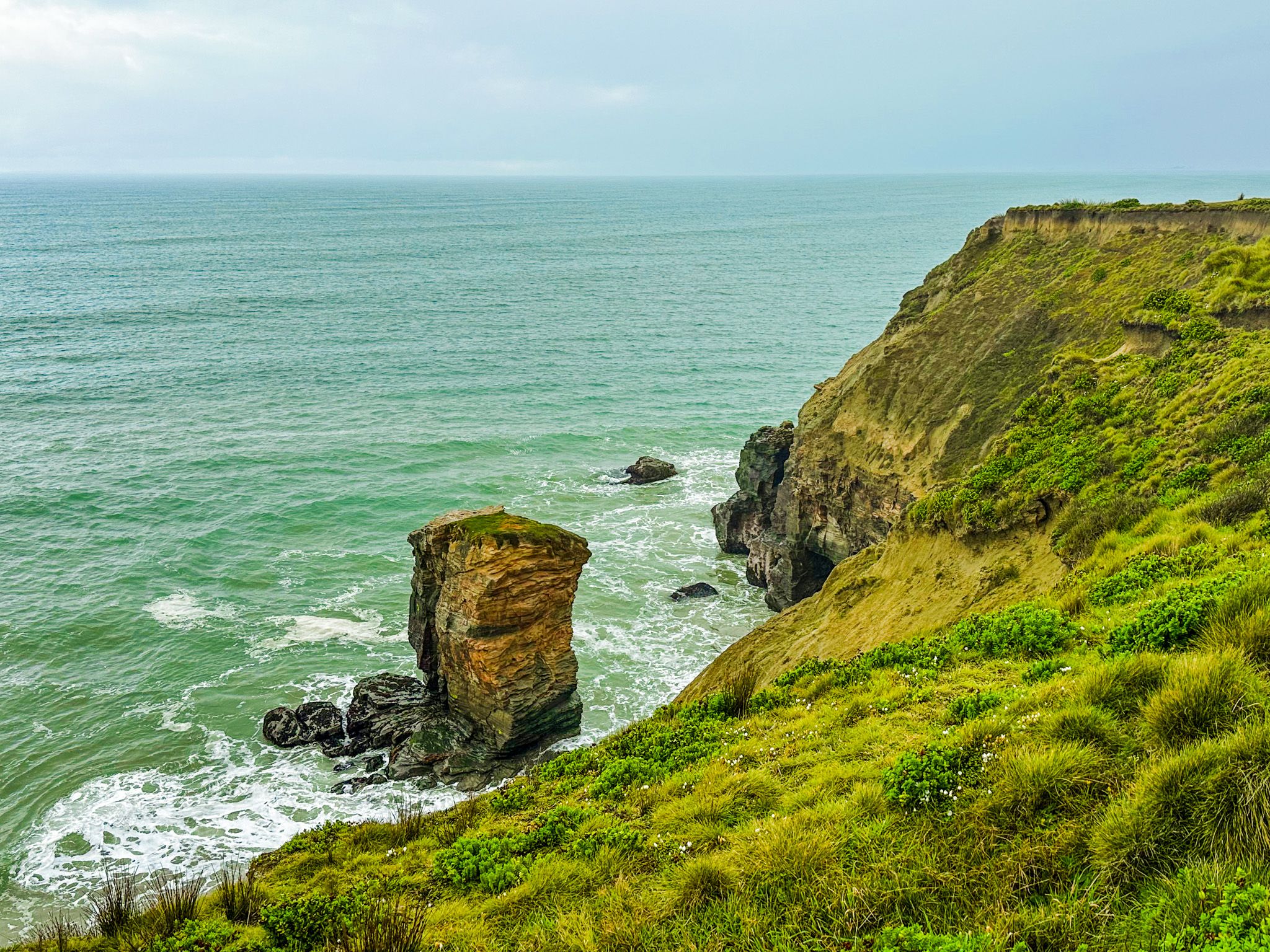
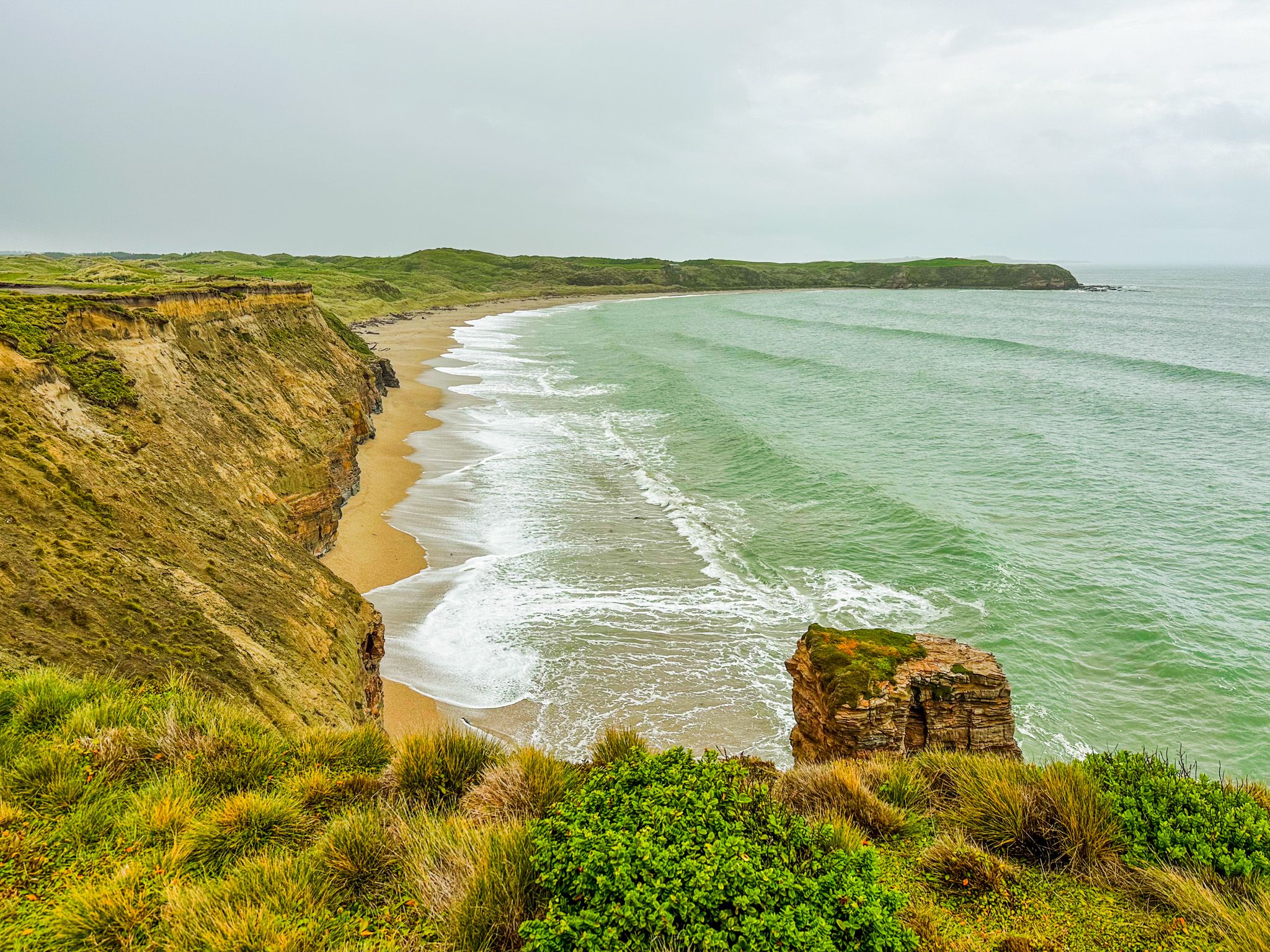
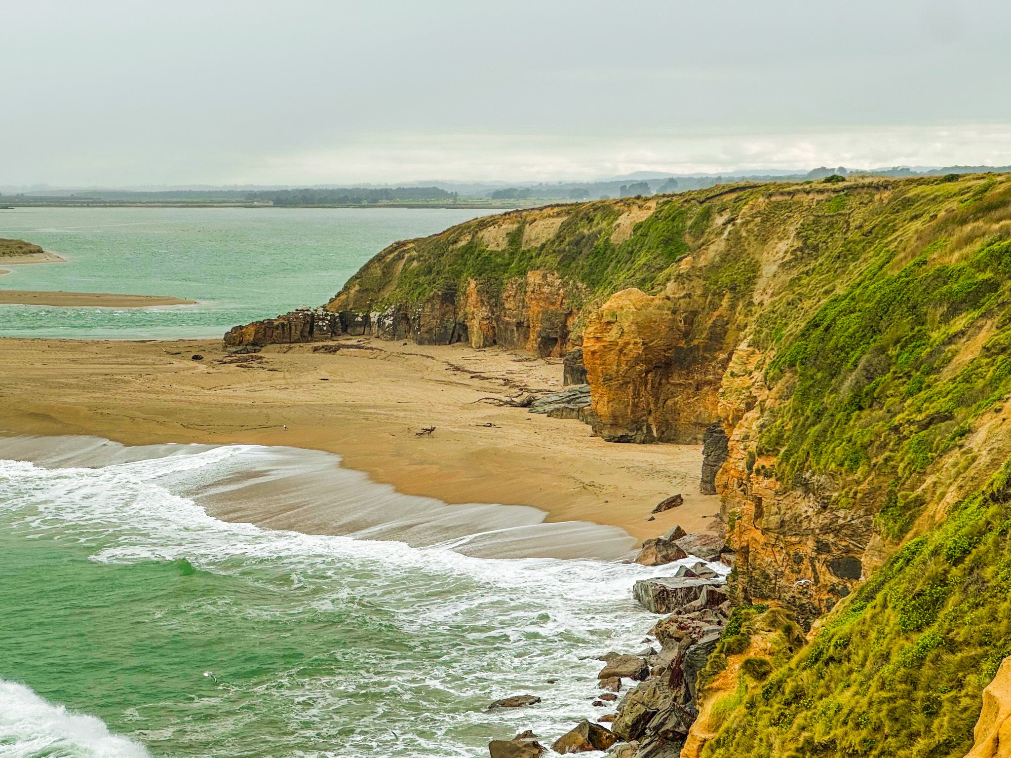
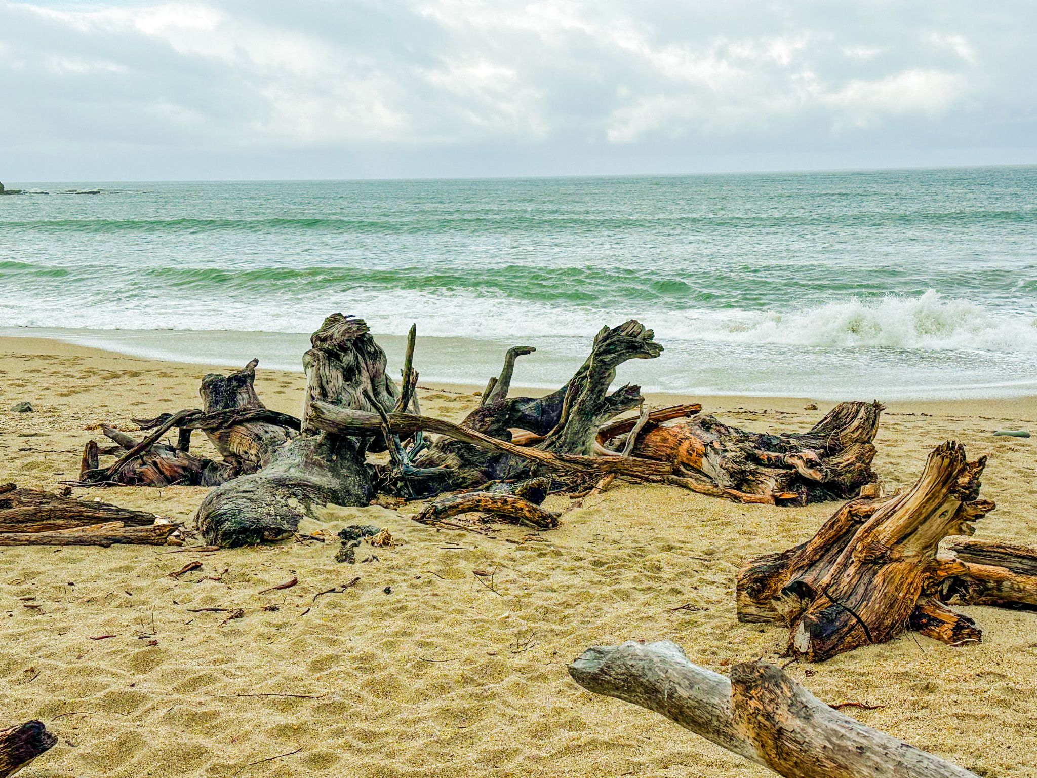
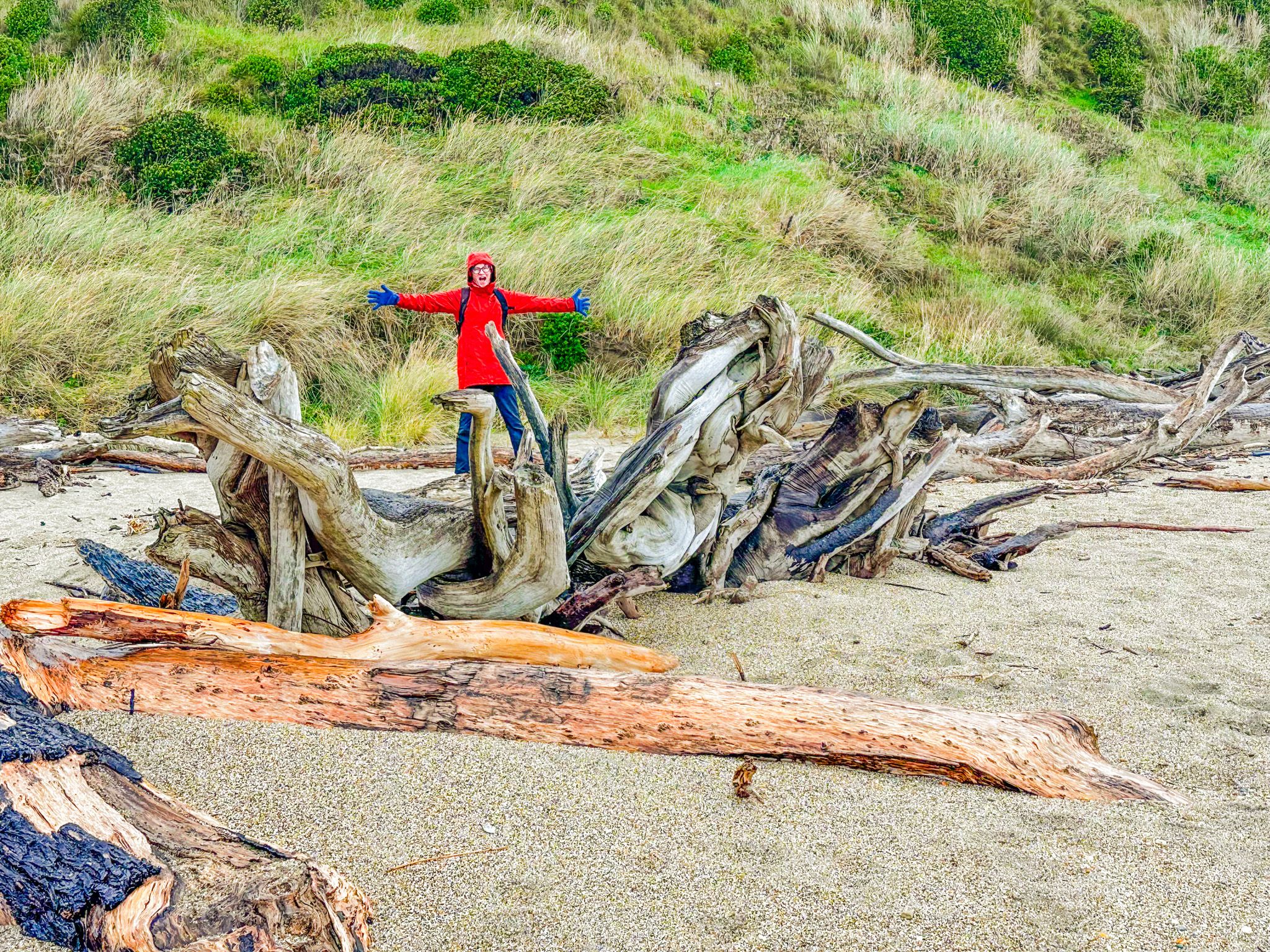
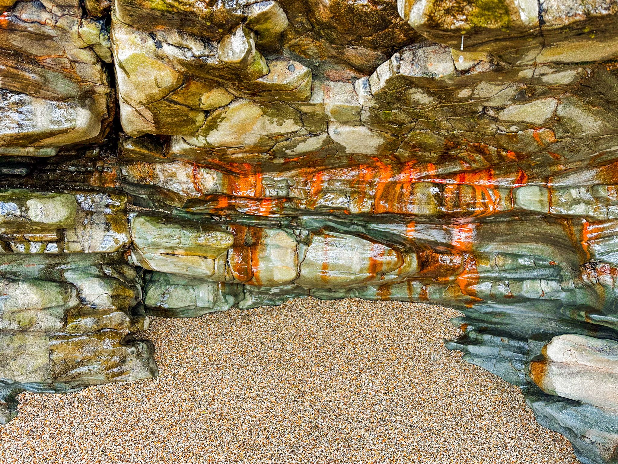
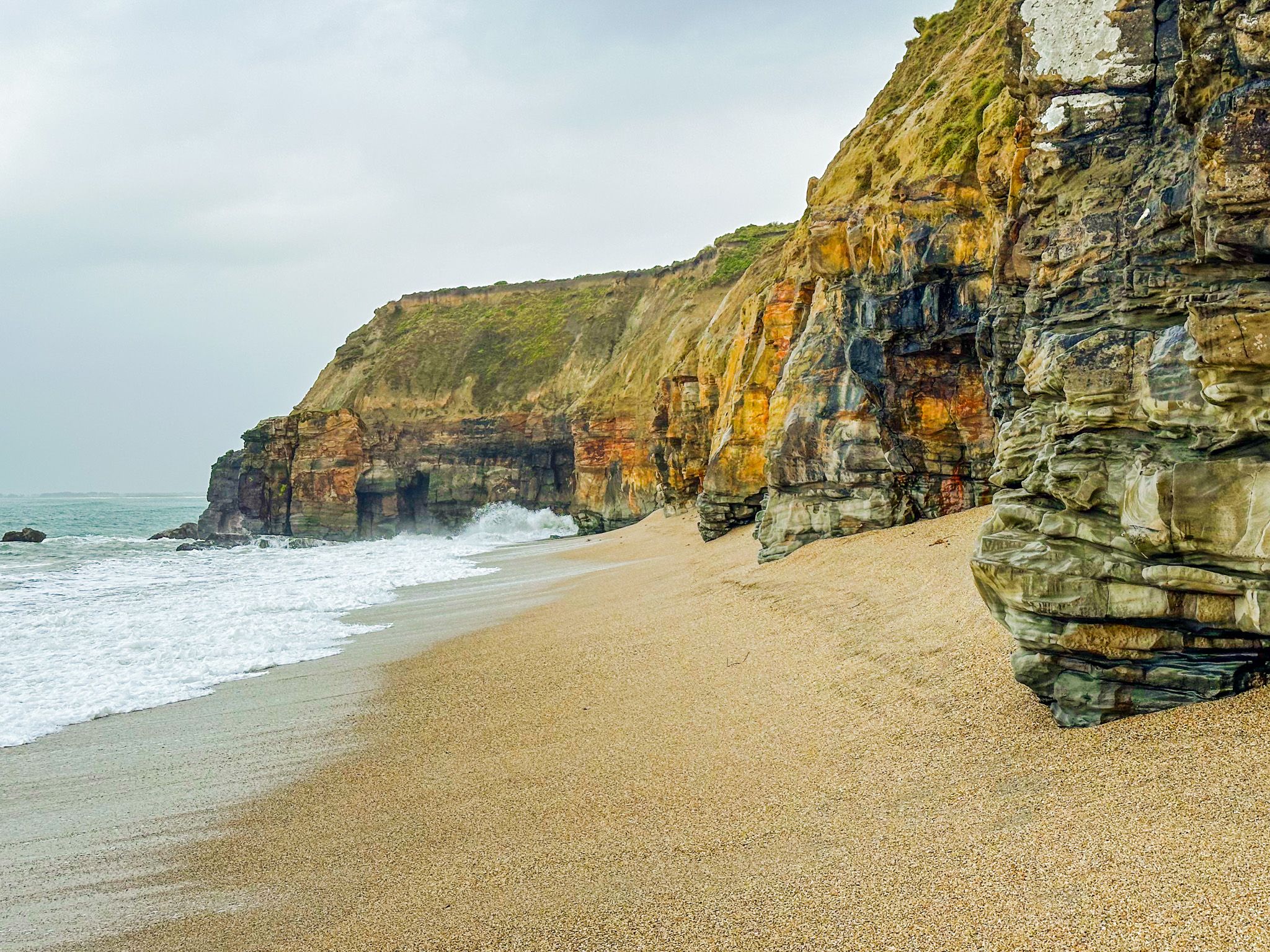
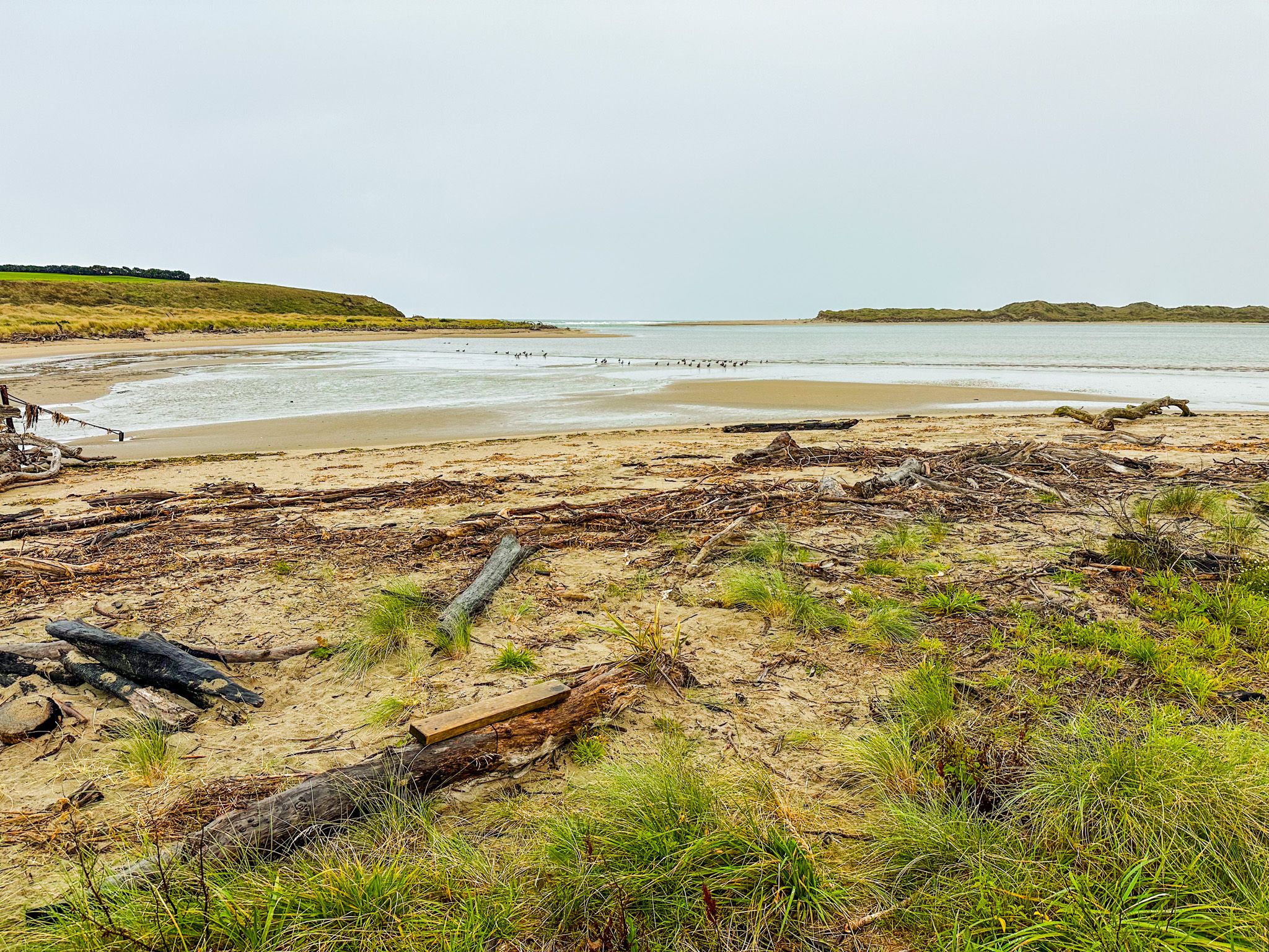
The 600 metre long beach is about 1 km south of the township on Boat Harbour Road, which runs around the edge of the estuary. It is accessible directly from the clifftop car park via a short walk through grass and dunes. At low tide, the cliff face at the water's edge is fully exposed: carved and colourful, with distinct sedimentary layers in ochre, grey and rust, with the rock undercut and shaped by the surf. The beach has an accumulation of driftwood driven in from the southern ocean, and very round, smooth stones can be found on the foreshore. At high tide, the waves reach the base of the cliffs, so low tide is the time to explore.
You walk around the edge of the cliffs from the car park, and from there, the views are immediate, with no barrier at the edge. The outlook takes in the full sweep of Toetoes Bay to the west, the southern Pacific coastline and the estuary mouth below, and on clear days, Rakiura / Stewart Island is visible to the southwest across Foveaux Strait. A spotted shag colony nests on the cliff face below.
Waituna Lagoon
At the eastern end of Toetoes Bay, Waituna Lagoon sits behind a narrow coastal gravel bar of white quartz. The lagoon was New Zealand's first site designated a Wetland of International Importance under the Ramsar Convention in 1976, and forms the heart of the broader 3,500-hectare Awarua Wetland complex. Access is via Waituna Lagoon Road, and DOC maintains a car park and a boardwalk with a 5 km loop track off nearby Waghorn Road.
From Port to Farming Town
Fortrose was an early Māori settlement, rich in food resources from the river mouth and coast. The estuary takes its name from the toetoe grass (Austroderia spp.) that grows along its margins, a plant common to coastal and riverbank habitats throughout the South Island.
European settlement began in earnest in the 1830s, when a whaling station operated from 1834 to 1836. Early plans for a township called the area Russelltown, but it was later renamed Fortrose after a Scottish borough on the Moray Firth near Inverness. This name was given by a Scottish drover in the mid-nineteenth century. By 1875, a 61-metre jetty had been built, and the settlement became a functioning port, exporting grain, logs, wool, skins and hides. In its early-1900s heyday, Fortrose had blacksmiths, churches and a school.
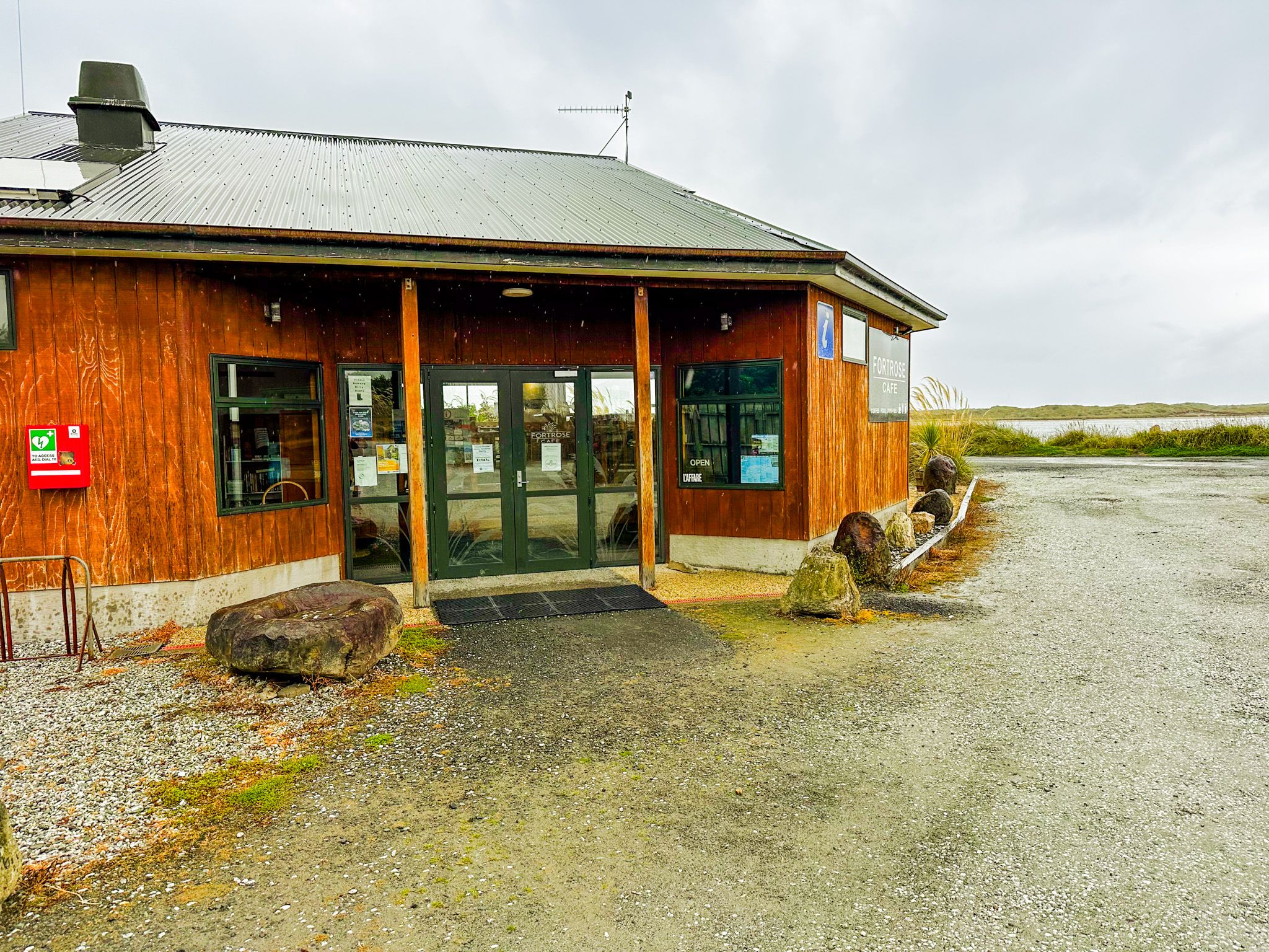
Decline followed the opening of the Tokanui Branch railway to Waimahaka in 1899 and Tokanui in 1911, which redirected freight to Bluff. A sandbar at the river mouth made the sea lane impassable, roads to larger centres improved, and the wooden buildings aged without repair. What remains now is a quiet farming community with a freedom camping area on the waterfront, a café and petrol station, and the southernmost NZ golf course, Tokanui Golf Club, exposed to whatever wind comes off the southern ocean!
The Cemetery
The historic Fortrose cemetery is the earliest documented European burial site in the South Catlins, with the first recorded burial in 1873. A headstone erected by local schoolchildren commemorates those who died in the wreck of the SS Tararua off the Catlins coast in 1881. The cemetery reflects the isolation and hardship of early Southland settlement.
The Wreck of the Ino
The hull of the steamship Ino is marked on topographic maps near the river mouth sandbar. It is occasionally visible at very low tide, though shifting sands determine how much can be seen.
How to Get There
From Invercargill, follow the Southern Scenic Route southeast for around 47 km to Fortrose. A café and petrol station are at the start of the township. The drive takes 38 minutes.
Continuing into the Catlins, nearby places to visit include Frasers Beach, Waipapa Point, Slope Point, Curio Bay, and the Waipohatu Waterfall Track.