Exploring Surprising Ward Beach
Ward Beach, located on the northeast coast of Marlborough, is a unique destination accessible via State Highway 1 between Cape Campbell and the mouth of the Waima River. This beach, though primarily composed of pebbles and gravel, is a hidden gem known for its unusual rock formations, Moeraki-style boulders, and diverse wildlife.
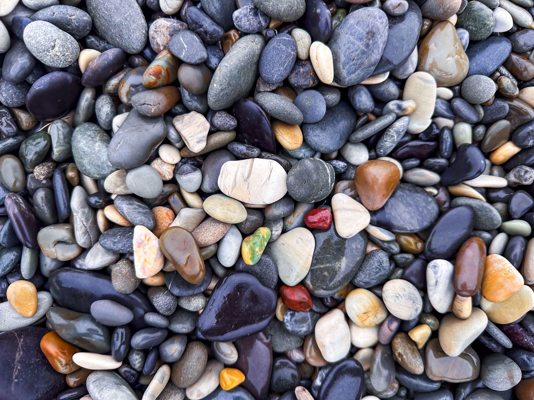
Pebble Beach and Striking Landscapes
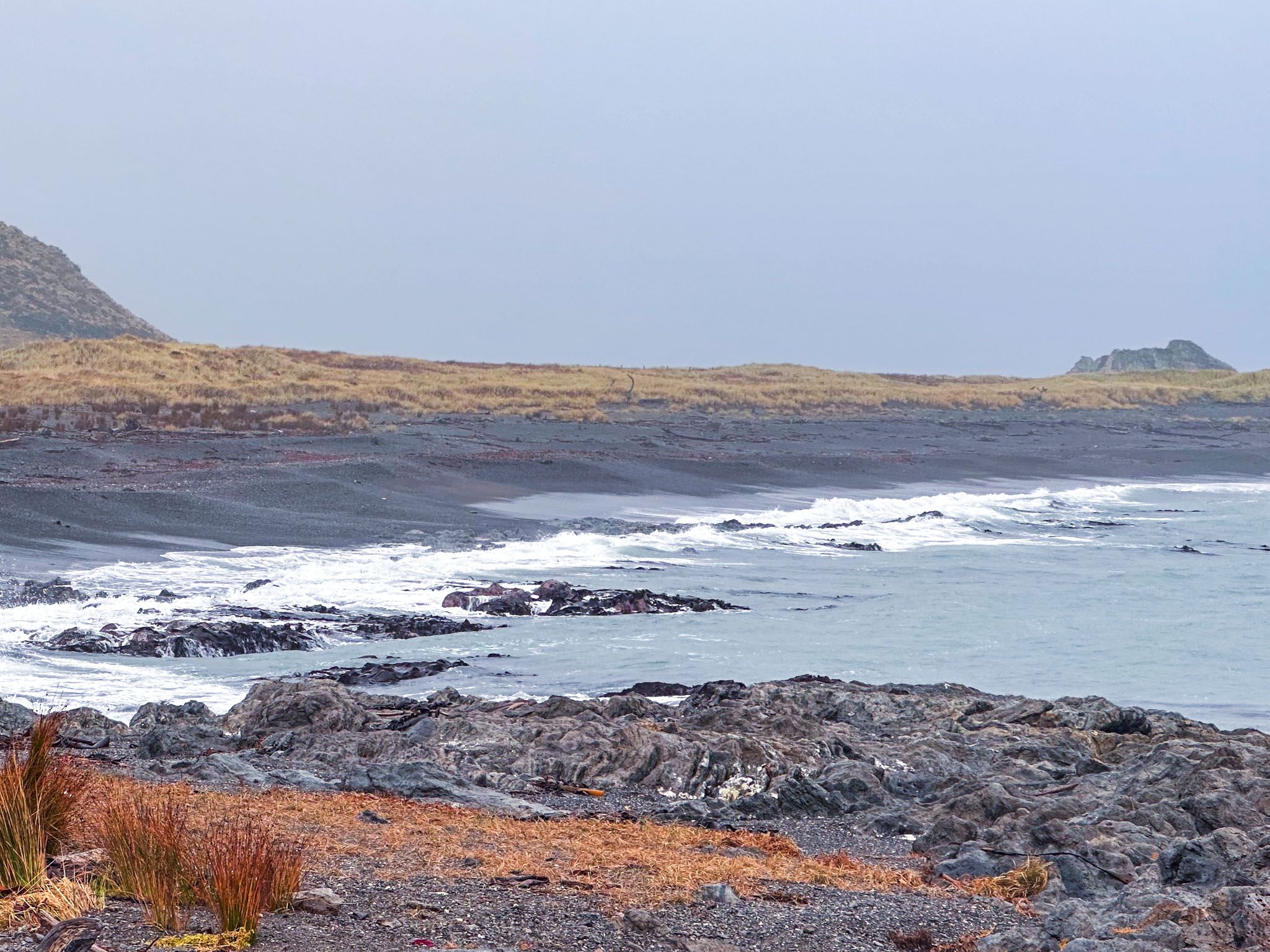
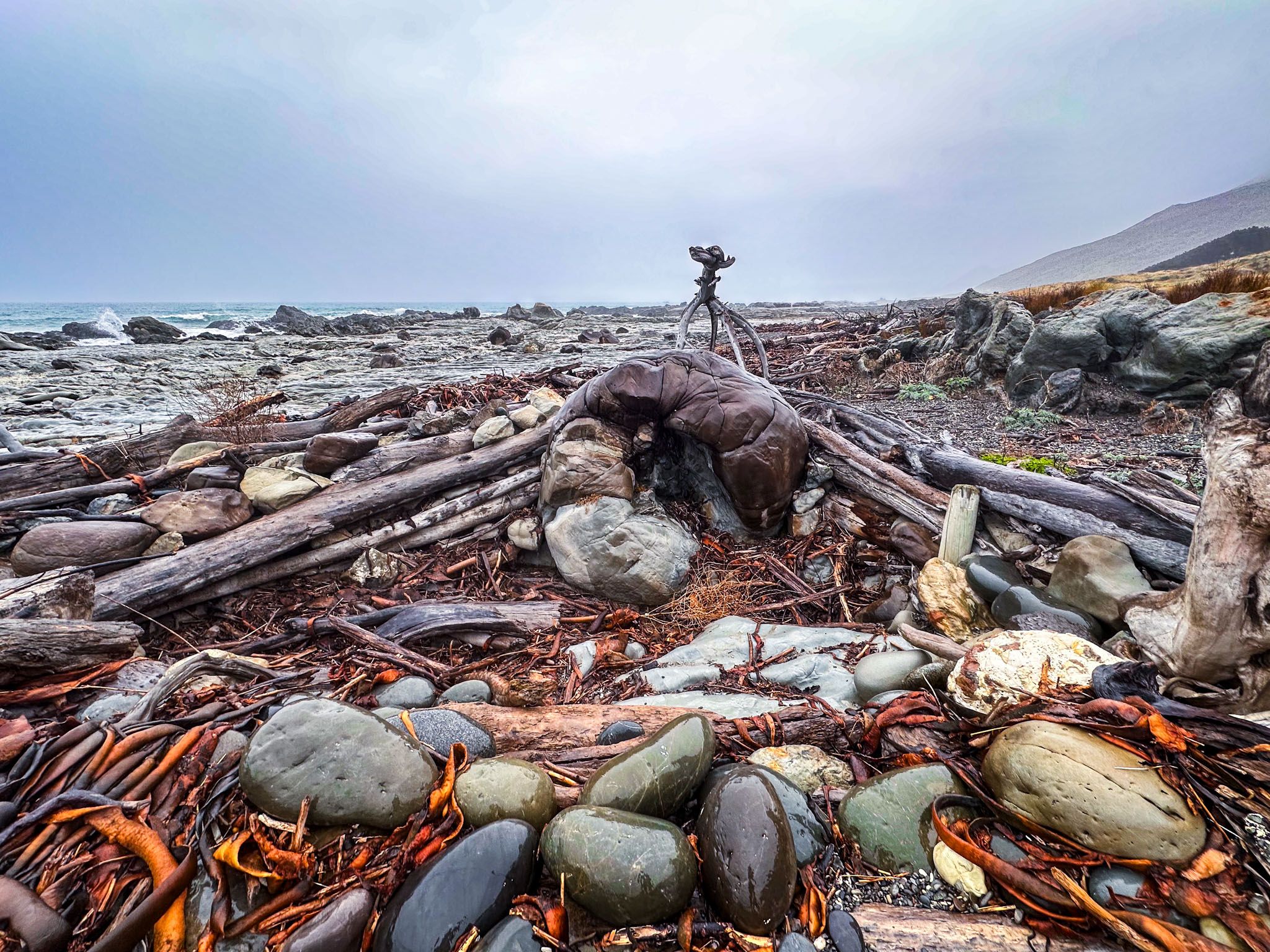
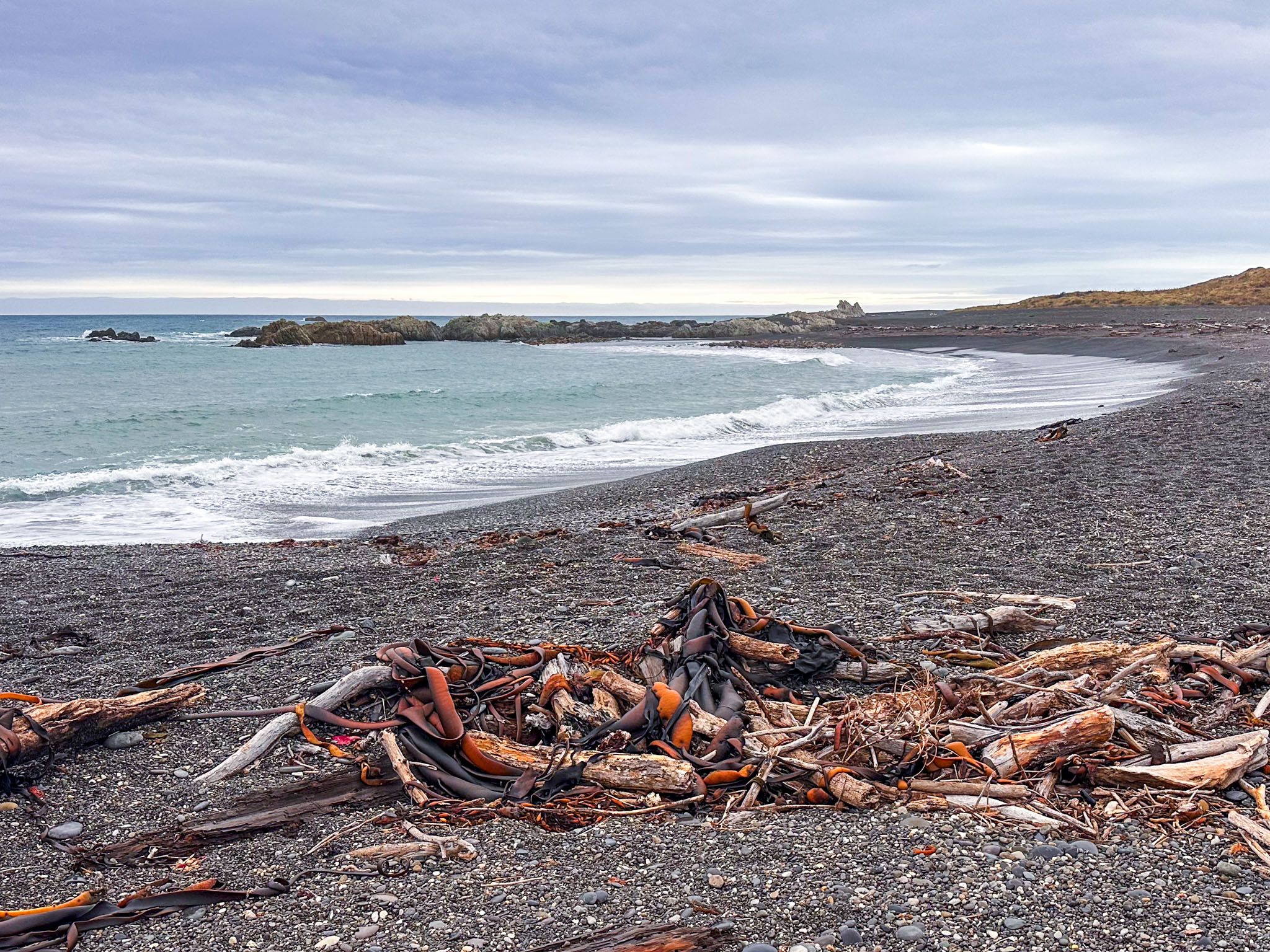
The beach spans approximately 300 metres and is characterised by its pebbly terrain. The pebbles, in shades of grey, blue, brown, purple, and white, create a striking contrast against the steep hills and limestone outcrops at both ends of the beach. Below the tide line, the pebbles are smaller, while larger, rounded stones accumulate around the tide line.
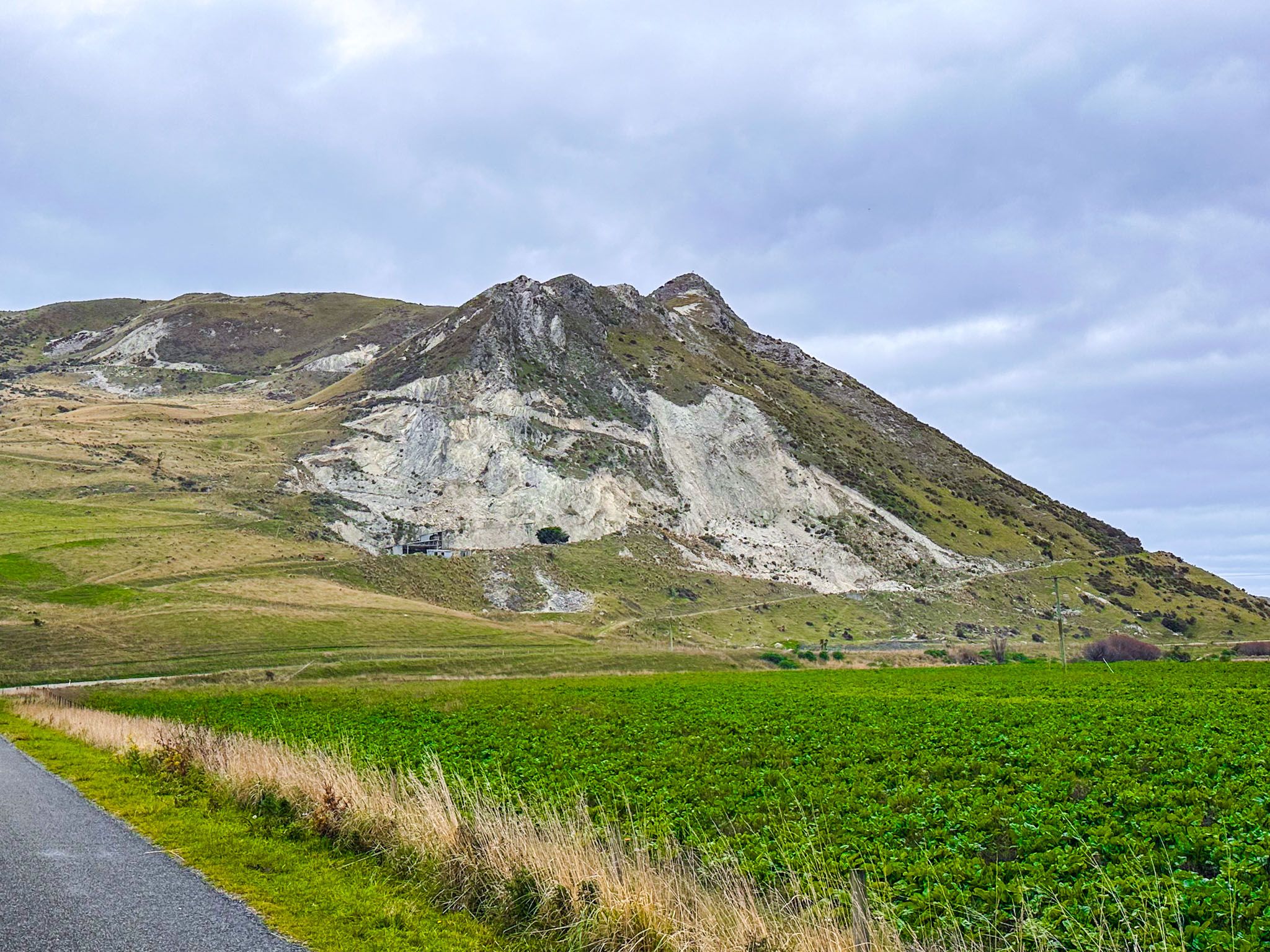
Geology Unveiled by the Kaikōura Earthquake
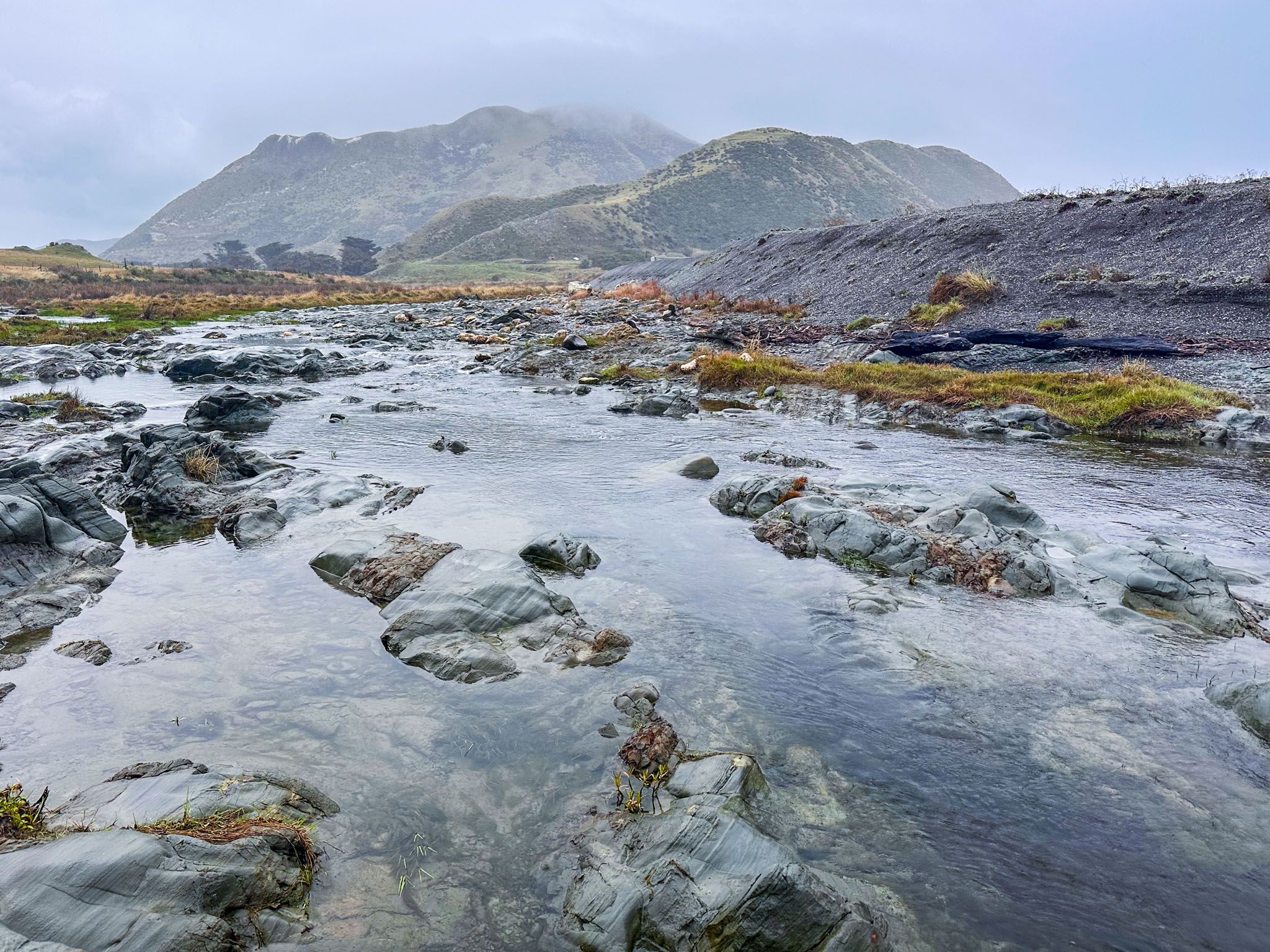
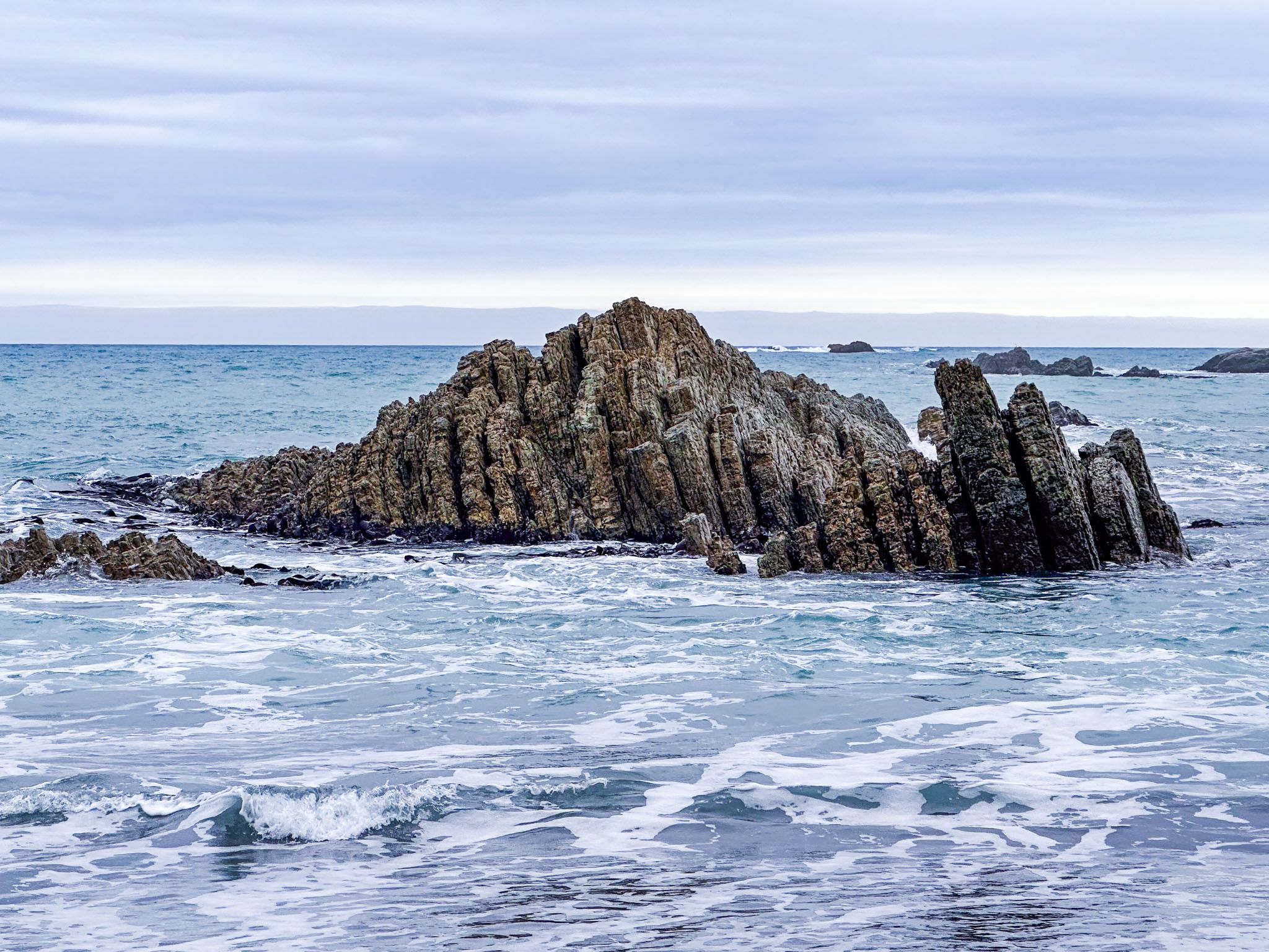
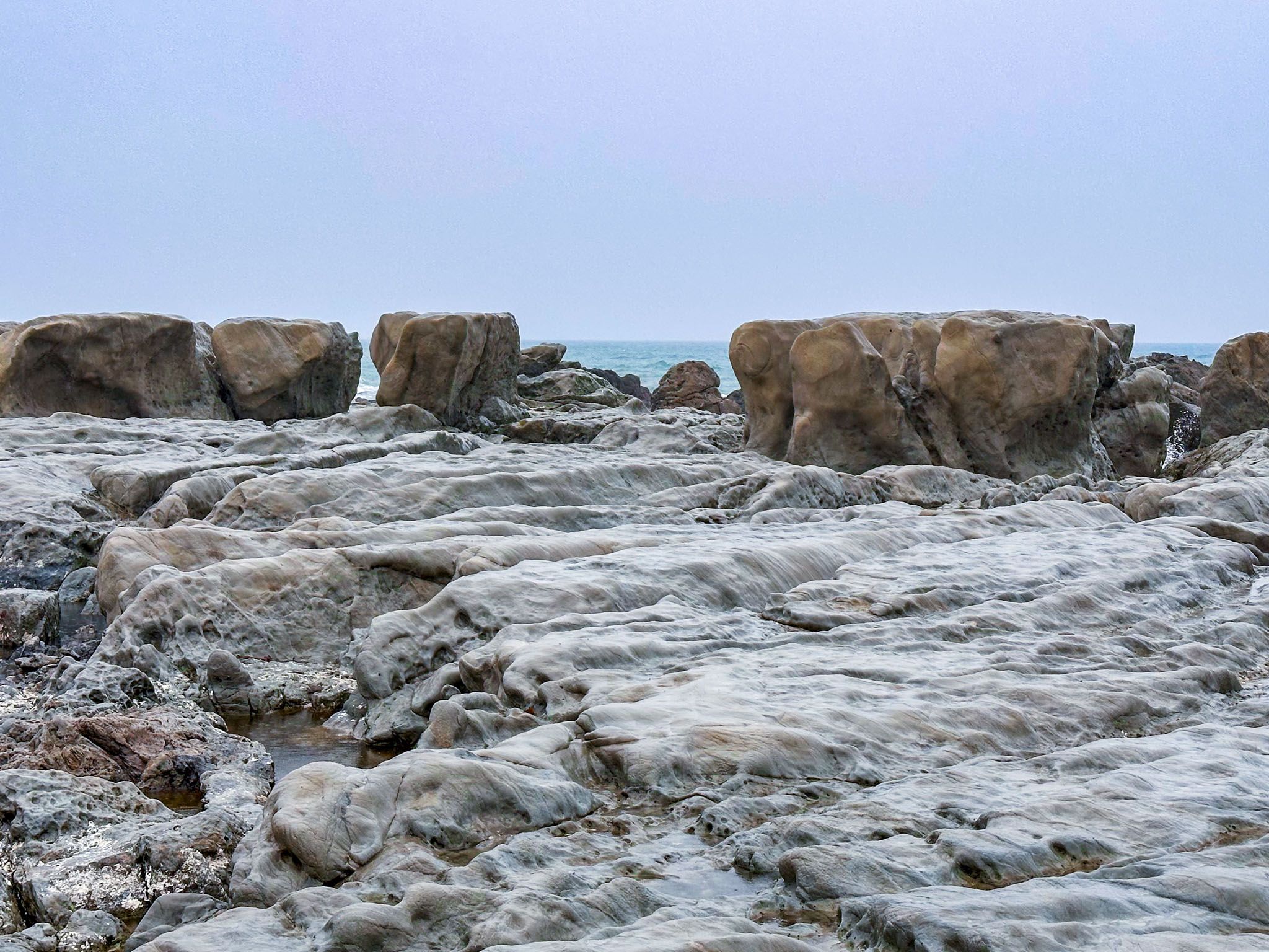
The 2016 Kaikōura earthquake significantly transformed Ward Beach, causing an uplift of 2.2 to 3 metres. This geological event exposed wave-cut reef platforms and mudstone layers, revealing a large rocky platform with intricately carved rock formations at the beach's northern end.
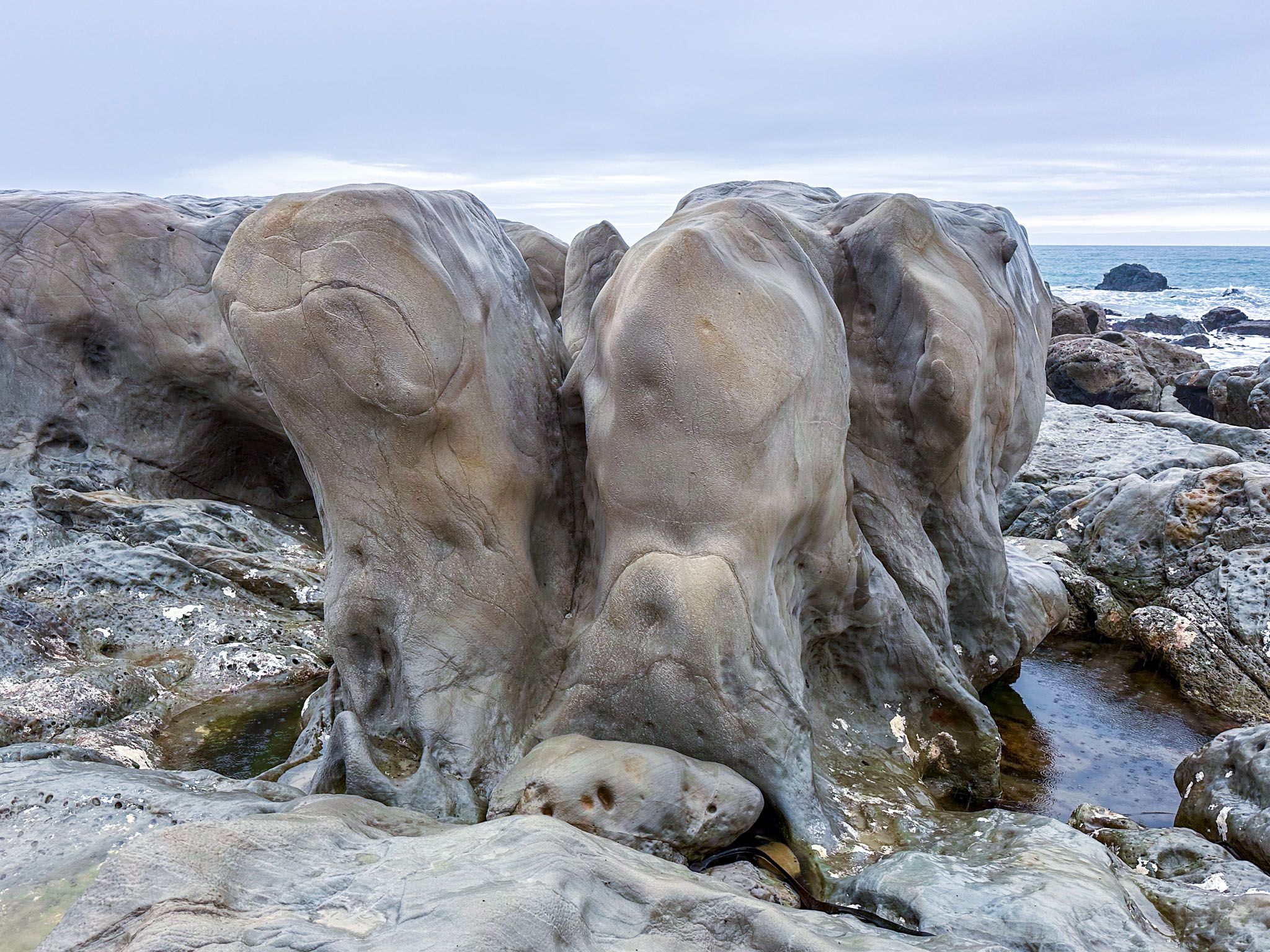
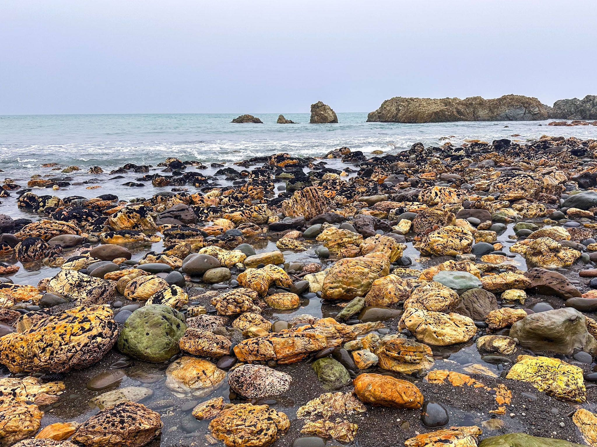
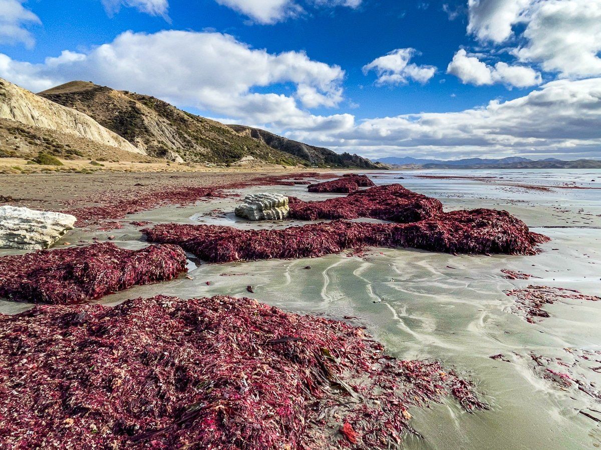
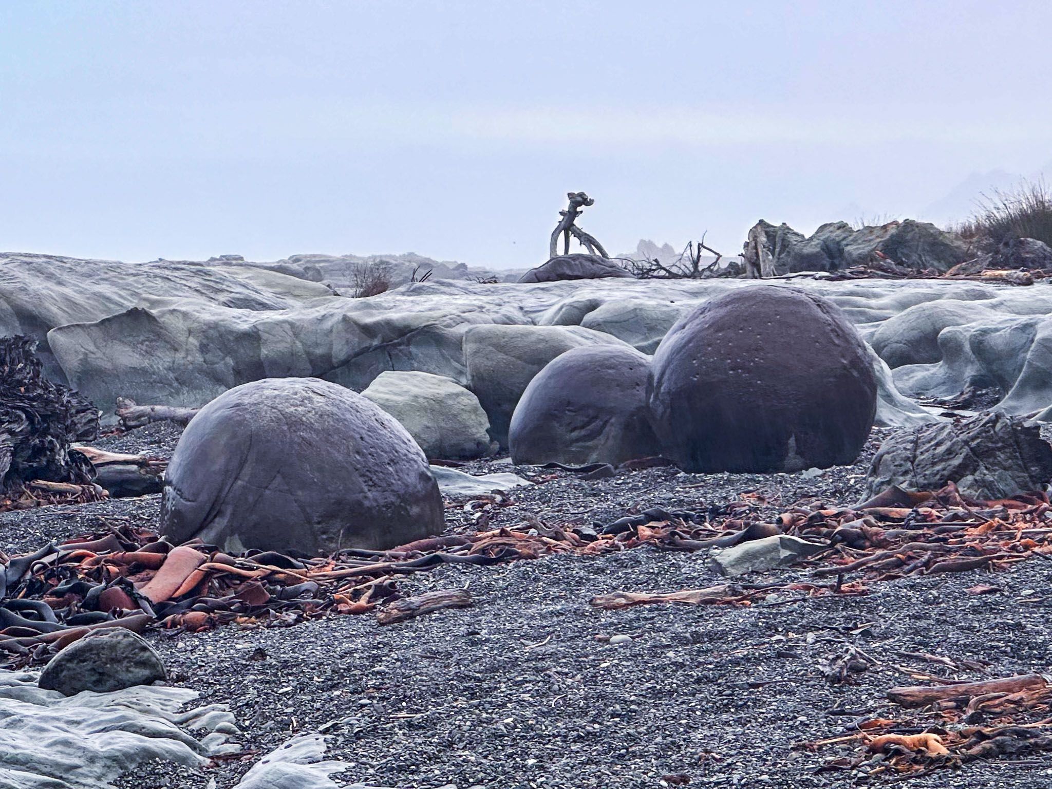
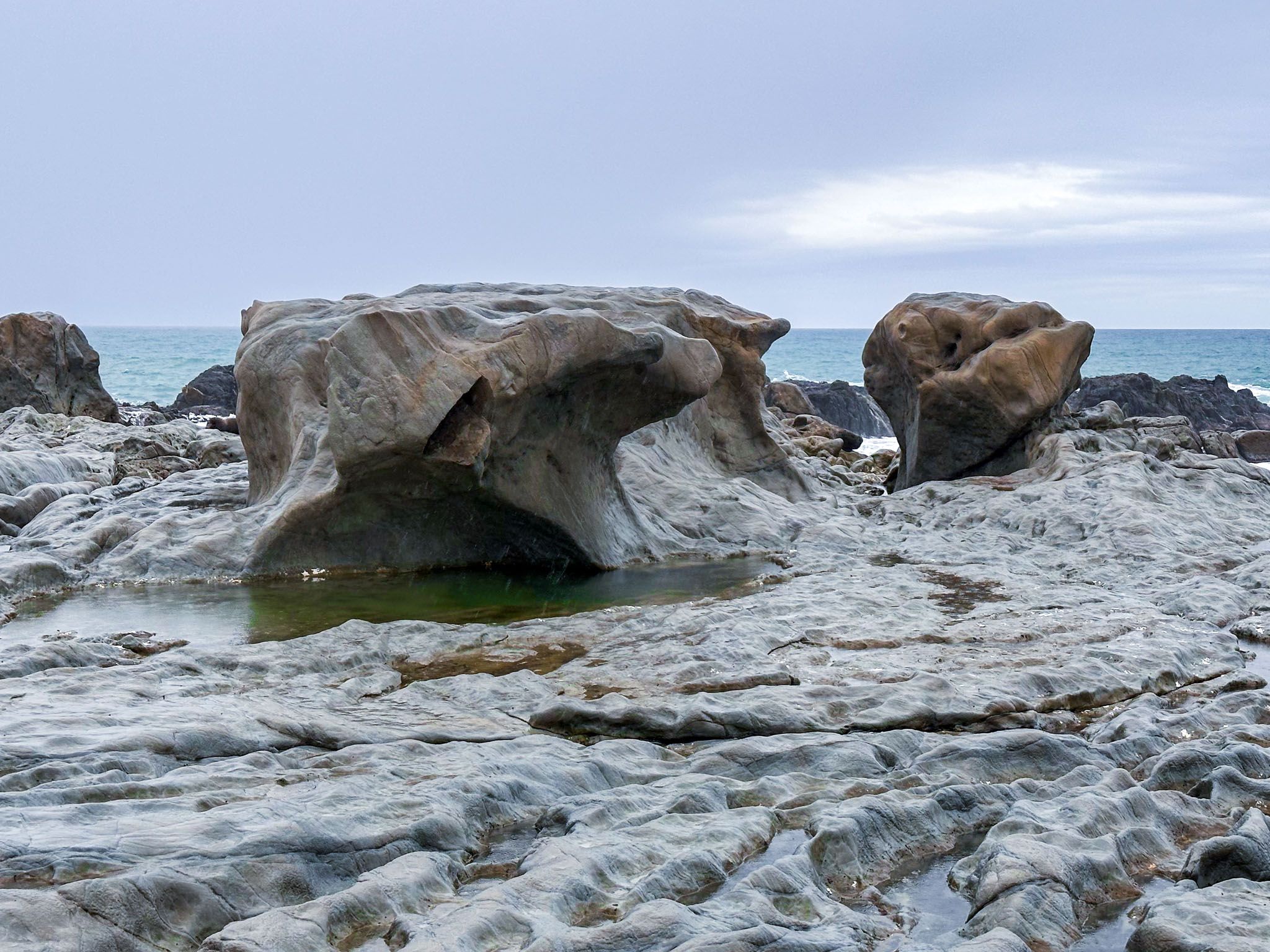
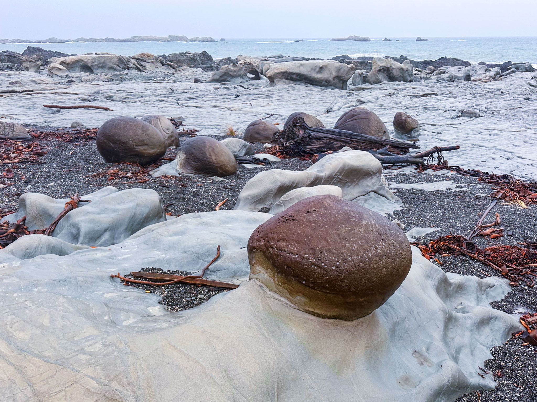
The earthquake also uncovered the "Ward Boulders," round rock concretions similar to the Moeraki, Whitecliffs, and Koutu boulders. These boulders, located about 800 metres north of the car park, are rare geological highlights formed millions of years ago in the mudstone cliffs and uncovered by erosion and the earthquake. Additionally, large piles of uplifted kelp remain scattered around the platform.
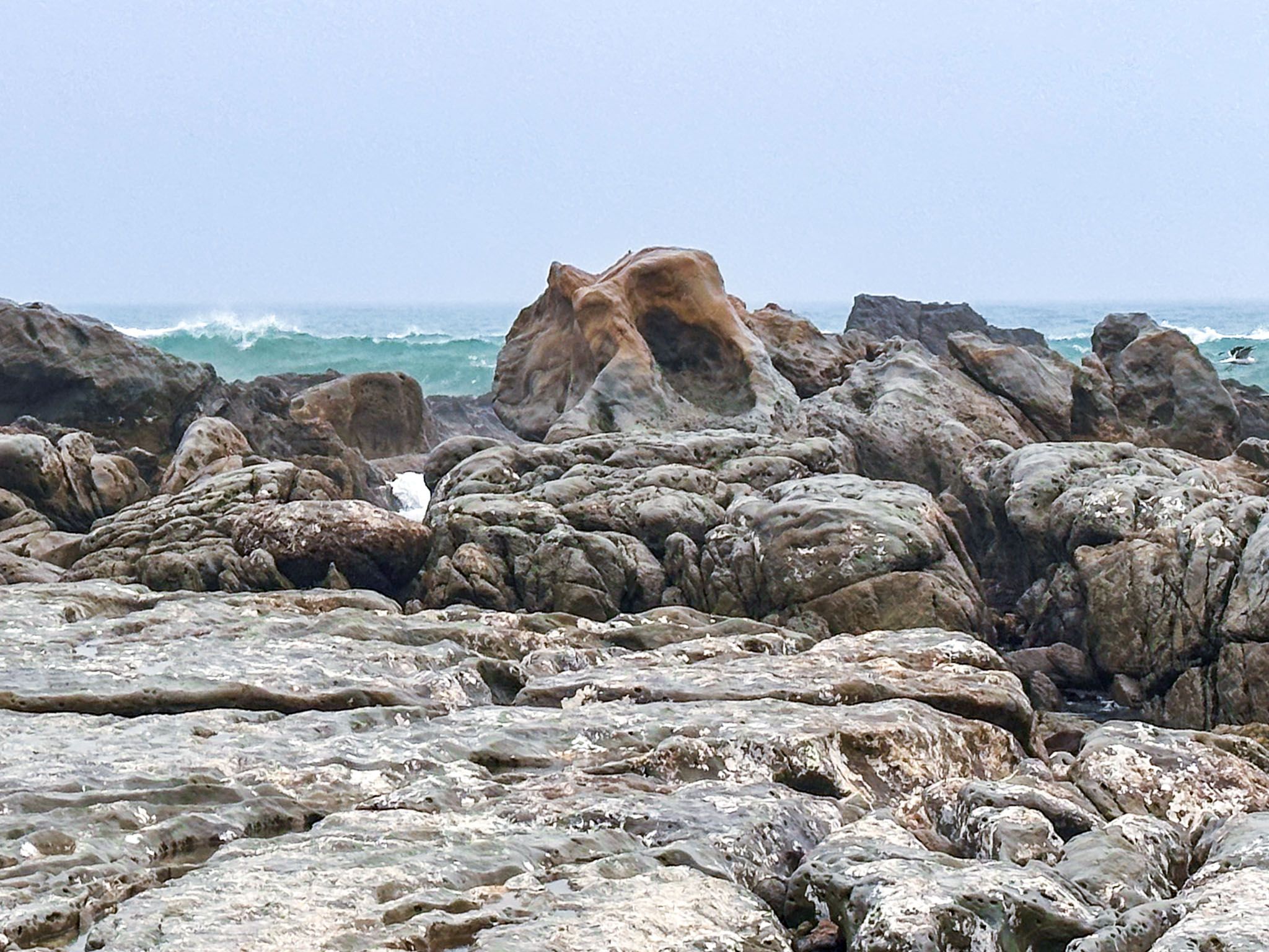
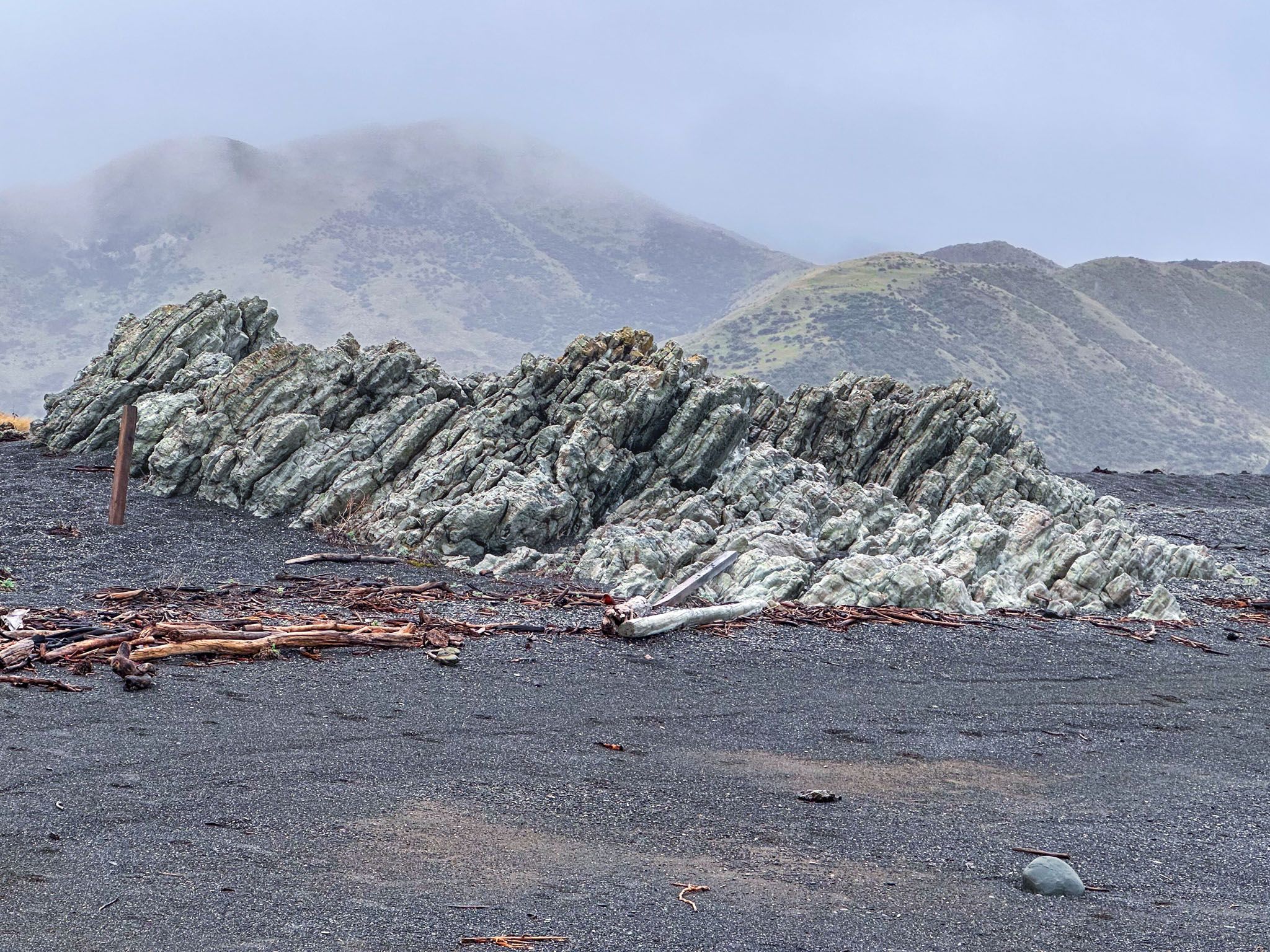
Chancet Rocks and the Cretaceous-Paleogene Boundary
Approximately 700 metres further north, across an unnamed beach, lie the Chancet Rocks. This coastal limestone formation is protected as a scientific reserve and is one of the best on-land sites in the Southern Hemisphere for observing the Cretaceous-Paleogene boundary. The area features fossil traces and rock layers dating back to the mass-extinction era 66 million years ago. To preserve this site, access beyond Ward Beach towards Chancet is restricted to foot traffic.

Flaxbourne River and Te Tai-o-Marakura Marine Area
At the southern end of Ward Beach, the Flaxbourne River meets the ocean. The earthquake altered the river's course, forcing it to cut through high gravel deposits and revealing additional limestone rock formations. A modest lagoon at the river mouth, beneath one of these formations, offers a pleasant spot for a Summer swim. From here, you can explore more rock formations. A longer pebble beach lies below the 369-metre Weld Cone.
Facilities and Wildlife
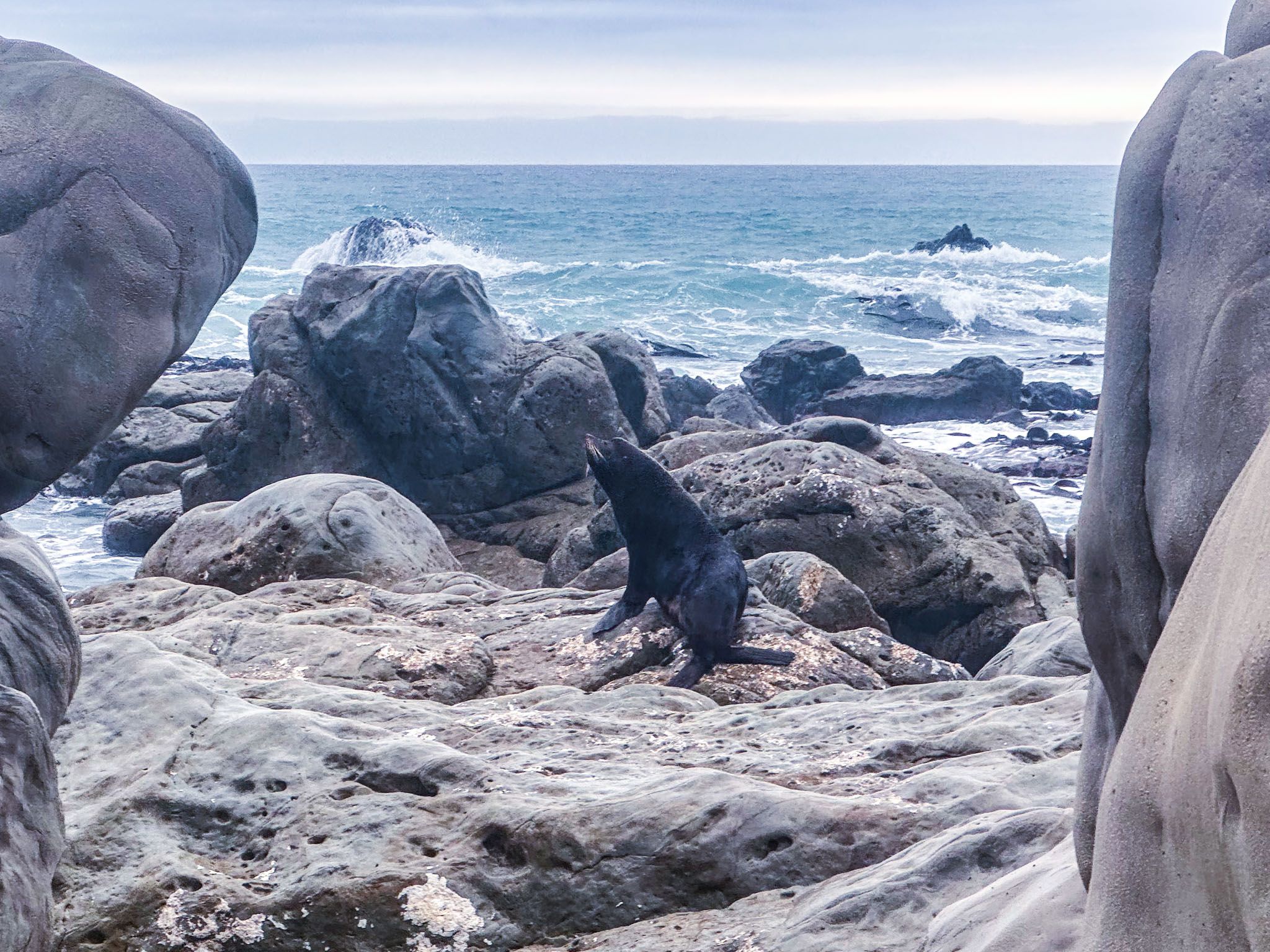
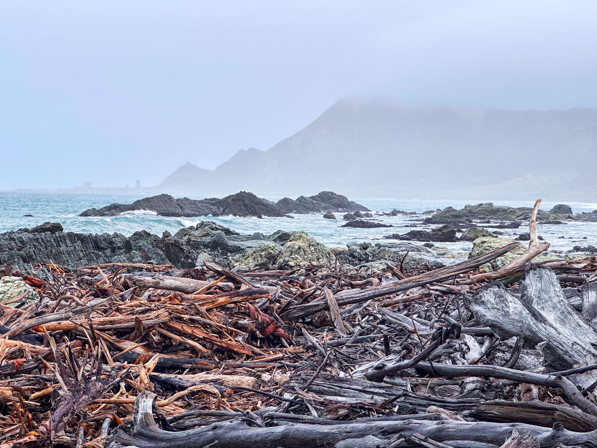
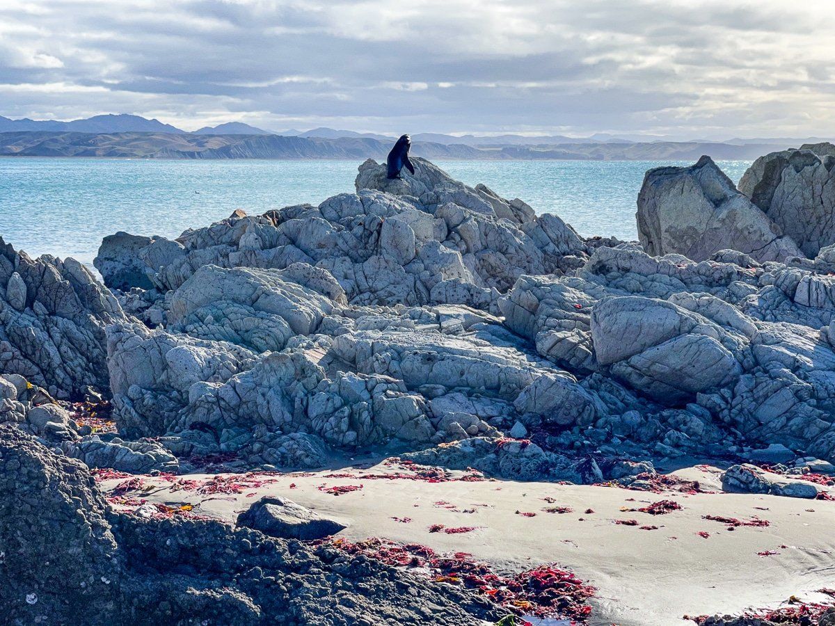
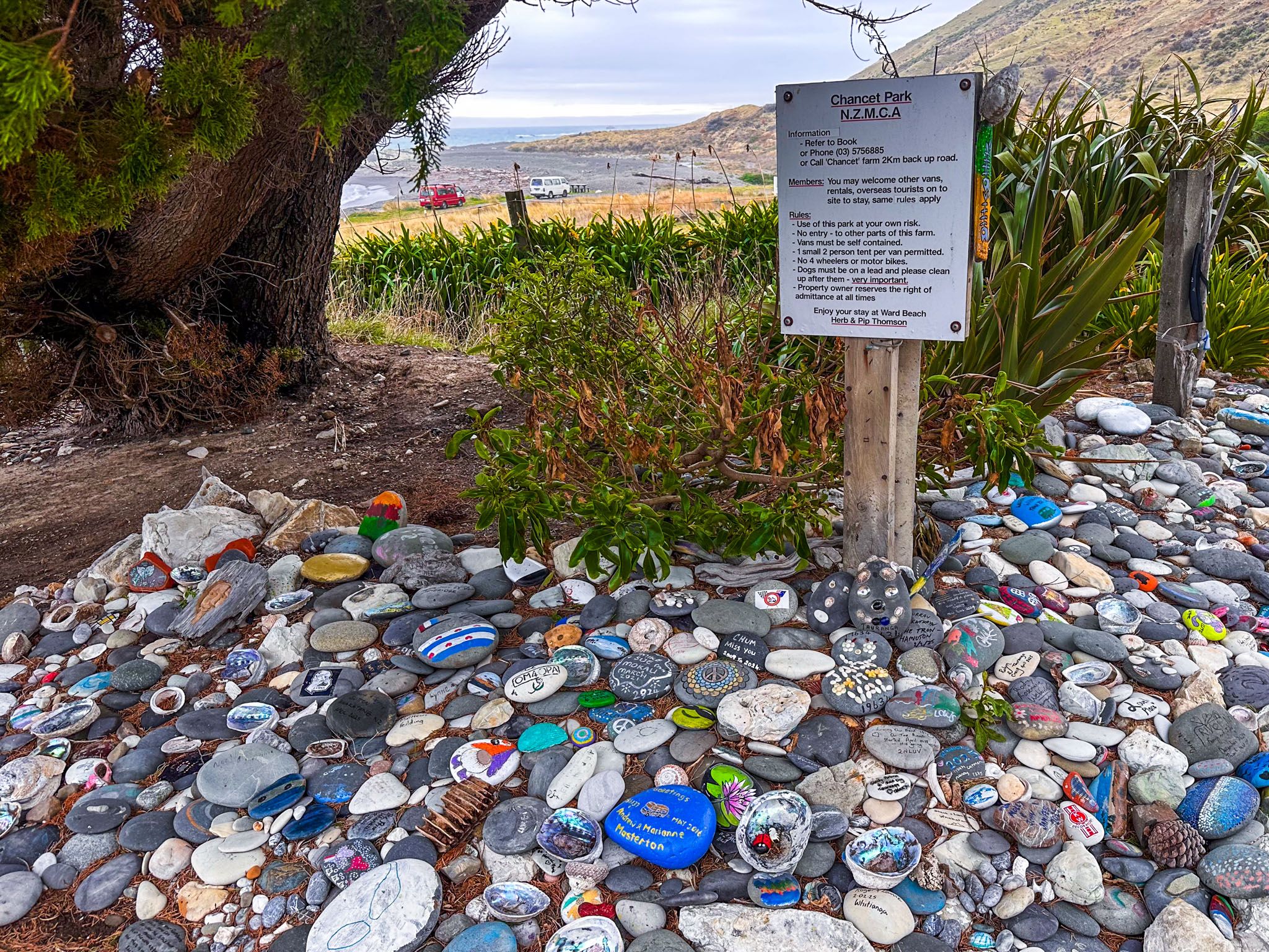
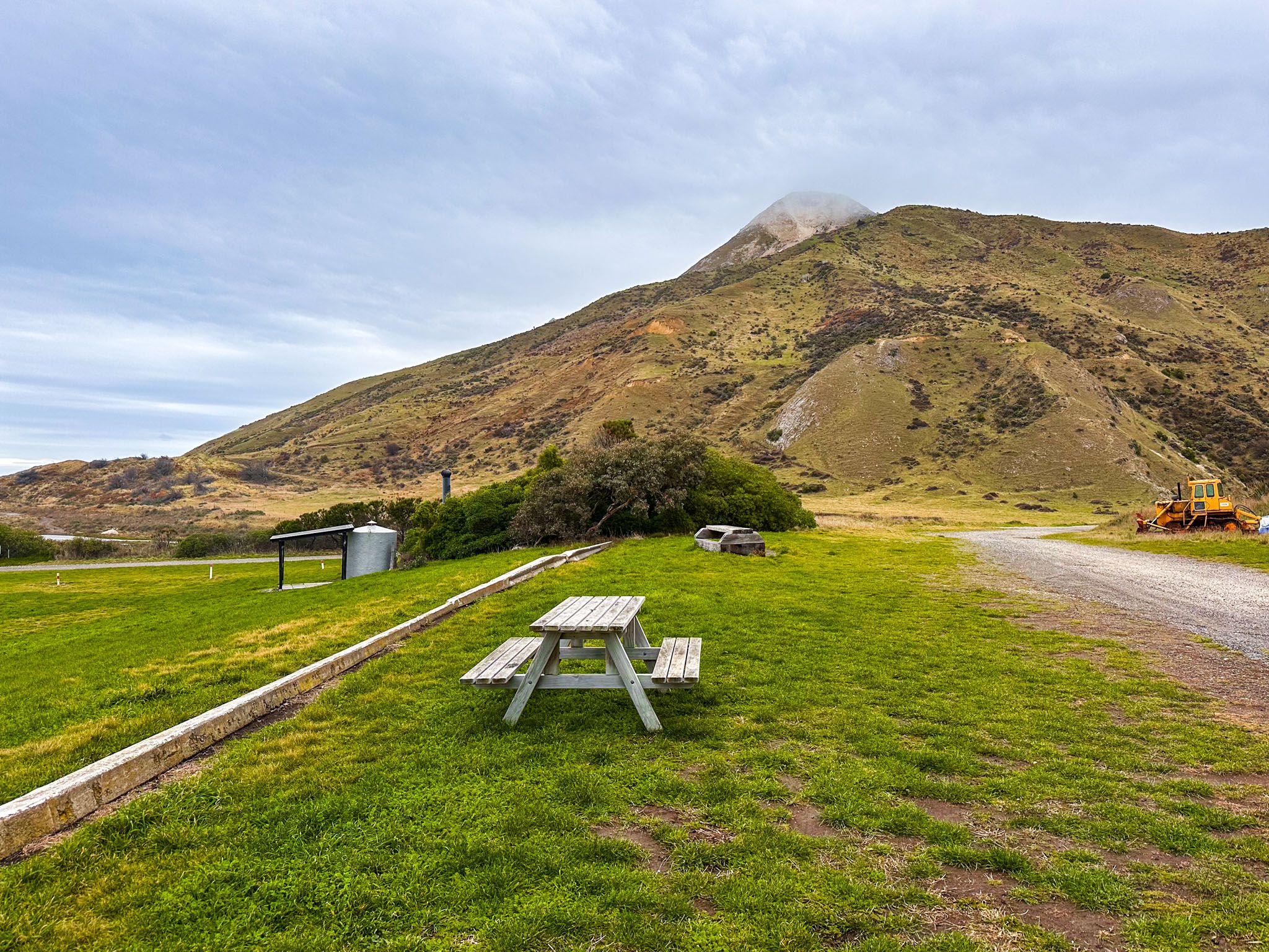
Above the beach, a grassy picnic reserve provides parking and a public toilet. For those travelling in self-contained camper vans, camping is available just beyond the reserve on private farmland. A small donation to the landowner is appreciated. This informal camping spot offers a remote and scenic location. The coast is also home to seals, particularly around the rocky outcrops. If you encounter a seal while exploring, remember to keep a respectful distance.
How to Get There
To reach Ward Beach from Blenheim, take Ward Beach Road off State Highway 1 and follow a 3.7 km stretch of scenic road across farmland, which becomes gravel towards the end, leading to the beach reserve. If travelling from the north, the turnoff is 3 km north of the small township of Ward. Coming from Kaikōura south on State Highway 1, take Seddon Street to connect with Ward Beach Road.
From Blenheim, the drive is 42 minutes and 48 km. From Kaikōura, the drive is 70 minutes and 89 km.