A Day Trip on the Routeburn Track
Routeburn Falls, located on the renowned Routeburn Track, is typically an overnight stop, but it can also be explored as a day trip. Starting from the Routeburn Shelter at the end of Routeburn Road, this exceptional walk takes about three hours each way. To make the most of your day, consider staying overnight in Kinloch or Glenorchy on Lake Wakatipu, reducing your travel time to the track's starting point.
The Walk to Routeburn Flats
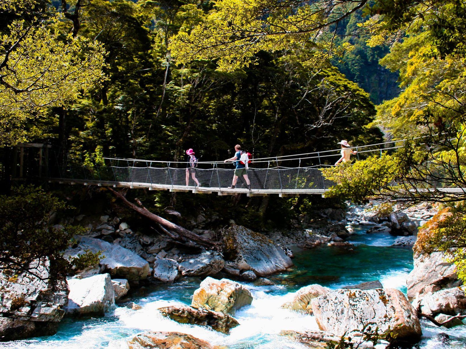
The initial part of the walk follows the Route Burn stream for just over six kilometres to Routeburn Flats. This section is an easy walk, mostly through beech forest, with a gentle elevation gain of 200 metres. The stream is visually striking, featuring turquoise waters and lively rapids, and is accessible with beaches at a couple of spots. A bridge crosses a secondary stream flowing from a steep gorge into the Route Burn, a site used for guided canyoning trips.
Reaching Routeburn Flats takes about 90 minutes to two hours. The Flats offer a stunning meadow campsite, divided by the Route Burn and surrounded by mountains and beech forest. It's an ideal location for a picnic and a convenient turnaround point if you're short on time.
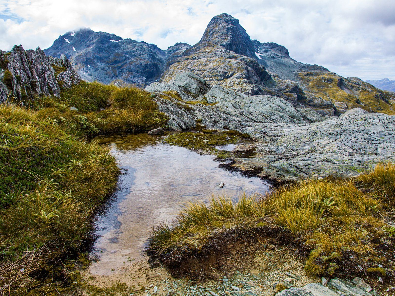
Climbing to Routeburn Falls
From Routeburn Flats, the walk to the Falls is 2.5 kilometres, with a 200-metre ascent to 960 metres above sea level. Most of the elevation gain occurs in the first kilometre, but the track remains relatively easy. The views back over the Flats and down the valley are spectacular.
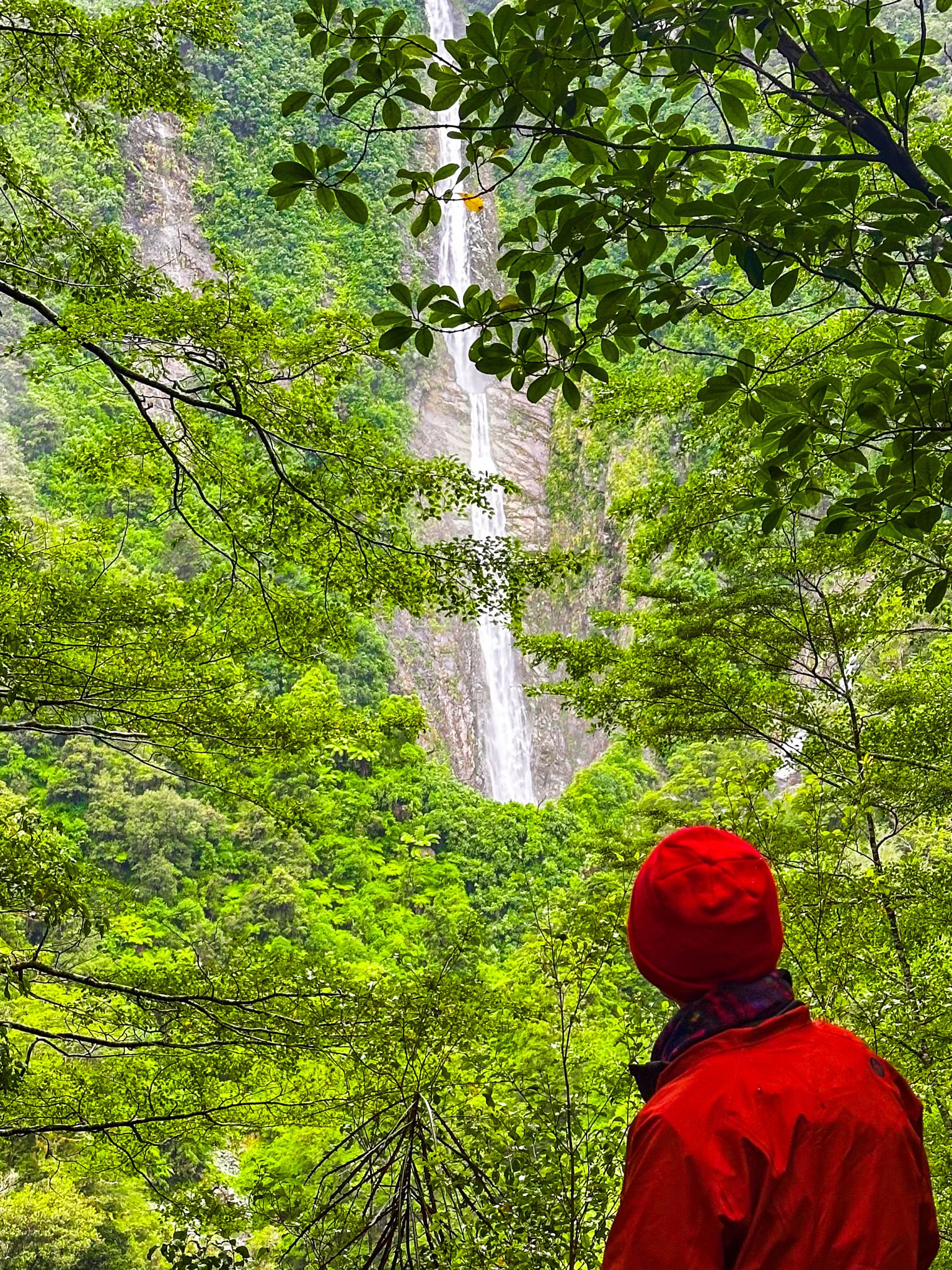
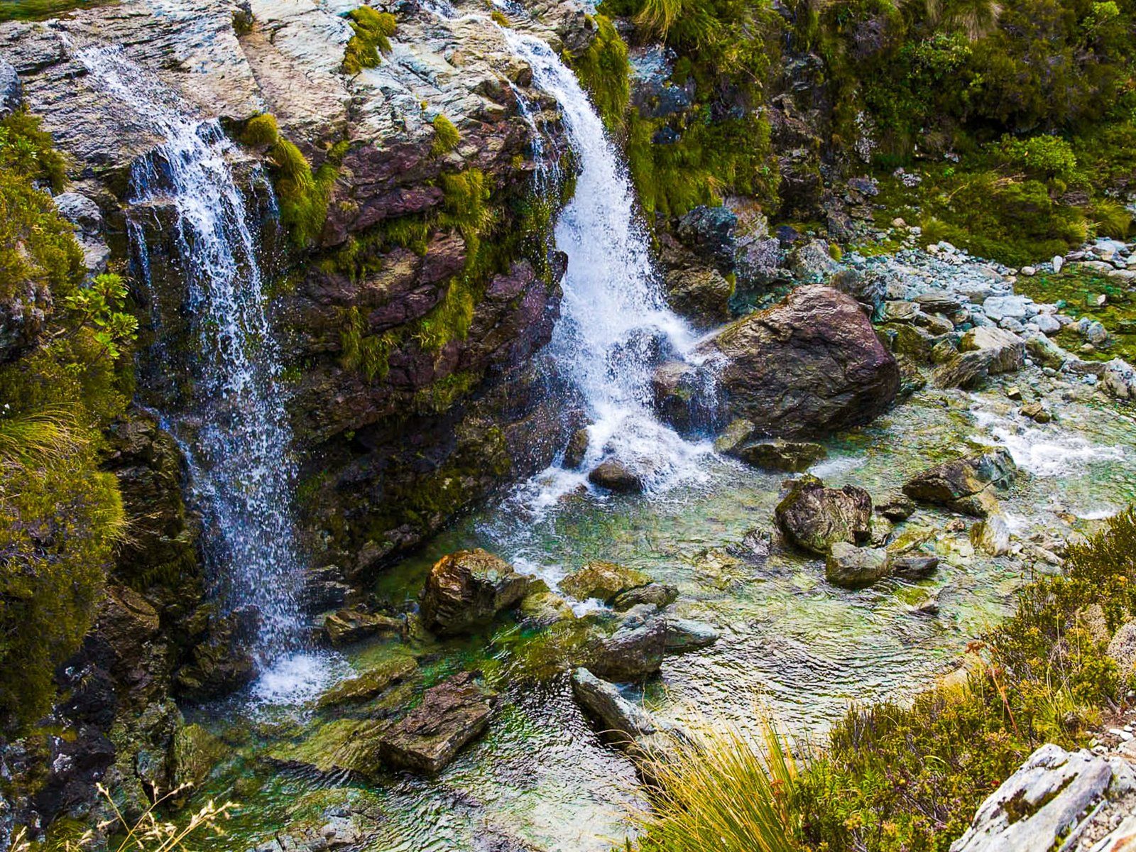
About halfway up, the track crosses an open area of an old slip. After approximately 45 minutes, you'll reach the DOC Routeburn Falls Hut and a private lodge. The Falls, located just north of these buildings, are easily accessible. Although Topo Maps suggest the falls are 176 metres high, they are closer to 20 metres, with the rest of the drop due to a series of cascades drops on the Route Burn below the Falls down to Routeburn Flats.
Getting to the Routeburn Track
To reach the start of the Routeburn Track, head to the Routeburn Shelter at the end of Routeburn Road. From Queenstown, take Glenorchy Queenstown Road to Glenorchy, then continue north on Glenorchy Paradise Road. Turn onto Priory Road at the intersection with Paradise Road. After a short drive around the south end of Mount Alfred, follow the highway right onto Glenorchy Routeburn Road until you reach the gravel Routeburn Road, north to the Routeburn Shelter.
If youhave enough time, you cna extend the hike to Lake Harris and the Harris Saddle, at 1,255 metres. Allow at least an extra hour each way. Around the area, you can also explore the Lake Sylvan Track, Diamond Creek Walk, the Dart Valley and Glenorchy Lagoon Walkway.