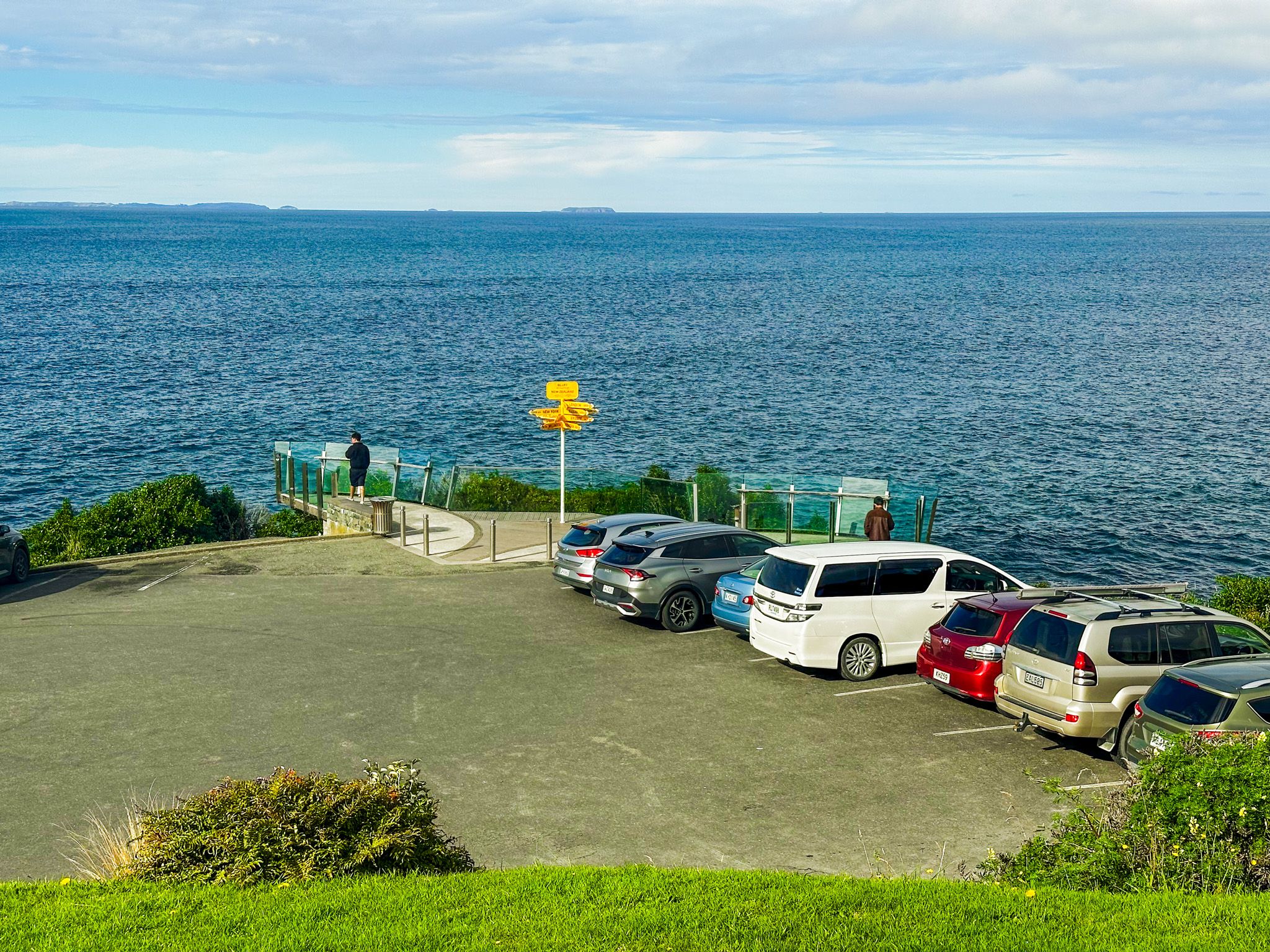
The End of the Road
The car park and viewpoint at Stirling Point mark the southern terminus of State Highway 1, the road that runs the full length of New Zealand from Cape Reinga in the Far North. It sits 1 km south of the centre of Bluff town on the shore of Foveaux Strait, at the base of Bluff Hill (Motupōhue). It is also the southern end of Te Araroa, the 3,000-km walking trail from Cape Reinga. Most people stop here to photograph the famous directional signpost, but a better reason to linger is the open view across Foveaux Strait, and the sense of standing at the rim of the country before the southern ocean takes over on the way to Antarctica.
The Signpost and the Name
The Stirling Point signpost was first erected around 1960 as a wooden post with six destination blades, pointing to Dog Island, Ruapuke Island, Wellington, London, and the South Pole. The current metal post, cemented into the ground against the Southland wind, has grown to more than 12 destinations. While the signpost technically marks the end of State Highway 1, Slope Point in the Catlins lies further south on the New Zealand mainland, and Rakiura / Stewart Island is further south again.
The point is named for Captain William Stirling, who ran a whaling station at this location from 1836 until 1844. Stirling was born in Broadstairs, England, ran away to sea as a boy, and worked the Foveaux Strait fishery for Johnny Jones before taking ownership of the site himself. By 1842, he had cleared the bush, laid gardens, and built infrastructure for whale processing on this exposed headland. Stirling was buried on the far side of the harbour mouth at Tiwai Point.
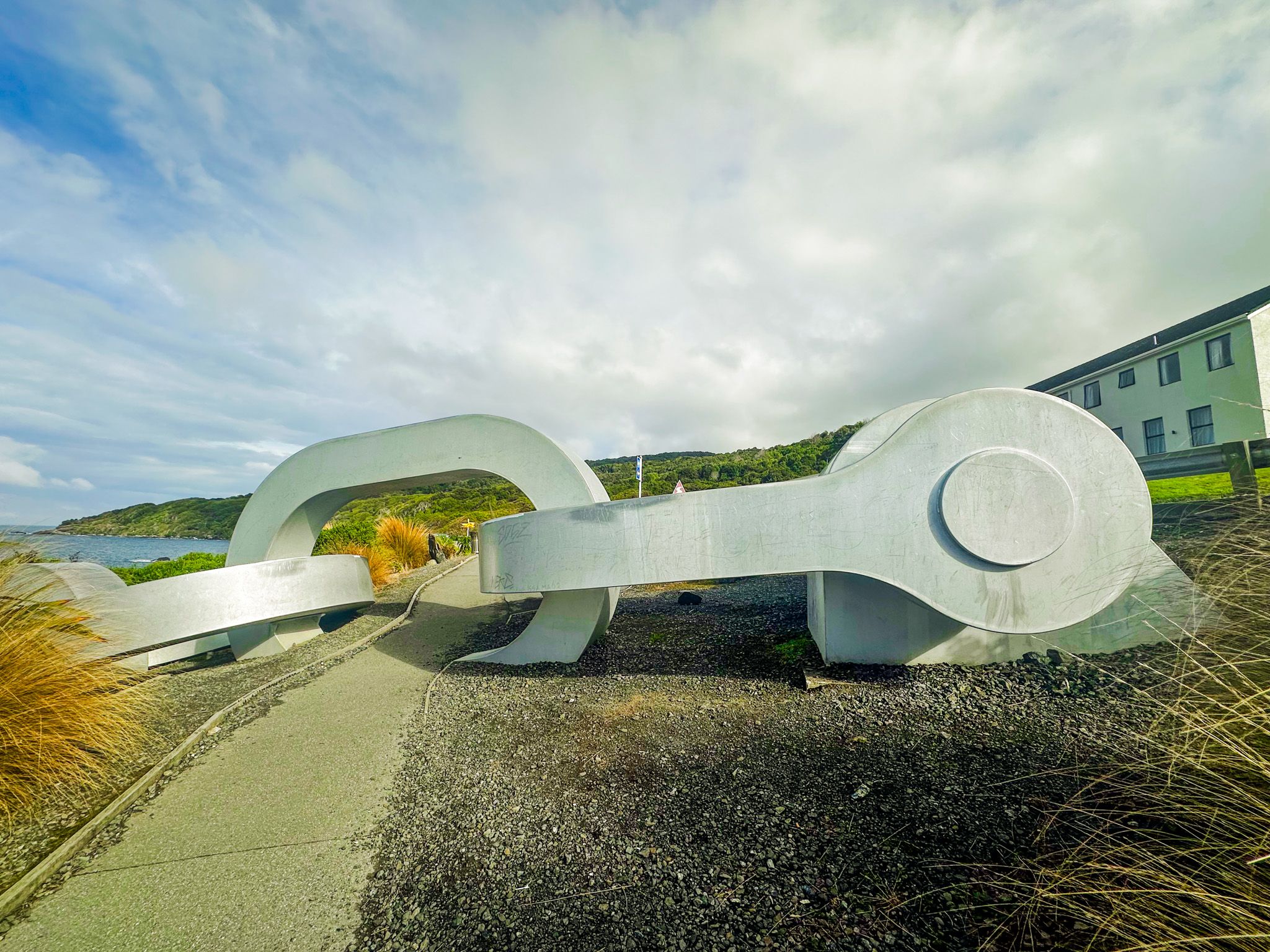
A Māori Legend and the Chain Sculpture
Near the signpost stands a large steel anchor chain sculpture, its links disappearing into Foveaux Strait. The sculpture connects to a matching piece at Lee Bay on Stewart Island / Rakiura, together representing the mythological anchor chain of the demigod Māui. In Māori tradition, the South Island is Te Waka-a-Māui, Māui's canoe, and Rakiura is Te Punga o Māui, its anchor stone. The North Island, Te Ika-a-Māui, was the fish that Māui successfully hauled from the sea.
The Bluff end of the chain, installed in 2009, includes a shackle connecting it to the stern of the canoe. The Rakiura end, unveiled in 2003, is rust-coloured, whereas the Bluff piece is silver, an artist's detail suggesting the southern Rakiura (anchor) end is always wet. Both pieces were created by Southland artist Russel Beck, with the help of his family.
The Small Lighthouse
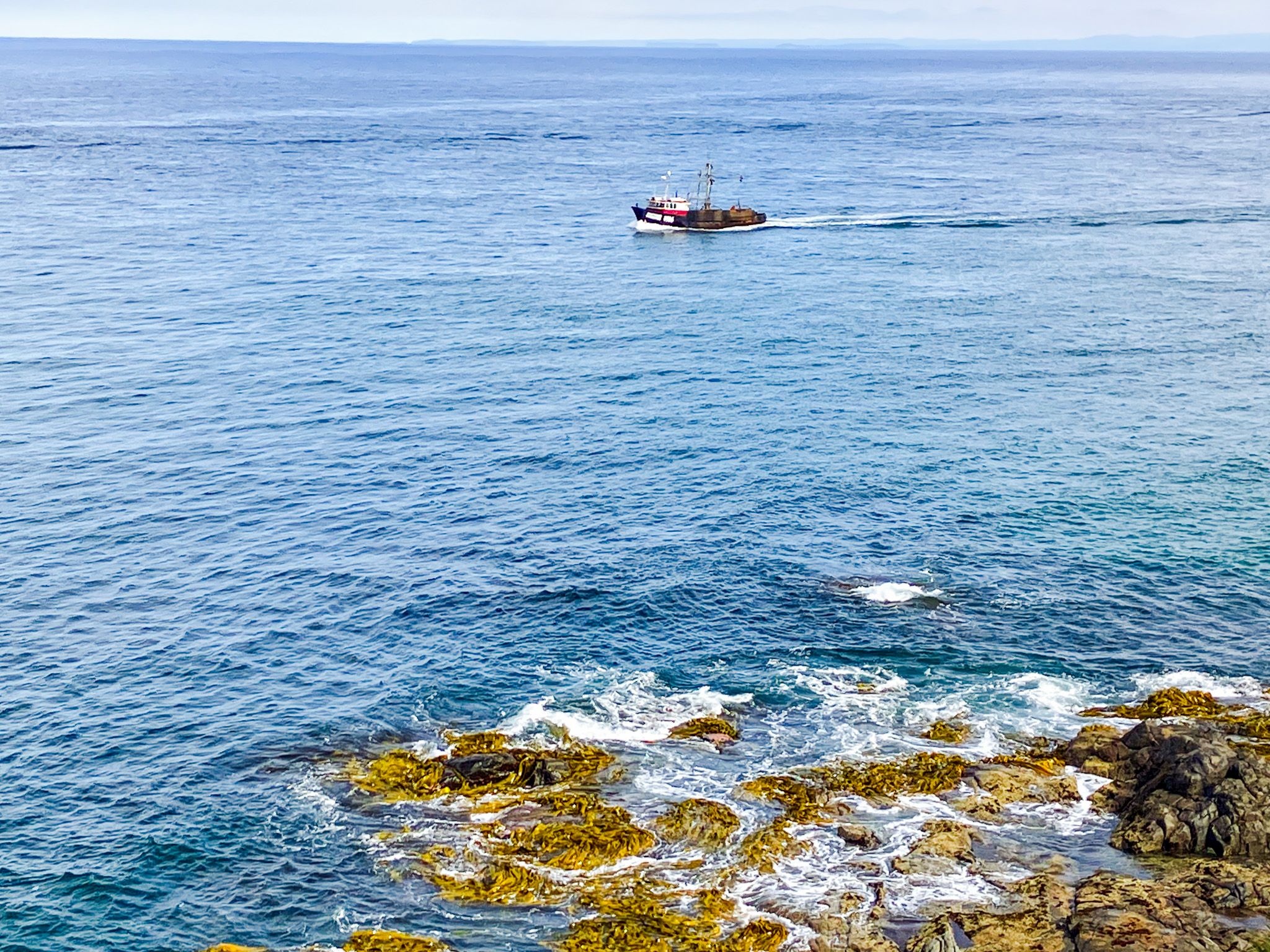
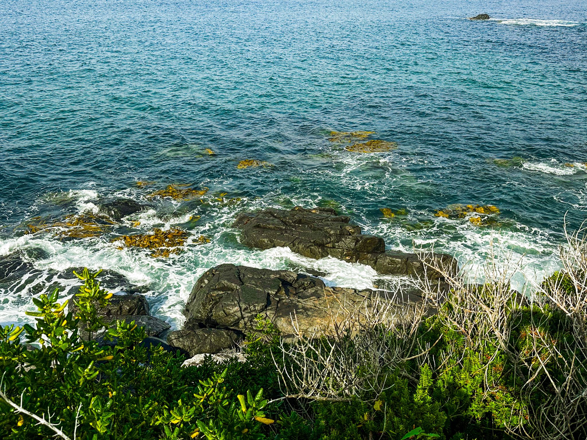
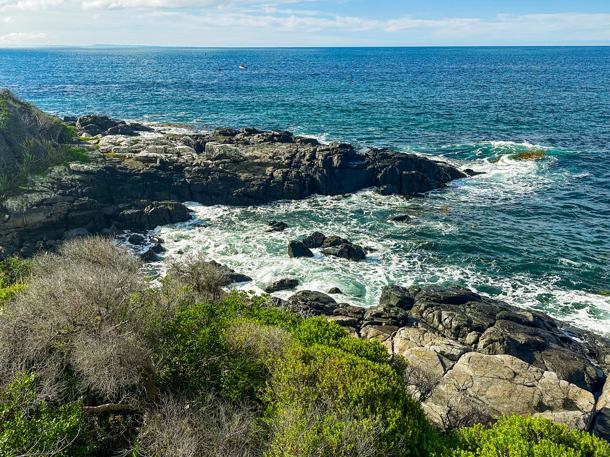
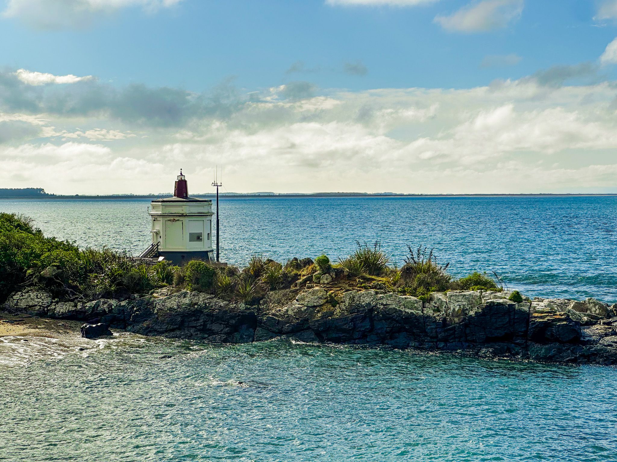
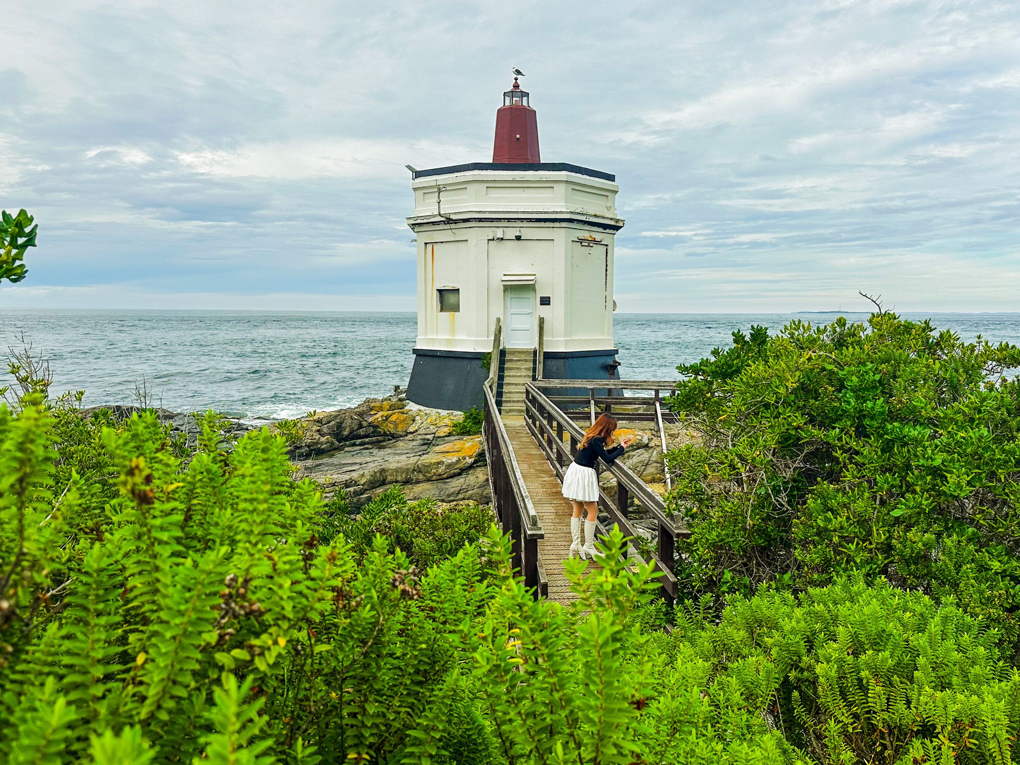
A short walk north from the signpost along the rocky shore brings you to the small Stirling Point lighthouse, marking the southern tip of Bluff Harbour. The rocks here are worn and wave-polished, and in Winter there is a reasonable chance of seeing southern right whales in the strait below. There are numerous information panels, especially near the lighthouse, that explain the region's human and natural aspects.
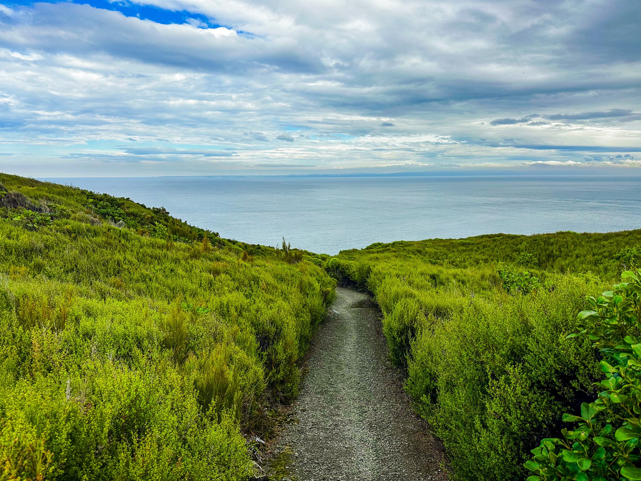
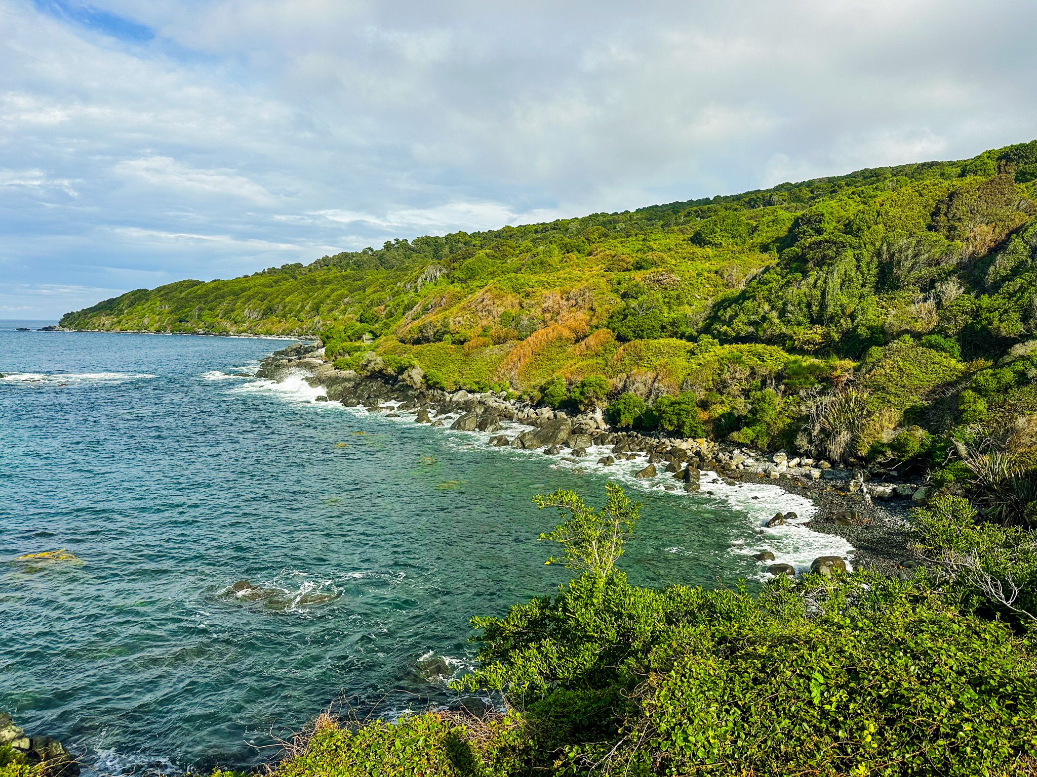
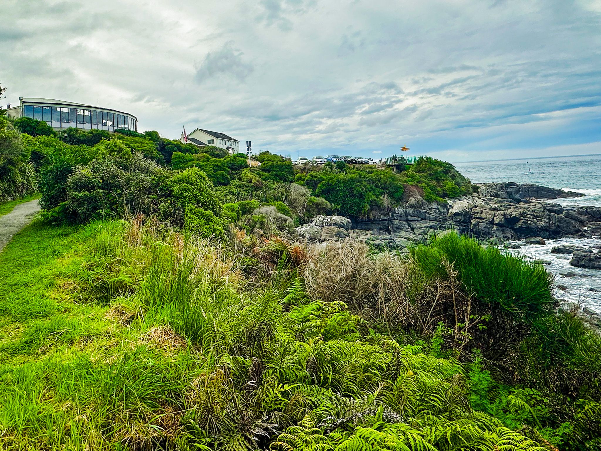
From the edge of the car park, there is a great view south, taking in the rocky coast and the base of Bluff Hill. From here, you can follow the Foveaux Walkway around the base of the hill, also the final section of Te Araroa. This track also forms loop options with the Toponui Track. From there, you can take the Glory Track about halfway up Bluff Hill, or continue to the car park on the peak, then follow the Millennium Track back to the Foveaux Track.
Immediately above the car park, there is a cafe/restaurant, the Oyster Cove, and next door is the aptly named Lands End Hotel.

How to Get There
Stirling Point is at the end of State Highway 1, 1 km south of Bluff town. From Invercargill, follow State Highway 1 south through Bluff to the car park at the road's end. The drive from Invercargill is 30 km and takes around 30 minutes.
Nearby places to visit include the Greenpoint Ship Graveyard, Greenhills and Ōmaui, all accessible from the highway north of Bluff.