Christchurch's Volcanic Backdrop
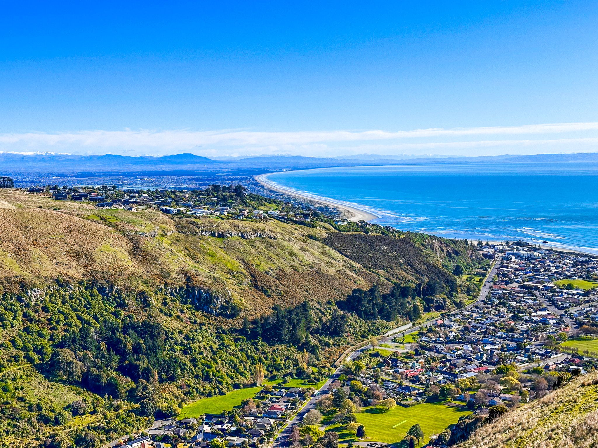
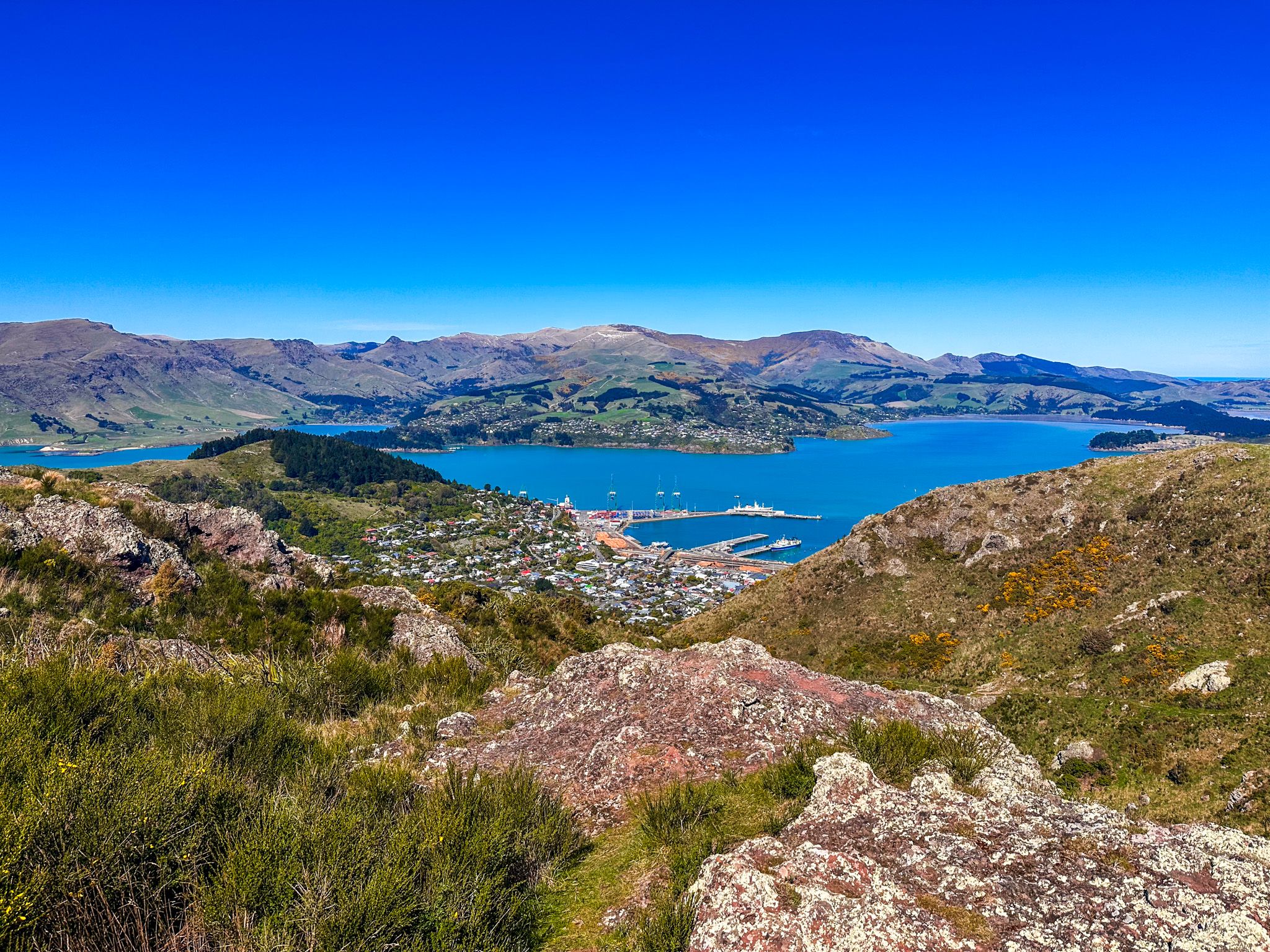
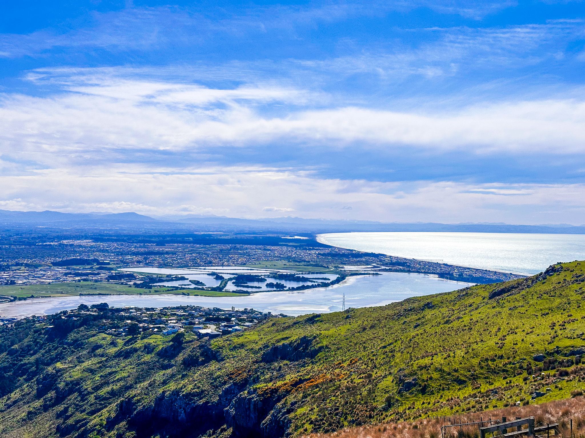
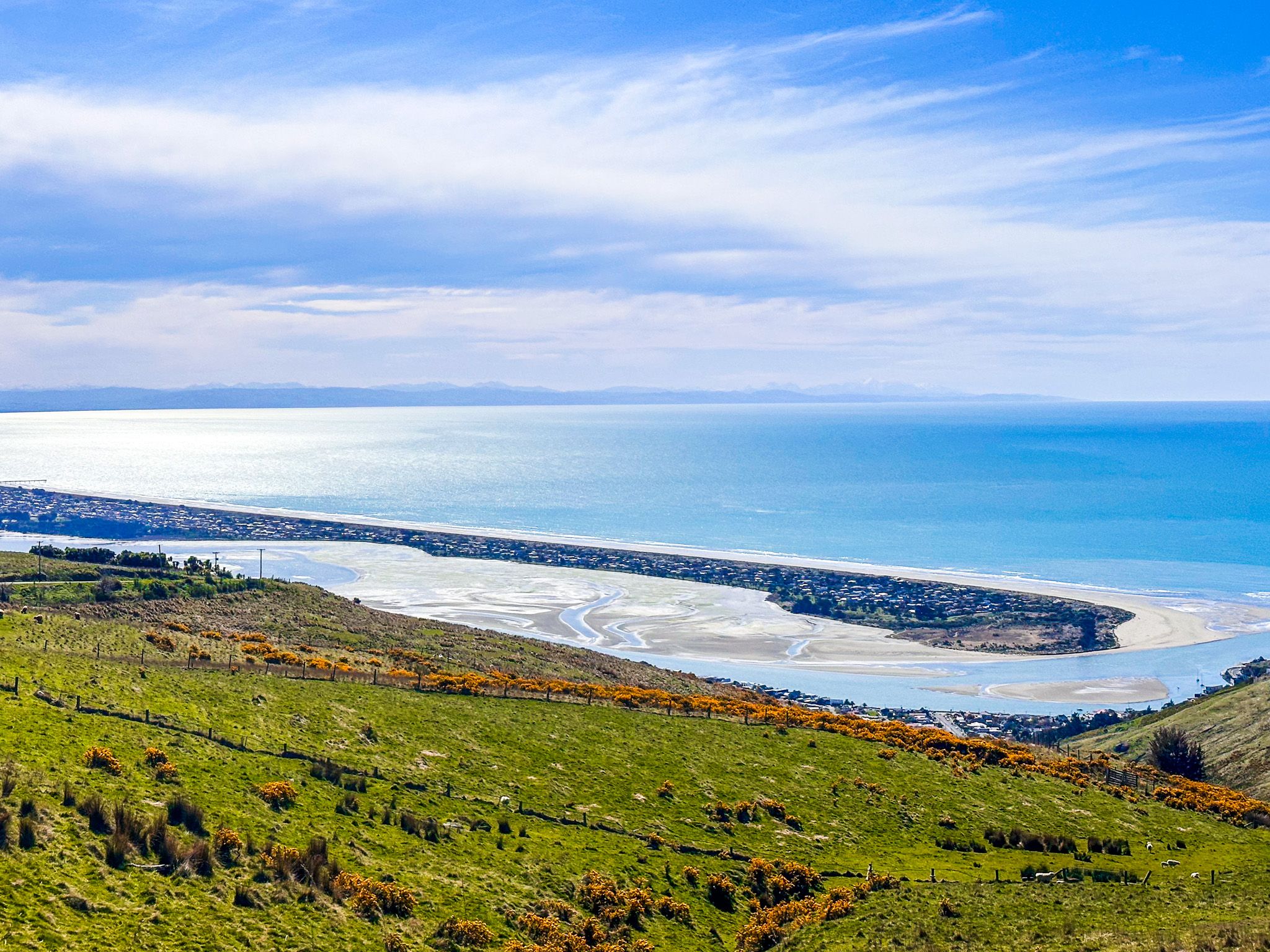
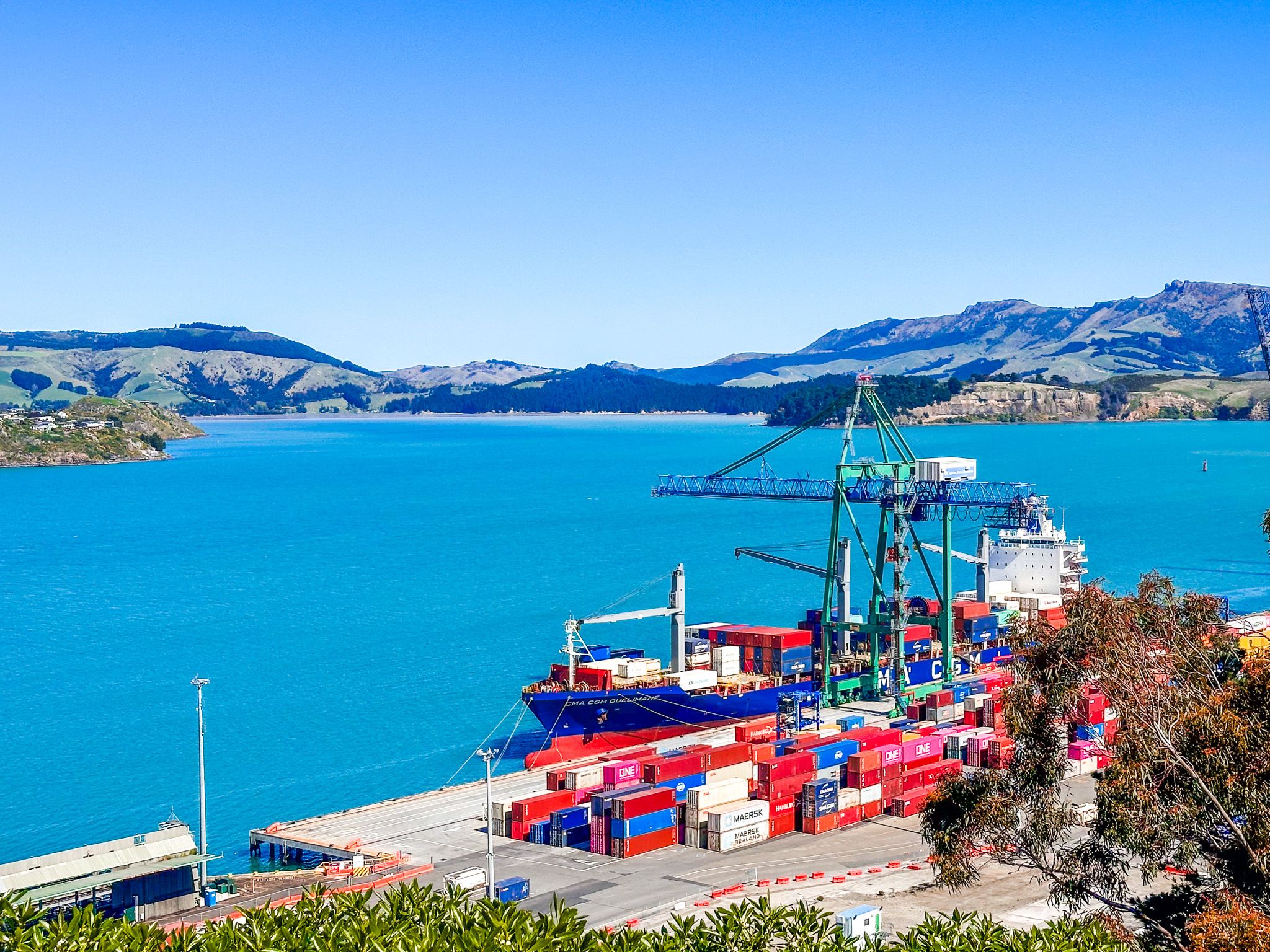
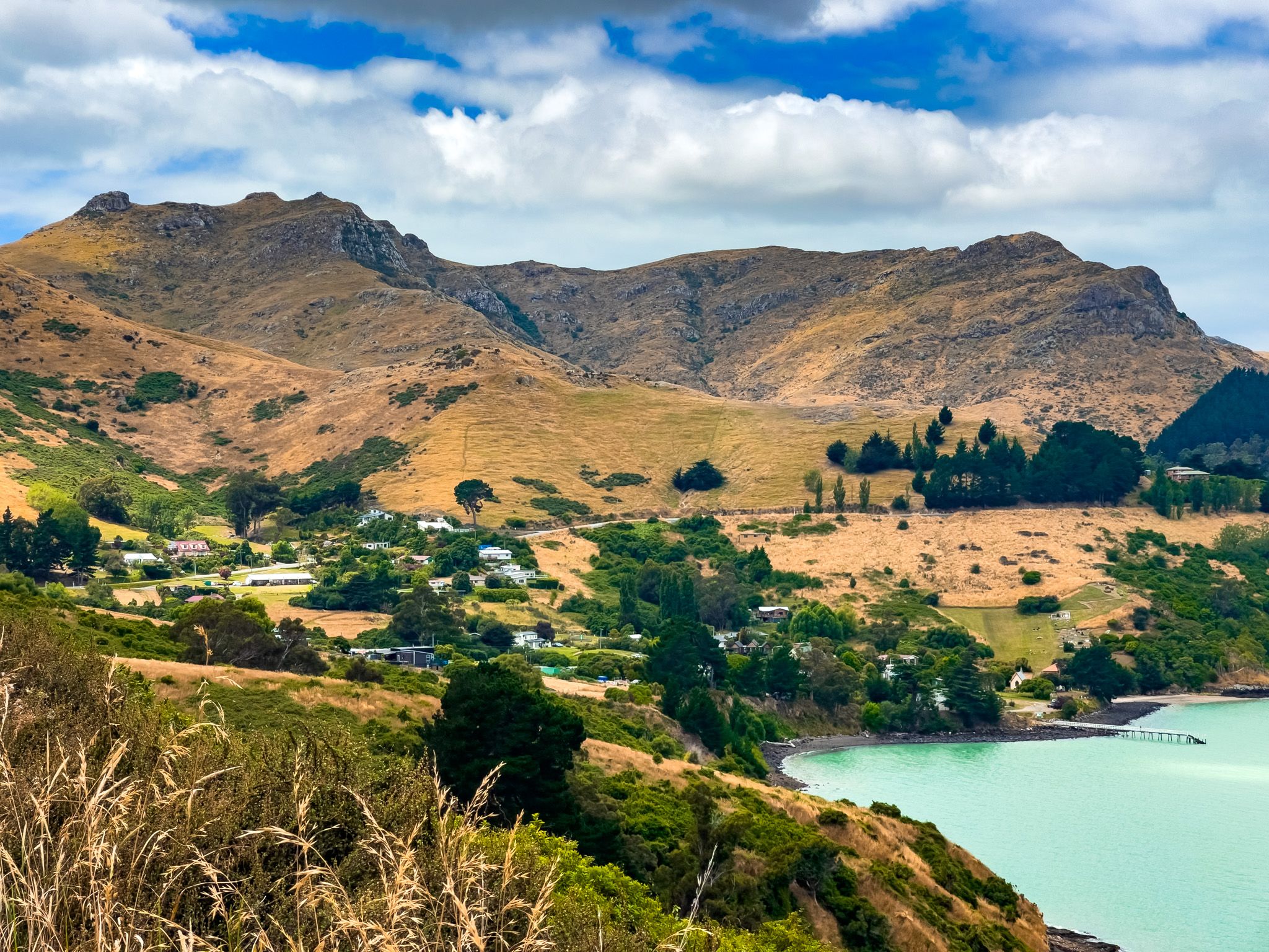
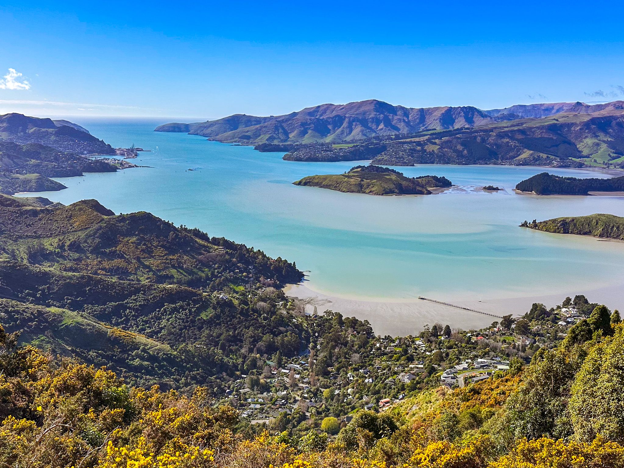
The Port Hills rise sharply from the southeastern edge of Christchurch / Ōtautahi, forming the northern arc of the ancient Lyttelton volcanic crater. They stretch from Godley Head in the northeast, curving from north to west, then to Gebbies Pass in the south. The crater rim that marks the top of the hills is roughly 20 km long and separates the city on the flat Canterbury plains from the aqua-blue water of Whakaraupō / Lyttelton Harbour. For Christchurch residents, the Port Hills are a natural escape on the doorstep: a place of sweeping views, ancient geology, layered history, and an extraordinary density of named features, reserves, and tracks.
Exploring the Crater Rim
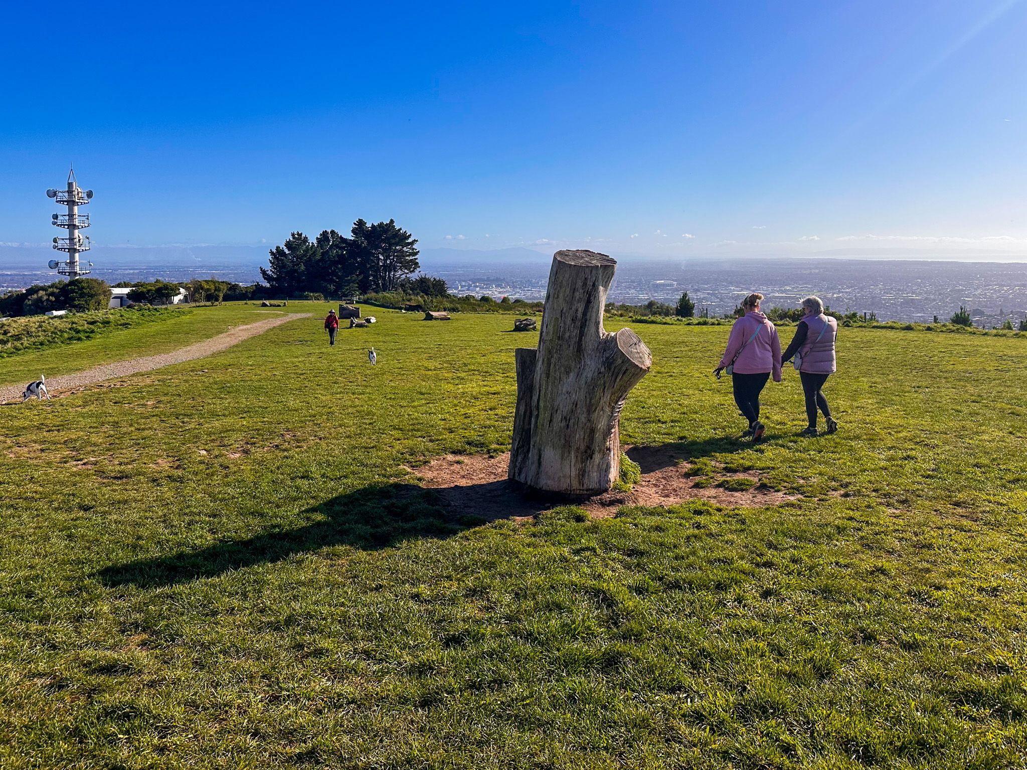
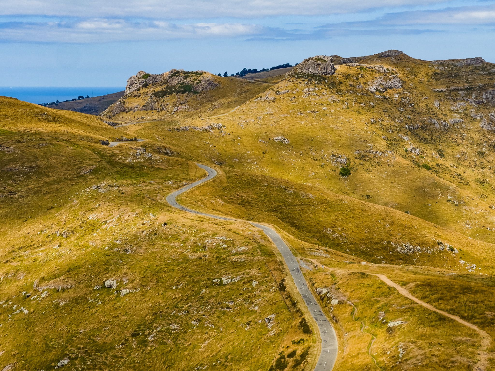
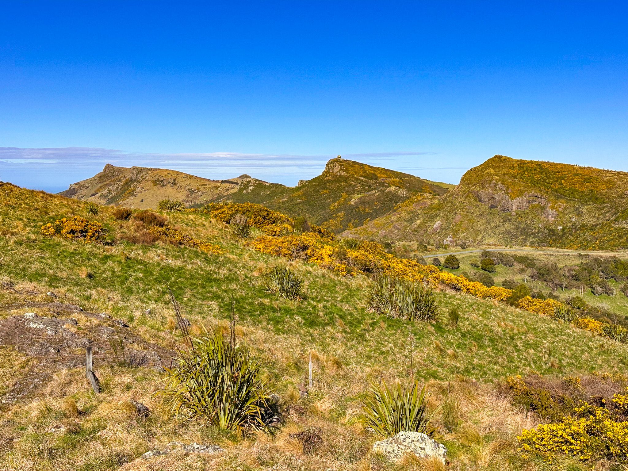
The best way to experience the Port Hills is to drive, walk, or cycle Summit Road and the adjacent Crater Rim Walkway. The road and track together run from Gebbies Pass in the southwest to Godley Head in the northeast, passing viewpoints, reserves, and named peaks at almost every turn.
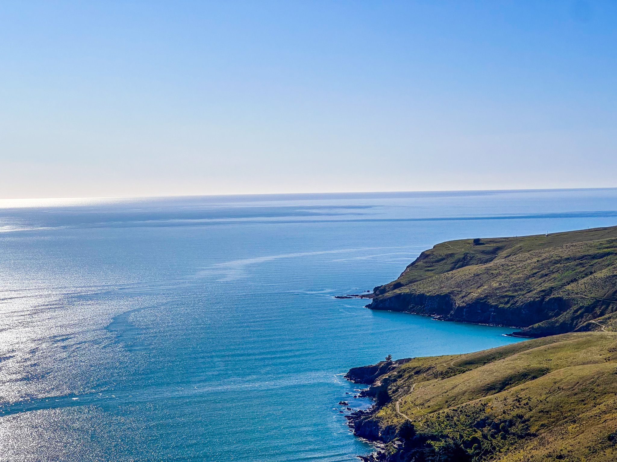
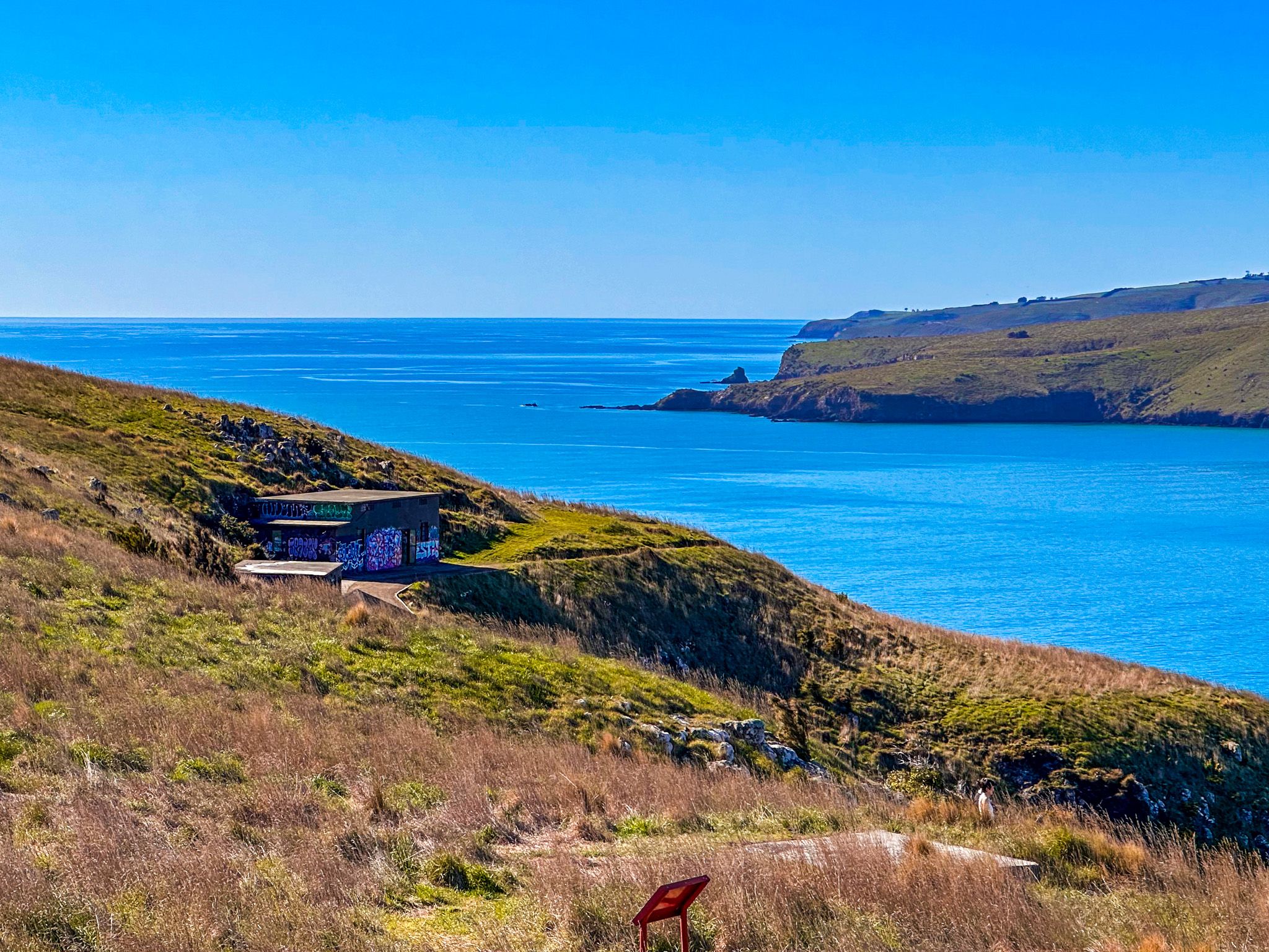
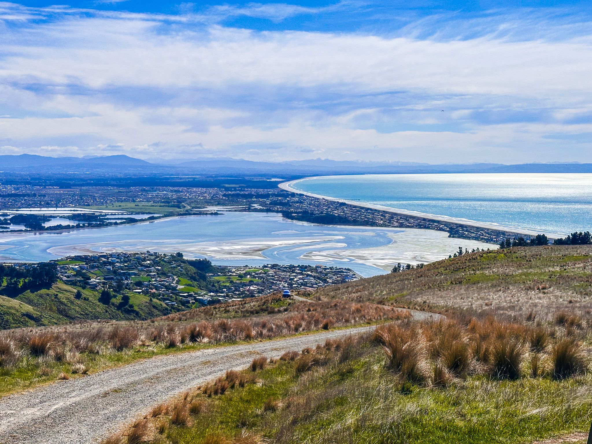
Views from the rim are exceptional in all directions: across Christchurch to the Canterbury Plains and the distant snowfields of the Southern Alps; along the north Canterbury coast toward Palliser Bay; and down into the harbour, where the aqua-blue water fills the ancient crater. On the far side of the harbour, the southern rim rises again to Mt Herbert and the hills of Banks Peninsula.
Note that Summit Road is closed to cars between Witch Hill and east of Mount Cavendish, so that section is accessible on foot or by bike only. Near Gebbies Pass, the road is narrow, steep, and winding, and walkers and cyclists share it with vehicles: take care in both directions. For those wanting to walk the entire rim, the route from Gebbies Pass to Godley Head is possible in a long day and stays mostly on dedicated tracks.
Rock climbing is another draw, with Witch Hill / Te Upoko-o-Kurī and the volcanic crags at Te Ahi-a-Tamatea / Rāpaki Rock among the main sites. Not all peaks are easily accessible, but the rock formations along the rim are fun to explore. For a quick alternative way up, the Christchurch Gondola on Mount Cavendish, opened in 1992, offers a direct 10-minute lift from Heathcote Valley to the crater rim at 445 m, with a viewing platform, cafe and walking tracks from the top station.
Tracks from the City
Several tracks climb directly from Christchurch suburbs to the crater rim. The quickest crossing to Lyttelton on foot is the Bridle Path, a steep 2.4 km track from Heathcote Valley that follows the route used by the first European settlers. They carried their belongings over the hill from 1850 until the rail tunnel opened in 1867. The path includes a moving set of pioneer memorials. Other tracks include the Rāpaki Track, which follows the traditional Māori route from the crater rim to the plains, and the Major Hornbrook Track to Mount Cavendish. These and other tracks, including those via Victoria Park, involve a climb of around 200 m and take roughly an hour to reach the crater rim. Some are shared with cyclists.
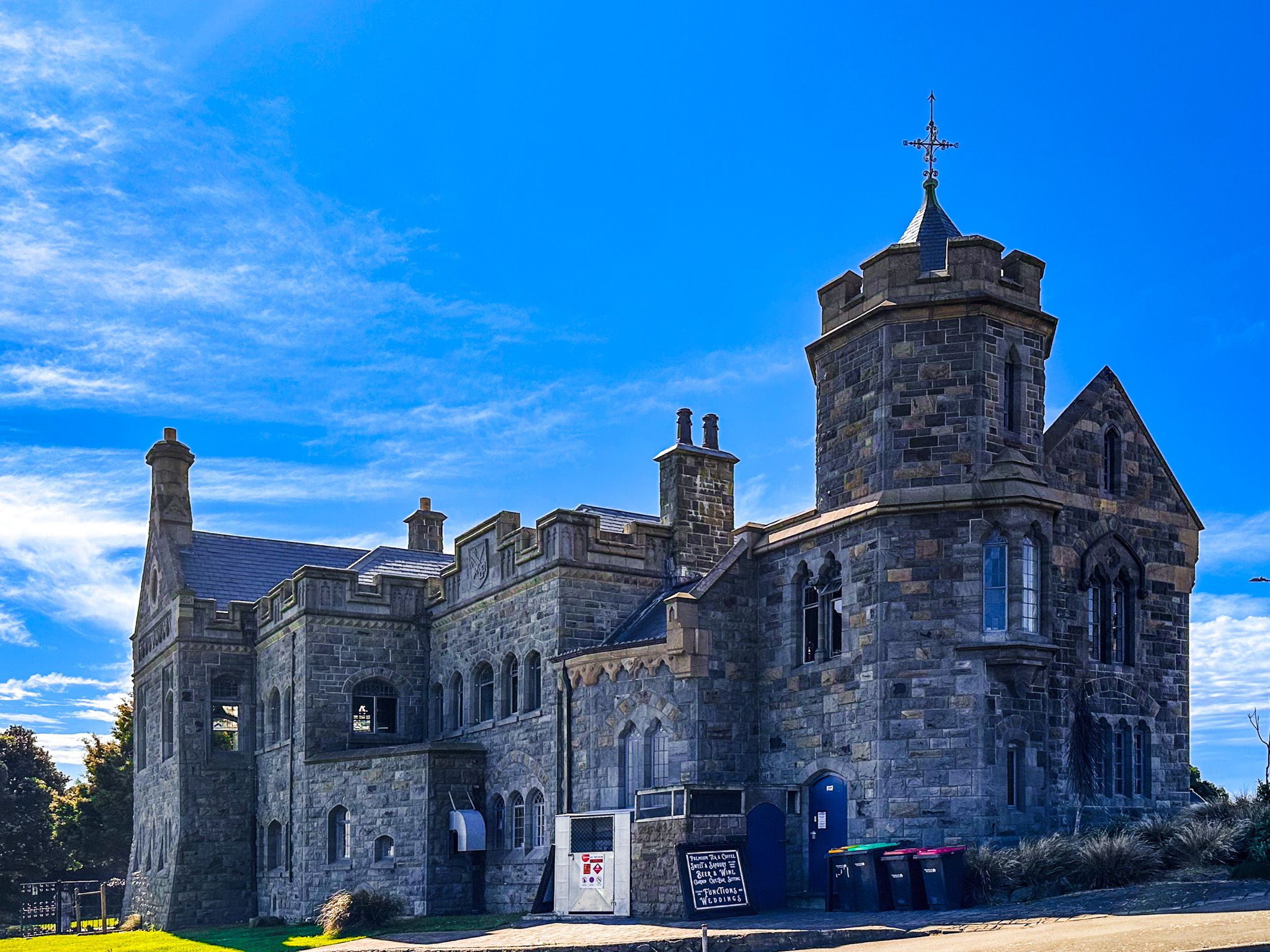
Harry Ell and the Summit Road
The Summit Road, which follows the crater rim from Gebbies Pass to Godley Head, owes its existence to one determined man. Harry Ell, a Christchurch city councillor and later a member of Parliament, began campaigning in 1900 to protect the Port Hills from encroaching development. He envisioned a network of scenic reserves connected by a purpose-built road, with stone rest-houses at intervals for walkers and travellers. The first reserve, Kennedy's Bush, was secured in 1906. By the 1930s, 500 hectares of reserves lined the proposed route. The road was built during the Great Depression, employing around 1,000 people, and opened in 1938.
Ell also commissioned four stone rest-houses designed by architect Samuel Hurst Seager, built of local volcanic rock to blend into the landscape: the Sign of the Takahe on Dyers Pass Road, the Sign of the Kiwi at Pukeatua / Dyers Pass, the Sign of the Bellbird along the southern rim next to Kennedy's Bush. The fourth, Packhorse Hut, is on the southeast side of Gebbies Pass. Ell died in 1934 before the grandest of them, the Sign of the Takahe, was completed.
In 1948, his grandson John Jameson founded the Summit Road Society to continue his work, and the society remains active today. The John Jameson Lookout, opposite Sign of the Bellbird and Kennedy’s Bush on the southern rim, commemorates his contribution.
Geology and Landscape
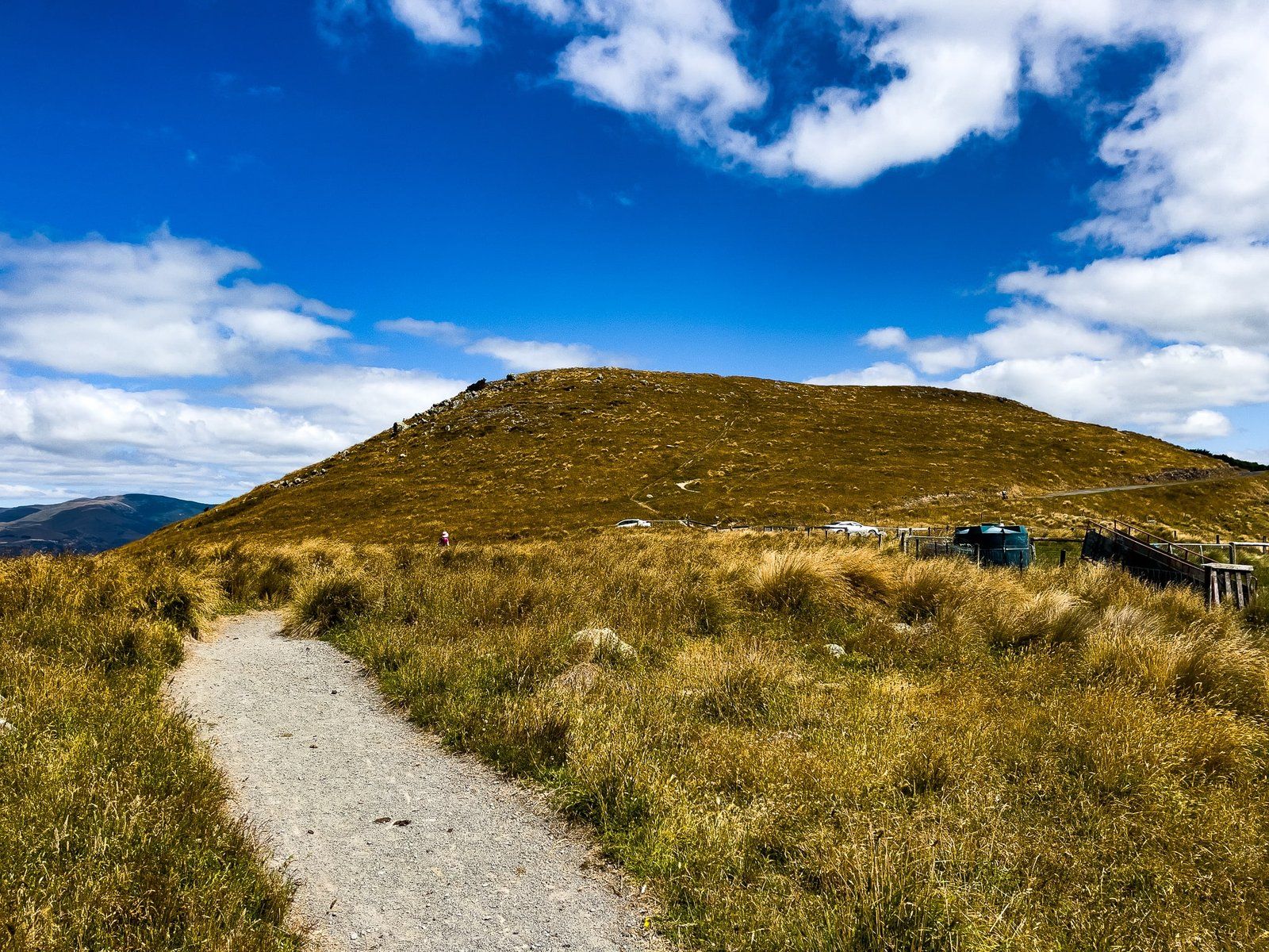
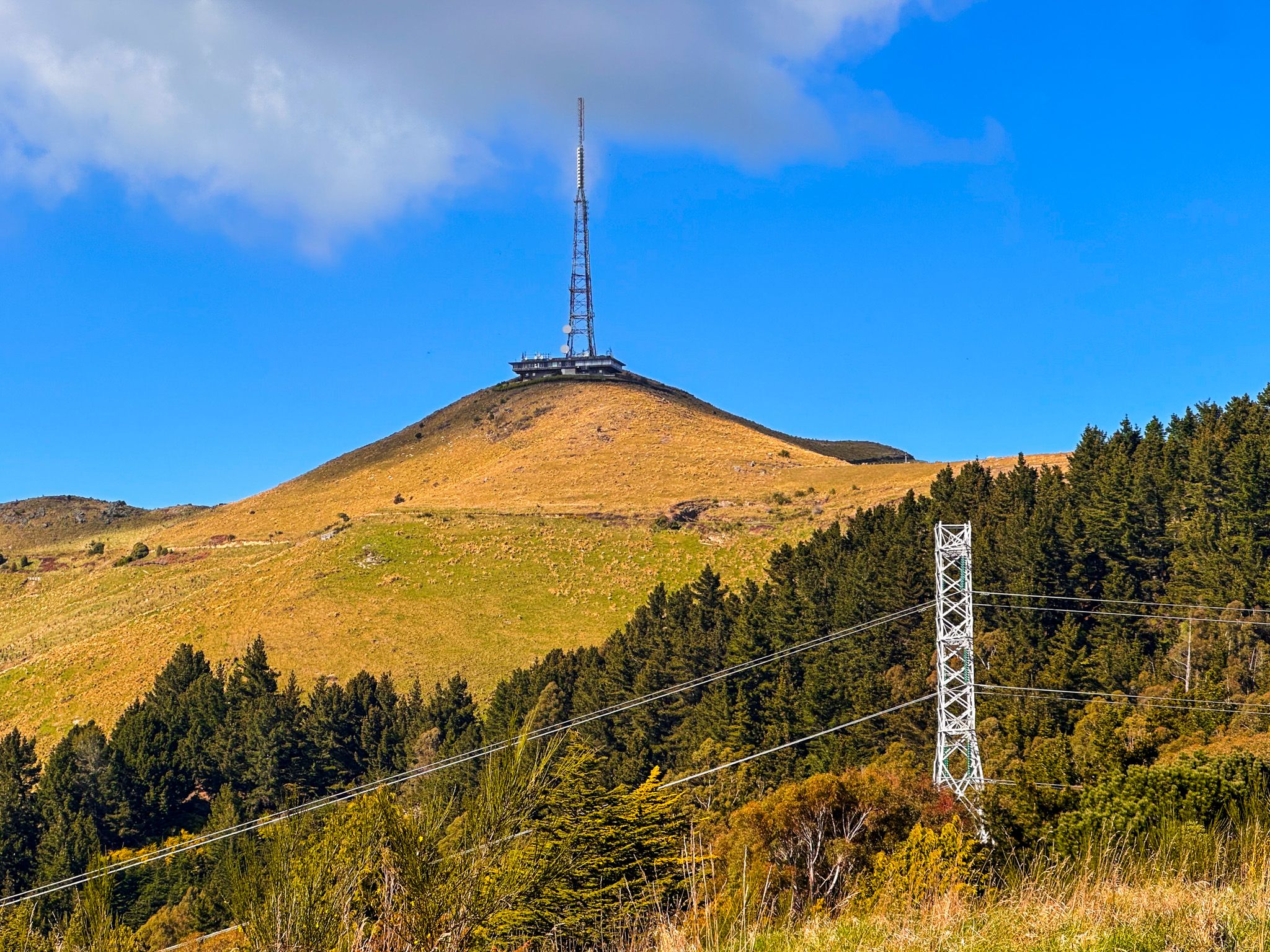
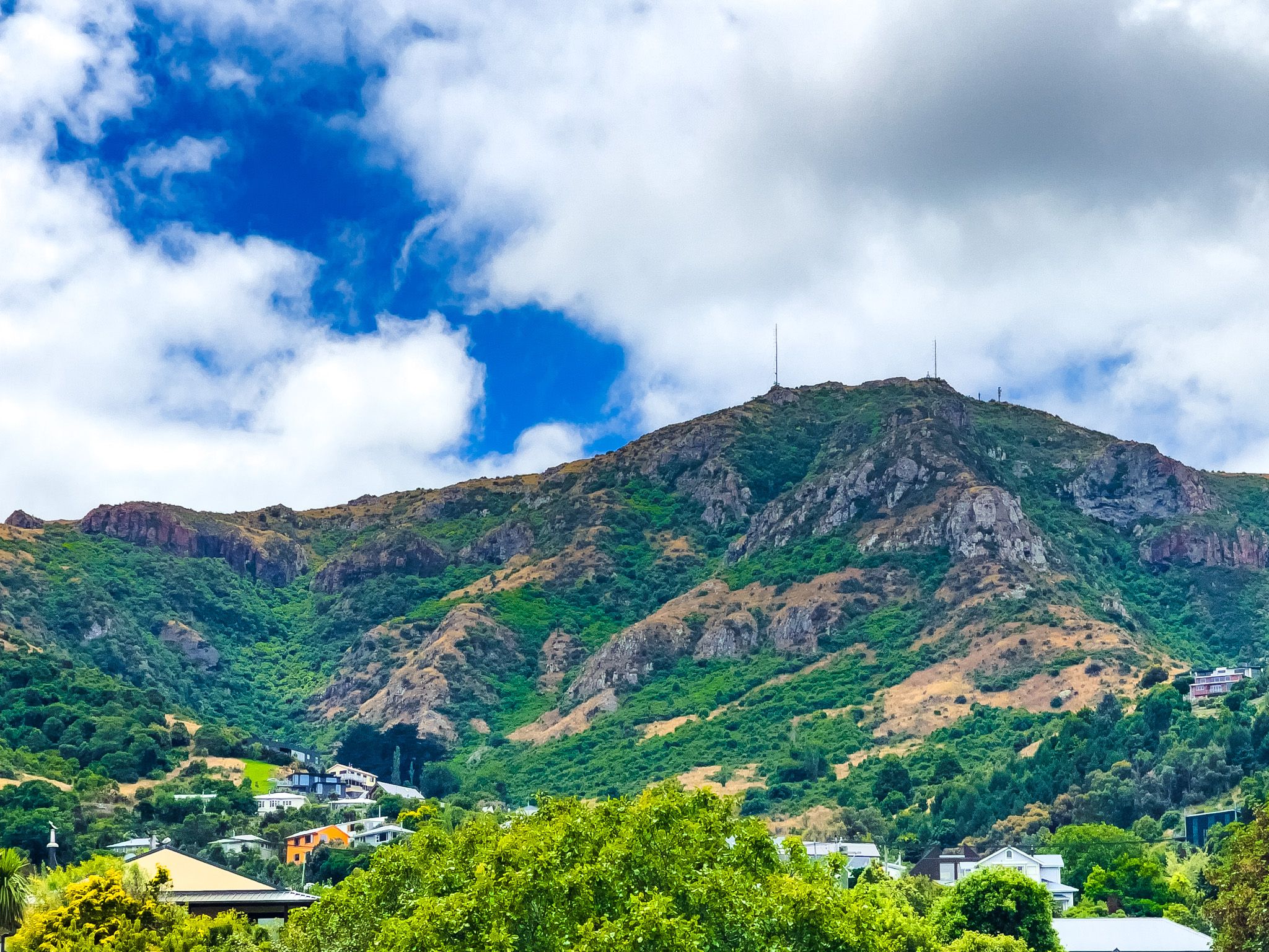
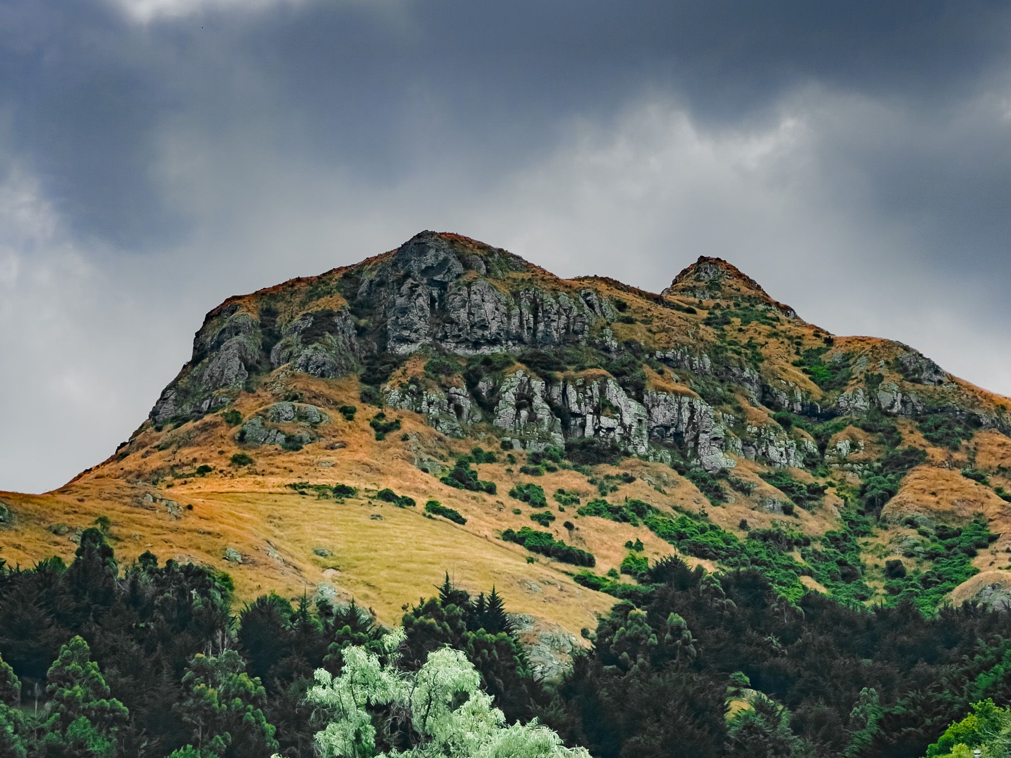
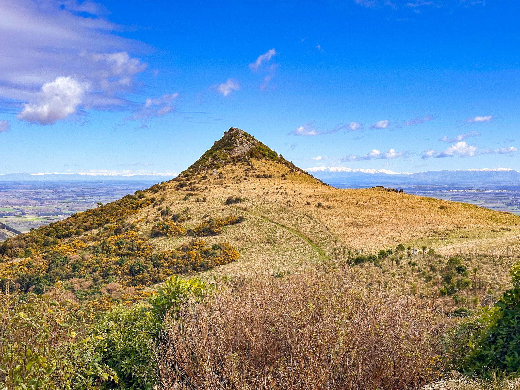
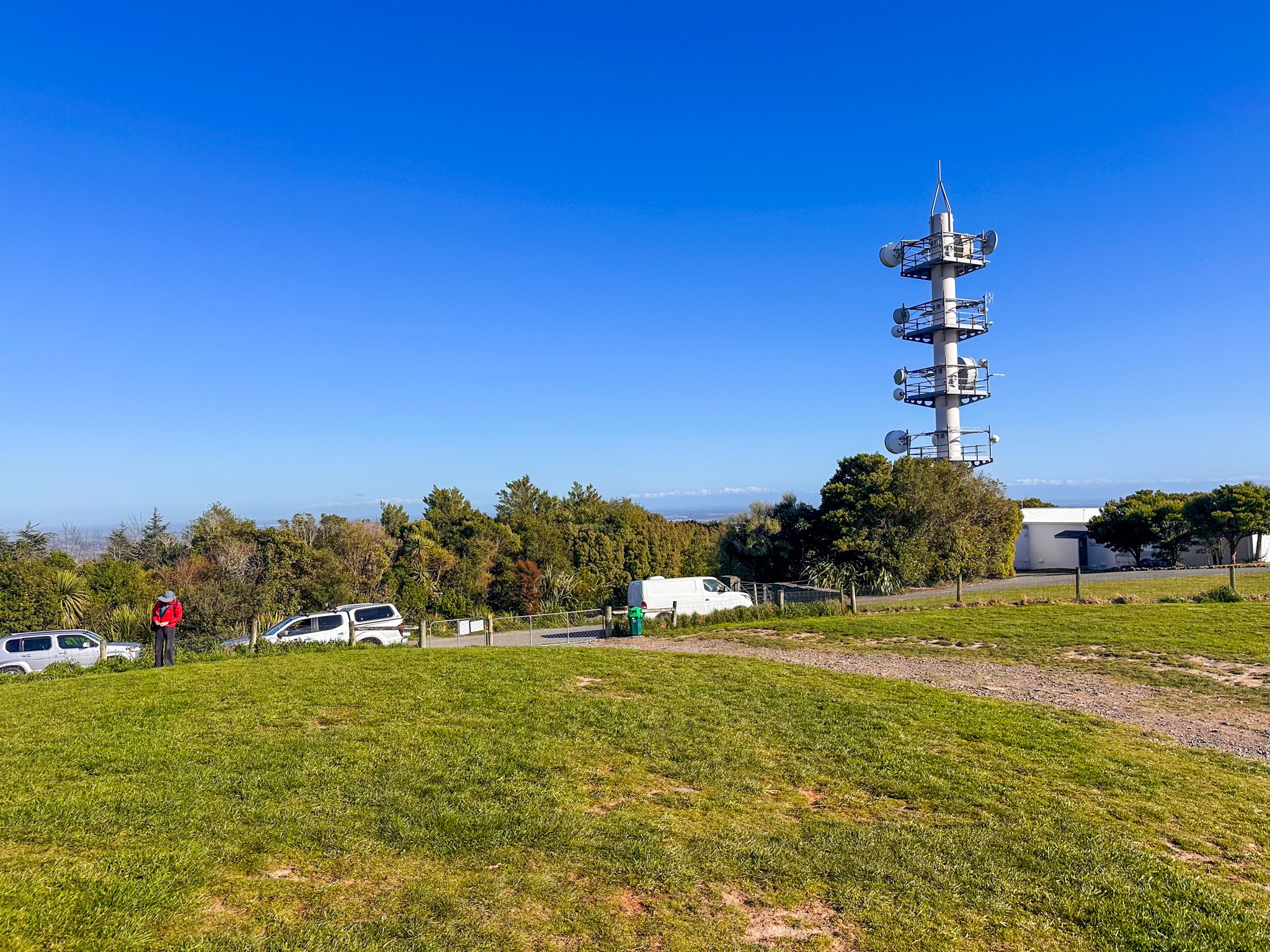
The Port Hills are the eroded remnants of the Lyttelton Volcano, one of several that formed Banks Peninsula between 8 and 12 million years ago. Wind, rain, ice, and sun have shaped the original crater into the rugged landscape seen today. The crest varies in height from around 200 metres at Evans Pass in the east to 573 metres at Coopers Knob south of Dyers Pass. Other significant summits include Tauhinukorokio / Mount Pleasant (499 m), Te Heru o Kahukura / Sugarloaf (494 m), recognisable by its television transmission tower, and Mount Cavendish (448 m). The hills are mostly open tussock and grassland, with recovering native scrub and forest in sheltered reserves such as Kennedys Bush and Victoria Park.
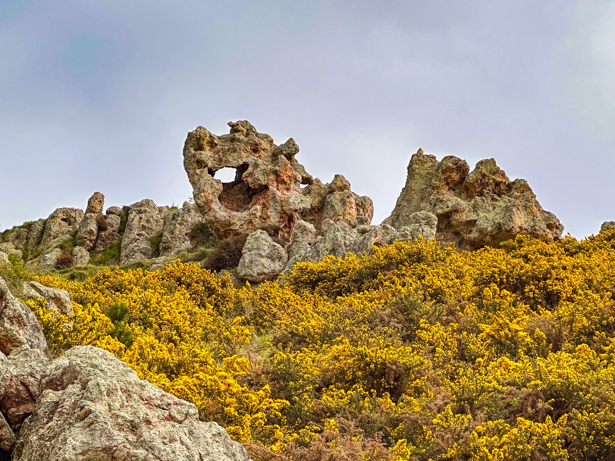
The volcanic origins are visible throughout. Exposed lava dykes cut through the hillsides, and volcanic domes such as Mt Vernon, Te Tihi-o-Kahukura / Castle Rock and Gibraltar Rock rise prominently from the ridge. Te Upoko-o-Kuri / Witch Hill and Te Moenga-o-Wheke / The Tors, further along the rim, are other striking remnants of ancient eruptions.
The Names of Tamatea
The Port Hills carry three Māori names, all tied to the same legend. The hills as a whole are Ngā Kohatu Whakarakaraka o Tamatea Pōkai Whenua, the “smouldering boulders of Tamatea Pōkai Whenua”. Te Poho o Tamatea, the “breast of Tamatea”, is the conical peak directly above the harbour-side settlement of Rāpaki. Te Whakatakanga-o-te-Ngārehu-o-te-ahi-a-Tamatea, “the place where the ashes of Tamatea's fire lay”, is the volcanic dyke formation near Witch Hill, known to European settlers as the Giant's Causeway and to climbers today as Rāpaki Rock.
The legend behind all three names tells of the Ngāi Tahu explorer Tamatea Pōkai Whenua, who was caught on the hills in a fierce southerly storm. Facing the cold without fire, he recited a karakia from the summit, calling on the tohunga Ngātoroirangi on the volcanic plateau of the central North Island to send warmth. The volcanic fires that answered his call dropped embers at Whakatū (Nelson), at Hanmer Springs (where they created the hot pools), and at Motunau Island before striking the Port Hills at the rocky dyke that still bears their name.
The hills around Rāpaki are a significant site for Te Hapū o Ngāti Wheke, the local hapū of Ngāi Tahu, and the settlement on the harbour shore below is one of the oldest continuously occupied sites on Banks Peninsula.

Recent History
The February 2011 Christchurch earthquake, centred beneath the hills near Lyttelton, triggered rock falls, cliff collapses, and landslides across the northern slopes, causing five deaths in Redcliffs, Sumner, and Lyttelton, and leading to more than 700 red-zoned properties. Evans Pass road on the Lyttelton side was closed until 2019, and part of Summit Road remains closed to vehicles. Major wildfires swept the hills in February 2017, when more than 1,600 ha burned, and again in February 2024, when a fire on Worsleys Road affected around 700 ha.
How to Get There
The best approach from central Christchurch is via Dyers Pass Road, heading southeast through the suburb of Cashmere to the Sign of the Takahe, then continuing up to Pukeatua / Dyers Pass and Summit Road. This route also gives access to Victoria Park on the way up.
From Sumner on the coast to the northeast, Evans Pass Road climbs to the eastern end of Summit Road. From the south, Gebbies Pass Road links State Highway 75 (the Christchurch to Akaroa road) with the south end of the rim.
The Christchurch Gondola base station is at 10 Bridle Path Road, Heathcote Valley, approximately a 15-minute drive from the city centre, with a shuttle service from Cathedral Square. Lyttelton is on the harbour side of the hills and is reached via the road tunnel from the Christchurch suburb of Heathcote, or by rail.